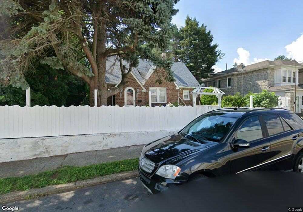
6711 Charles St Philadelphia, PA 19135
Tacony NeighborhoodEstimated Value: $329,000 - $340,000
5
Beds
2
Baths
1,440
Sq Ft
$232/Sq Ft
Est. Value
About This Home
This home is located at 6711 Charles St, Philadelphia, PA 19135 and is currently estimated at $334,509, approximately $232 per square foot. 6711 Charles St is a home located in Philadelphia County with nearby schools including Lincoln High School, Disston Hamilton School, and Keystone Academy Charter School.
Ownership History
Date
Name
Owned For
Owner Type
Purchase Details
Closed on
Nov 4, 2011
Sold by
Davern Lawrence P
Bought by
Perllaku Fadil and Perllaku Elona
Current Estimated Value
Home Financials for this Owner
Home Financials are based on the most recent Mortgage that was taken out on this home.
Original Mortgage
$153,520
Outstanding Balance
$106,587
Interest Rate
4.4%
Mortgage Type
FHA
Estimated Equity
$227,922
Purchase Details
Closed on
Aug 19, 1994
Sold by
Loiseau Joseph J and Loiseau Rita A
Bought by
Devern John H and Devern Betty Jane
Create a Home Valuation Report for This Property
The Home Valuation Report is an in-depth analysis detailing your home's value as well as a comparison with similar homes in the area
Home Values in the Area
Average Home Value in this Area
Purchase History
| Date | Buyer | Sale Price | Title Company |
|---|---|---|---|
| Perllaku Fadil | $169,000 | None Available | |
| Devern John H | $7,500 | -- |
Source: Public Records
Mortgage History
| Date | Status | Borrower | Loan Amount |
|---|---|---|---|
| Open | Perllaku Fadil | $153,520 |
Source: Public Records
Tax History Compared to Growth
Tax History
| Year | Tax Paid | Tax Assessment Tax Assessment Total Assessment is a certain percentage of the fair market value that is determined by local assessors to be the total taxable value of land and additions on the property. | Land | Improvement |
|---|---|---|---|---|
| 2025 | $3,872 | $318,700 | $63,740 | $254,960 |
| 2024 | $3,872 | $318,700 | $63,740 | $254,960 |
| 2023 | $3,872 | $276,600 | $55,320 | $221,280 |
| 2022 | $2,132 | $231,600 | $55,320 | $176,280 |
| 2021 | $2,762 | $0 | $0 | $0 |
| 2020 | $2,762 | $0 | $0 | $0 |
| 2019 | $2,755 | $0 | $0 | $0 |
| 2018 | $2,661 | $0 | $0 | $0 |
| 2017 | $2,661 | $0 | $0 | $0 |
| 2016 | $2,241 | $0 | $0 | $0 |
| 2015 | $2,145 | $0 | $0 | $0 |
| 2014 | -- | $190,100 | $58,188 | $131,912 |
| 2012 | -- | $18,240 | $8,143 | $10,097 |
Source: Public Records
Map
Nearby Homes
- 4100 Knorr Ct Unit J
- 4100 Knorr Ct Unit C
- 4917 Charles St
- 6650 Erdrick St
- 4805 11 Rawle St
- 3328 Glenview St
- 3316 Glenview St
- 6631 Erdrick St
- 3346 Longshore Ave
- 3324 Longshore Ave
- 6600 Erdrick St
- 3254 Longshore Ave
- 6601 Montague St
- 3202 Unruh Ave
- 4112 Gilham St
- 4016 Gilham St
- 3228 Magee Ave
- 4107 Greeby St
- 3335 Disston St
- 3333 Disston St
- 6709 Charles St
- 4100 Knorr St Unit F
- 4100 Knorr St Unit J
- 4100 Knorr St Unit B
- 6707 Charles St
- 4120 Knorr Ct Unit A
- 4120 Knorr Ct Unit G
- 4120 Knorr Ct Unit F
- 4120 Knorr Ct Unit H
- 4120 Knorr Ct Unit K
- 4120 Knorr Ct Unit E
- 4100 Knorr Ct
- 4100 Knorr Ct Unit B
- 4100 Knorr Ct Unit G
- 4100 Knorr Ct Unit F
- 4100 Knorr Ct Unit K
- 4100 Knorr Ct Unit H
- 4100 Knorr Ct Unit E
- 4100 Knorr Ct Unit D
- 6710 Charles St