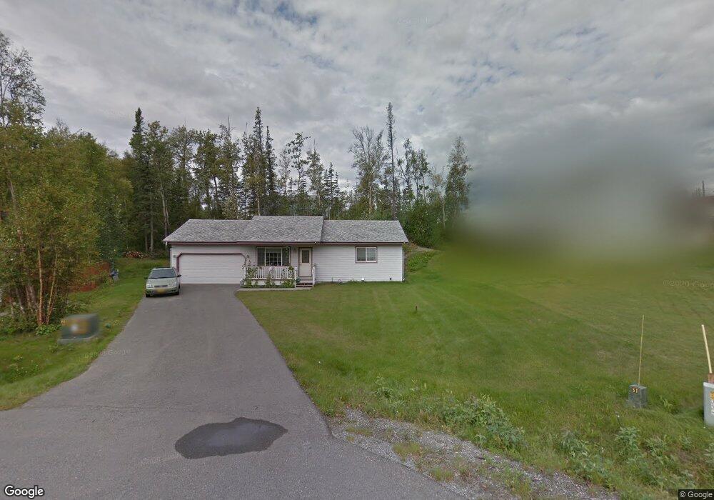
6711 E David H Cir Palmer, AK 99645
South Lakes NeighborhoodEstimated Value: $249,000 - $351,000
2
Beds
1
Bath
888
Sq Ft
$335/Sq Ft
Est. Value
About This Home
This home is located at 6711 E David H Cir, Palmer, AK 99645 and is currently estimated at $297,153, approximately $334 per square foot. 6711 E David H Cir is a home located in Matanuska-Susitna Borough with nearby schools including Pioneer Peak Elementary School, Colony Middle School, and Colony High School.
Ownership History
Date
Name
Owned For
Owner Type
Purchase Details
Closed on
Jul 25, 2013
Sold by
Johnson Erik M and Johnson Kelly B
Bought by
Johnson Karen S
Current Estimated Value
Purchase Details
Closed on
May 26, 2006
Sold by
Younger Lewis Stephen and Younger Chantel S
Bought by
Johnson Erik M and Johnson Kelly B
Home Financials for this Owner
Home Financials are based on the most recent Mortgage that was taken out on this home.
Original Mortgage
$153,061
Outstanding Balance
$89,735
Interest Rate
6.52%
Mortgage Type
Purchase Money Mortgage
Estimated Equity
$207,418
Purchase Details
Closed on
Aug 12, 2003
Sold by
Selway Corp
Bought by
Younger Lewis Stephen and Younger Chantel S
Home Financials for this Owner
Home Financials are based on the most recent Mortgage that was taken out on this home.
Original Mortgage
$121,539
Interest Rate
5.29%
Mortgage Type
FHA
Create a Home Valuation Report for This Property
The Home Valuation Report is an in-depth analysis detailing your home's value as well as a comparison with similar homes in the area
Home Values in the Area
Average Home Value in this Area
Purchase History
| Date | Buyer | Sale Price | Title Company |
|---|---|---|---|
| Johnson Karen S | -- | Atga | |
| Johnson Erik M | -- | First American Title Ins Co | |
| Younger Lewis Stephen | -- | First American Title Of Alas |
Source: Public Records
Mortgage History
| Date | Status | Borrower | Loan Amount |
|---|---|---|---|
| Open | Johnson Erik M | $153,061 | |
| Previous Owner | Younger Lewis Stephen | $121,539 |
Source: Public Records
Tax History Compared to Growth
Tax History
| Year | Tax Paid | Tax Assessment Tax Assessment Total Assessment is a certain percentage of the fair market value that is determined by local assessors to be the total taxable value of land and additions on the property. | Land | Improvement |
|---|---|---|---|---|
| 2025 | $2,291 | $255,900 | $40,000 | $215,900 |
| 2024 | $2,291 | $239,200 | $40,000 | $199,200 |
| 2023 | $2,291 | $228,200 | $40,000 | $188,200 |
| 2022 | $2,291 | $209,400 | $40,000 | $169,400 |
| 2021 | $0 | $186,900 | $40,000 | $146,900 |
| 2020 | $0 | $177,400 | $40,000 | $137,400 |
| 2019 | $0 | $173,300 | $40,000 | $133,300 |
| 2018 | $0 | $170,200 | $40,000 | $130,200 |
| 2017 | $0 | $169,000 | $40,000 | $129,000 |
| 2016 | $0 | $170,300 | $40,000 | $130,300 |
| 2015 | $2,244 | $164,100 | $35,000 | $129,100 |
| 2014 | $2,244 | $150,800 | $35,000 | $115,800 |
Source: Public Records
Map
Nearby Homes
- 6816 E Andrew Cir
- 7140 E Riparian Loop
- 555 S Lower Rd
- 7340 E Timber Ridge Cir Unit 28
- 6801 E Upper Mesa Dr
- 7535 E Woodview Way
- 7302 &7303 E Double B Cir
- 550 S Warmwood Way
- 834 N Upstream Place
- 1125 N Colonial Dr
- 7460 E Rawhide Ln
- 6991 E Connect Ct
- L6A S Baroness Ln
- 1571 S Middle Mesa Dr
- 6020 E Westview Cir
- 5740 E Blue Lupine Dr
- 8300 E Regents Rd
- 940 S Serrano Dr
- 2154 S Sanctuary Dr
- 2206 S Sanctuary Dr
- 6701 E David H Cir
- 351 N Lauren Ln
- 285 N Lauren Ln
- 6702 E David H Cir
- L5 E David H Cir
- 591 N Tiffany Dr
- 591 N Tiffany Dr Unit 2
- 591 N Tiffany Dr Unit 1
- 358 N Lauren Ln
- 6653 E Wilderness Cir
- 175 N Lauren Ln
- 6751 E Kathleen Cir
- 6700 E Wilderness Cir
- 285 N Lauren Ln
- 510 N Tiffany Dr
- 278 N Lauren Ln
- 6685 E Wilderness Cir
- 670 N Tiffany Dr
- 6775 E Kathleen Cir
- 244 N Lauren Ln