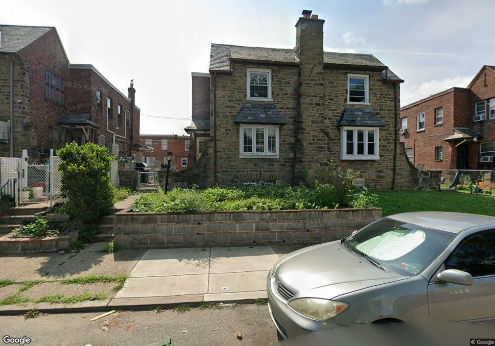
6711 Large St Philadelphia, PA 19149
Castor Gardens NeighborhoodEstimated Value: $264,000 - $389,000
4
Beds
1
Bath
1,586
Sq Ft
$207/Sq Ft
Est. Value
About This Home
This home is located at 6711 Large St, Philadelphia, PA 19149 and is currently estimated at $328,147, approximately $206 per square foot. 6711 Large St is a home with nearby schools including Gilbert Spruance School, Northeast High School, and Gospel of Grace Christian School.
Ownership History
Date
Name
Owned For
Owner Type
Purchase Details
Closed on
Jul 11, 2005
Sold by
Scutti Thomas J and Scutti Frances M
Bought by
Chan Ngai Man and Li Ying Chao
Current Estimated Value
Home Financials for this Owner
Home Financials are based on the most recent Mortgage that was taken out on this home.
Original Mortgage
$123,000
Interest Rate
5.67%
Mortgage Type
Fannie Mae Freddie Mac
Create a Home Valuation Report for This Property
The Home Valuation Report is an in-depth analysis detailing your home's value as well as a comparison with similar homes in the area
Home Values in the Area
Average Home Value in this Area
Purchase History
| Date | Buyer | Sale Price | Title Company |
|---|---|---|---|
| Chan Ngai Man | $243,000 | Lawyers Title Insurance Co |
Source: Public Records
Mortgage History
| Date | Status | Borrower | Loan Amount |
|---|---|---|---|
| Closed | Chan Ngai Man | $123,000 |
Source: Public Records
Tax History Compared to Growth
Tax History
| Year | Tax Paid | Tax Assessment Tax Assessment Total Assessment is a certain percentage of the fair market value that is determined by local assessors to be the total taxable value of land and additions on the property. | Land | Improvement |
|---|---|---|---|---|
| 2025 | $3,400 | $274,800 | $54,960 | $219,840 |
| 2024 | $3,400 | $274,800 | $54,960 | $219,840 |
| 2023 | $3,400 | $242,900 | $48,580 | $194,320 |
| 2022 | $1,901 | $197,900 | $48,580 | $149,320 |
| 2021 | $2,531 | $0 | $0 | $0 |
| 2020 | $2,531 | $0 | $0 | $0 |
| 2019 | $2,429 | $0 | $0 | $0 |
| 2018 | $1,802 | $0 | $0 | $0 |
| 2017 | $2,221 | $0 | $0 | $0 |
| 2016 | $1,802 | $0 | $0 | $0 |
| 2015 | $1,725 | $0 | $0 | $0 |
| 2014 | -- | $158,700 | $34,544 | $124,156 |
| 2012 | -- | $20,736 | $2,953 | $17,783 |
Source: Public Records
Map
Nearby Homes
- 6739 Lynford St
- 6640 Souder St
- 6626 Lynford St
- 6829 Horrocks St
- 6827 Lynford St
- 6834 Large St
- 1600 Magee Ave
- 1604 Magee Ave
- 1612 Magee Ave
- 6621 Sylvester St
- 1527 Longshore Ave
- 6541 Souder St
- 1417 Unruh Ave
- 6627 Oakland St
- 1437 Magee Ave
- 6725 Eastwood St
- 6946 Kindred St
- 1535 Hellerman St
- 1500 Hellerman St
- 6900 Eastwood St
- 6709 Large St
- 6713 Large St
- 6707 Large St
- 6715 Large St
- 6705 Large St
- 6716 Kindred St
- 6714 Kindred St
- 6718 Kindred St
- 6712 Kindred St
- 6720 Kindred St
- 6710 Kindred St
- 6722 Kindred St
- 6717 Large St
- 6708 Kindred St
- 6703 Large St
- 6724 Kindred St
- 6706 Kindred St
- 6719 Large St
- 6726 Kindred St
- 6704 Kindred St