Estimated Value: $606,000 - $648,908
4
Beds
3
Baths
2,922
Sq Ft
$215/Sq Ft
Est. Value
About This Home
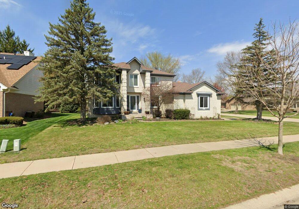
This home is located at 6711 Westpointe Dr Unit Bldg-Unit, Troy, MI 48085 and is currently estimated at $627,477, approximately $214 per square foot. 6711 Westpointe Dr Unit Bldg-Unit is a home located in Oakland County with nearby schools including Troy Union Elementary School, Smith Middle School, and Athens High School.
Ownership History
Date
Name
Owned For
Owner Type
Purchase Details
Closed on
Jan 23, 2018
Sold by
Zhang Tong Bing
Bought by
James Sam Prasanna and Karunakar Esther Kavitha
Current Estimated Value
Purchase Details
Closed on
Apr 7, 2008
Sold by
Chen Xue Hua
Bought by
Zhang Tong Bing
Purchase Details
Closed on
Mar 16, 2000
Sold by
Zheng Da X
Bought by
Zhang Tong B
Purchase Details
Closed on
Apr 7, 1999
Sold by
Zhao Yan Yun
Bought by
Zheng Daxuan
Purchase Details
Closed on
Nov 23, 1998
Sold by
Zheng Da Xuan
Bought by
Zheng Da Xuan
Purchase Details
Closed on
Apr 1, 1996
Sold by
Asmaro Thair
Bought by
Babbie Sabah
Home Financials for this Owner
Home Financials are based on the most recent Mortgage that was taken out on this home.
Original Mortgage
$200,000
Interest Rate
7.86%
Create a Home Valuation Report for This Property
The Home Valuation Report is an in-depth analysis detailing your home's value as well as a comparison with similar homes in the area
Home Values in the Area
Average Home Value in this Area
Purchase History
| Date | Buyer | Sale Price | Title Company |
|---|---|---|---|
| James Sam Prasanna | $390,000 | Devon Title Agency | |
| Zhang Tong Bing | -- | None Available | |
| Zhang Tong B | $303,000 | -- | |
| Zheng Daxuan | -- | -- | |
| Zheng Da Xuan | -- | -- | |
| Babbie Sabah | $267,000 | -- |
Source: Public Records
Mortgage History
| Date | Status | Borrower | Loan Amount |
|---|---|---|---|
| Previous Owner | Babbie Sabah | $200,000 |
Source: Public Records
Tax History
| Year | Tax Paid | Tax Assessment Tax Assessment Total Assessment is a certain percentage of the fair market value that is determined by local assessors to be the total taxable value of land and additions on the property. | Land | Improvement |
|---|---|---|---|---|
| 2022 | $6,715 | $224,930 | $0 | $0 |
| 2015 | $7,044 | $175,390 | $0 | $0 |
| 2014 | -- | $150,900 | $0 | $0 |
| 2011 | -- | $143,850 | $0 | $0 |
Source: Public Records
Map
Nearby Homes
- 6740 Barabeau Dr
- 1839 Smallbrook Dr
- unit #3 Michelson Rd
- 6820 Emerald Shores Dr
- 6831 John R Rd
- 6833 John R Rd
- 6835 John R Rd
- 1128 Alameda Blvd
- 1180 Alameda Blvd Unit 75
- 185 Michelson Rd
- 1142 E South Blvd
- 6257 Sandshores Dr
- 954 Sandalwood Dr Unit 52
- 3845 Hazelton Ave
- 6178 Elarz Dr
- 396 South Blvd W
- 5926 Everton Ave
- 5871 Everton Ct
- 5884 Willow Grove
- 5872 Willow Grove
- 6711 Westpointe Dr
- 6699 Westpointe Dr
- 6815 Redford Cir
- 6687 Westpointe Dr
- 6798 Redford Cir
- 6829 Redford Cir
- 6812 Redford Cir
- 6710 Westpointe Dr
- 6814 Shelldrake Dr
- 6696 Westpointe Dr
- 6826 Redford Cir
- 6675 Westpointe Dr
- 6826 Shelldrake Dr
- 6843 Redford Cir
- 6684 Westpointe Dr
- 6840 Redford Cir
- 6752 Redford Cir
- 6838 Shelldrake Dr
- 6795 Westpointe Dr
- 6838 Shelldrake Dr
Your Personal Tour Guide
Ask me questions while you tour the home.