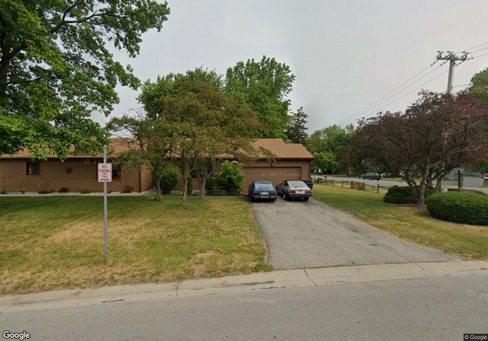
6712 Woodlake Dr Unit 6712 Toledo, OH 43617
Estimated Value: $169,000 - $181,463
2
Beds
2
Baths
1,399
Sq Ft
$124/Sq Ft
Est. Value
About This Home
This home is located at 6712 Woodlake Dr Unit 6712, Toledo, OH 43617 and is currently estimated at $174,116, approximately $124 per square foot. 6712 Woodlake Dr Unit 6712 is a home located in Lucas County with nearby schools including Stranahan Elementary School, Sylvania Timberstone Junior High School, and Sylvania Southview High School.
Ownership History
Date
Name
Owned For
Owner Type
Purchase Details
Closed on
Jan 27, 2005
Sold by
Roesti Bradley C and Roesti Stephanie L
Bought by
Sarsour Hanan Ettaher
Current Estimated Value
Purchase Details
Closed on
Jun 19, 1995
Sold by
Harold D Raesti
Bought by
Roesti Bradley C
Home Financials for this Owner
Home Financials are based on the most recent Mortgage that was taken out on this home.
Original Mortgage
$69,000
Interest Rate
8.27%
Mortgage Type
New Conventional
Purchase Details
Closed on
Apr 27, 1995
Sold by
Shrf Anne M Holman Pr
Bought by
Roesti Harold
Home Financials for this Owner
Home Financials are based on the most recent Mortgage that was taken out on this home.
Original Mortgage
$69,000
Interest Rate
8.27%
Mortgage Type
New Conventional
Create a Home Valuation Report for This Property
The Home Valuation Report is an in-depth analysis detailing your home's value as well as a comparison with similar homes in the area
Home Values in the Area
Average Home Value in this Area
Purchase History
| Date | Buyer | Sale Price | Title Company |
|---|---|---|---|
| Sarsour Hanan Ettaher | $122,000 | Northwest Title Agency Of Oh | |
| Roesti Bradley C | $69,000 | -- | |
| Roesti Harold | $68,100 | -- |
Source: Public Records
Mortgage History
| Date | Status | Borrower | Loan Amount |
|---|---|---|---|
| Previous Owner | Roesti Bradley C | $69,000 |
Source: Public Records
Tax History Compared to Growth
Tax History
| Year | Tax Paid | Tax Assessment Tax Assessment Total Assessment is a certain percentage of the fair market value that is determined by local assessors to be the total taxable value of land and additions on the property. | Land | Improvement |
|---|---|---|---|---|
| 2024 | $1,929 | $57,750 | $17,325 | $40,425 |
| 2023 | $3,266 | $41,720 | $14,560 | $27,160 |
| 2022 | $3,264 | $41,720 | $14,560 | $27,160 |
| 2021 | $3,291 | $41,720 | $14,560 | $27,160 |
| 2020 | $3,646 | $40,390 | $13,230 | $27,160 |
| 2019 | $3,517 | $40,390 | $13,230 | $27,160 |
| 2018 | $3,118 | $40,390 | $13,230 | $27,160 |
| 2017 | $2,935 | $30,555 | $3,605 | $26,950 |
| 2016 | $2,881 | $87,300 | $10,300 | $77,000 |
| 2015 | $2,725 | $87,300 | $10,300 | $77,000 |
| 2014 | $2,614 | $30,240 | $3,570 | $26,670 |
| 2013 | $2,614 | $30,240 | $3,570 | $26,670 |
Source: Public Records
Map
Nearby Homes
- 3302 Zone Ave
- 3330 Wilford Dr
- 2822 Page Lindsay Ln
- 3507 Indian Oaks Ln
- 6830 Carrietowne Ln Unit 6830
- 6606 Blossman Rd
- 3655 Woodspring Rd
- 6243 Bonsels Pkwy
- 3757 N Mccord Rd
- 7035 Mourning Dove Ct
- 6855 Shooters Hill Rd
- 6968 Shooters Hill Rd
- 6817 Hampsford Cir
- 3800 Harrowsfield Rd
- 2946 Orchard Tree Ln
- 2422 Manoa Ln N
- 2412 McKivett Dr
- 2910 Tracewood Dr
- 2355 Parliament Square
- 2321 Saint James Woods Blvd
- 6714 Woodlake Dr Unit 6714
- 3221 N Mccord Rd
- 3216 Meadowlake Dr Unit 3216
- 3218 Meadowlake Dr
- 6711 Woodlake Dr
- 3224 Meadowlake Dr Unit 3224
- 3226 Meadowlake Dr Unit 3226
- 6713 Woodlake Dr Unit 6713
- 3229 N Mccord Rd
- 6721 Woodlake Dr
- 3232 Meadowlake Unit A Dr Unit A
- 3232 Meadowlake Dr Unit B
- 3232 Meadowlake Dr Unit A
- 6731 Woodlake Dr Unit 6731
- 3210 N Mccord Rd
- 6729 Woodlake Dr
- 6729 Woodlake Dr Unit 6729
- 3237 N Mccord Rd
- 3240 Meadowlake Dr Unit 3240
- 3226 N Mccord Rd