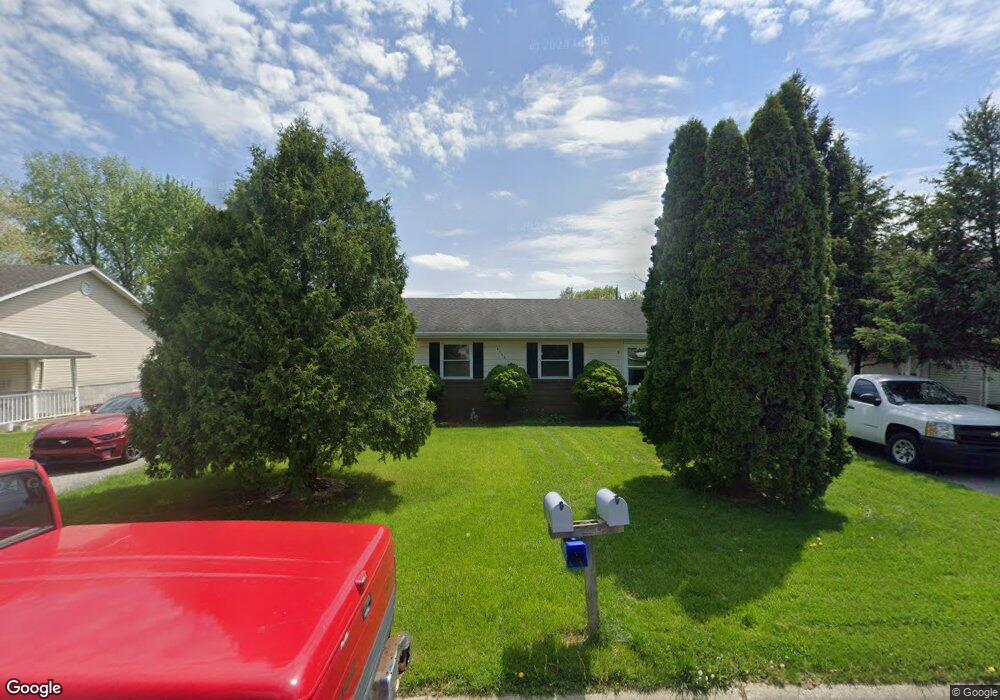
6717 W 130th Ave Cedar Lake, IN 46303
Estimated Value: $219,000 - $274,000
4
Beds
2
Baths
1,681
Sq Ft
$145/Sq Ft
Est. Value
About This Home
This home is located at 6717 W 130th Ave, Cedar Lake, IN 46303 and is currently estimated at $244,233, approximately $145 per square foot. 6717 W 130th Ave is a home located in Lake County with nearby schools including Douglas MacArthur Elementary School, Robert Taft Middle School, and Crown Point High School.
Ownership History
Date
Name
Owned For
Owner Type
Purchase Details
Closed on
Jul 17, 2006
Sold by
Terzijoski Ilo and Terzijoski Visna
Bought by
Morris Mark A and Morris Julie A
Current Estimated Value
Home Financials for this Owner
Home Financials are based on the most recent Mortgage that was taken out on this home.
Original Mortgage
$114,800
Outstanding Balance
$68,455
Interest Rate
6.73%
Mortgage Type
Purchase Money Mortgage
Estimated Equity
$175,778
Create a Home Valuation Report for This Property
The Home Valuation Report is an in-depth analysis detailing your home's value as well as a comparison with similar homes in the area
Home Values in the Area
Average Home Value in this Area
Purchase History
| Date | Buyer | Sale Price | Title Company |
|---|---|---|---|
| Morris Mark A | -- | Chicago Title Insurance Co |
Source: Public Records
Mortgage History
| Date | Status | Borrower | Loan Amount |
|---|---|---|---|
| Open | Morris Mark A | $114,800 |
Source: Public Records
Tax History Compared to Growth
Tax History
| Year | Tax Paid | Tax Assessment Tax Assessment Total Assessment is a certain percentage of the fair market value that is determined by local assessors to be the total taxable value of land and additions on the property. | Land | Improvement |
|---|---|---|---|---|
| 2024 | $5,713 | $218,300 | $33,700 | $184,600 |
| 2023 | $3,026 | $205,300 | $33,700 | $171,600 |
| 2022 | $3,026 | $205,600 | $33,700 | $171,900 |
| 2021 | $2,792 | $201,200 | $23,100 | $178,100 |
| 2020 | $2,631 | $187,000 | $23,100 | $163,900 |
| 2019 | $2,380 | $171,800 | $23,100 | $148,700 |
| 2018 | $2,439 | $165,400 | $23,100 | $142,300 |
| 2017 | $2,437 | $161,200 | $23,100 | $138,100 |
| 2016 | $2,551 | $161,700 | $23,100 | $138,600 |
| 2014 | $2,200 | $153,400 | $23,000 | $130,400 |
| 2013 | $2,276 | $153,900 | $23,000 | $130,900 |
Source: Public Records
Map
Nearby Homes
- 13111 Hobart Ct
- 7302 Morse Ln
- 12917 Fulton St
- 13236 E Lakeshore Dr Unit J-302
- 13234 Lake Shore Dr Unit K202
- 13234 E Lakeshore Dr Unit 302
- 13317 Sherman St
- 13244 E Lake Shore Dr Unit B-102
- 13654 Freedom Way
- 13665 Freedom Way
- 13304 E Lakeshore Dr Unit 202
- 6711 W 134th Place
- 13341 Fulton St
- 13425 Morse Place
- 13463 Superior Ln
- 13443 Superior Ln
- The Powell II Plan at Lakeside
- The Alverstone Plan at Lakeside
- The Monarch Plan at Lakeside
- The Capital Plan at Lakeside
- 6699 W 130th Ave
- 6739 W 130th Ave
- 6704 W 131st Ave
- 6706 W 131st Ave
- 6637 W 130th Ave
- 6606 W 131st Ave
- 6712 W 130th Ave
- 6698 W 130th Ave
- 6604 W 131st Ave
- 6636 W 130th Ave
- 6615 W 130th Ave
- 6602 W 131st Ave
- 13108 Hobart Ct
- 13107 Hobart Ct
- 6628 W 130th Ave
- 6597 W 130th Ave
- 6701 W 129th Ave
- 6781 W 129th Ave
- 6679 W 129th Ave
- 6508 W 131st Ave