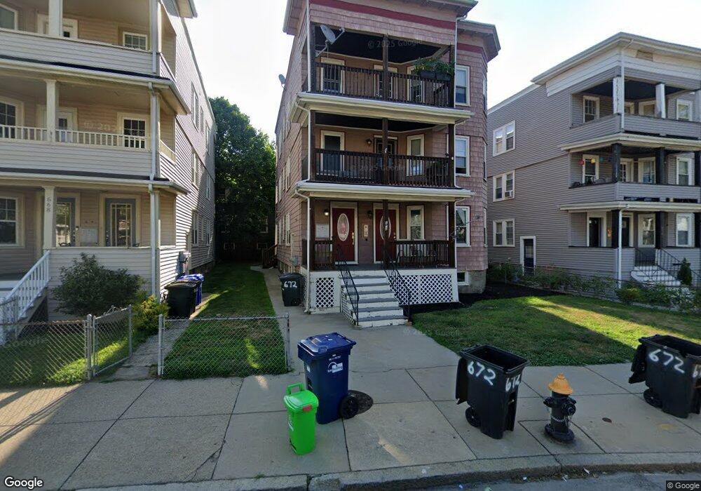
672 Adams St Dorchester, MA 02122
Neponset-Port Norfolk NeighborhoodEstimated Value: $1,237,000 - $1,273,000
6
Beds
3
Baths
3,201
Sq Ft
$393/Sq Ft
Est. Value
About This Home
This home is located at 672 Adams St, Dorchester, MA 02122 and is currently estimated at $1,258,667, approximately $393 per square foot. 672 Adams St is a home located in Suffolk County with nearby schools including Neighborhood House Charter School, St Brendan School, and Epiphany School.
Ownership History
Date
Name
Owned For
Owner Type
Purchase Details
Closed on
Jan 30, 2019
Sold by
Lavin Peter and Lavin Una T
Bought by
Laimhin Llc
Current Estimated Value
Purchase Details
Closed on
Apr 14, 2011
Sold by
Lavin Peter
Bought by
Levin Peter and Lavin Una T
Home Financials for this Owner
Home Financials are based on the most recent Mortgage that was taken out on this home.
Original Mortgage
$366,000
Interest Rate
4.89%
Mortgage Type
Purchase Money Mortgage
Purchase Details
Closed on
Jun 18, 2010
Sold by
Adams Street Rt
Bought by
Lavin Peter
Home Financials for this Owner
Home Financials are based on the most recent Mortgage that was taken out on this home.
Original Mortgage
$432,000
Interest Rate
5.03%
Mortgage Type
Purchase Money Mortgage
Purchase Details
Closed on
Feb 26, 2010
Sold by
Kromah Abdul
Bought by
Yee Preston
Purchase Details
Closed on
Nov 4, 2009
Sold by
Samuels Arthur
Bought by
Adams Street Rt
Purchase Details
Closed on
Jul 17, 2009
Sold by
Singletary Shawn
Bought by
Adams Street Rt
Purchase Details
Closed on
Apr 30, 2008
Sold by
Astoria Rt
Bought by
Kromah Abdul
Home Financials for this Owner
Home Financials are based on the most recent Mortgage that was taken out on this home.
Original Mortgage
$232,000
Interest Rate
5.99%
Mortgage Type
Purchase Money Mortgage
Purchase Details
Closed on
Apr 28, 2008
Sold by
Astoria Rt
Bought by
Singletary Shawn
Home Financials for this Owner
Home Financials are based on the most recent Mortgage that was taken out on this home.
Original Mortgage
$232,000
Interest Rate
5.99%
Mortgage Type
Purchase Money Mortgage
Create a Home Valuation Report for This Property
The Home Valuation Report is an in-depth analysis detailing your home's value as well as a comparison with similar homes in the area
Home Values in the Area
Average Home Value in this Area
Purchase History
| Date | Buyer | Sale Price | Title Company |
|---|---|---|---|
| Laimhin Llc | -- | -- | |
| Levin Peter | -- | -- | |
| Lavin Peter | $235,000 | -- | |
| Yee Preston | $43,900 | -- | |
| Adams Street Rt | $51,000 | -- | |
| Adams Street Rt | $46,000 | -- | |
| Kromah Abdul | $290,000 | -- | |
| Singletary Shawn | $290,000 | -- | |
| Samuels Arthur | $290,000 | -- | |
| Astoria Rt | $435,000 | -- |
Source: Public Records
Mortgage History
| Date | Status | Borrower | Loan Amount |
|---|---|---|---|
| Previous Owner | Levin Peter | $366,000 | |
| Previous Owner | Lavin Peter | $432,000 | |
| Previous Owner | Kromah Abdul | $232,000 | |
| Previous Owner | Samuels Arthur | $246,500 | |
| Previous Owner | Singletary Shawn | $217,500 |
Source: Public Records
Tax History Compared to Growth
Tax History
| Year | Tax Paid | Tax Assessment Tax Assessment Total Assessment is a certain percentage of the fair market value that is determined by local assessors to be the total taxable value of land and additions on the property. | Land | Improvement |
|---|---|---|---|---|
| 2025 | $13,795 | $1,191,300 | $299,400 | $891,900 |
| 2024 | $11,492 | $1,054,300 | $258,800 | $795,500 |
| 2023 | $10,294 | $958,500 | $235,300 | $723,200 |
| 2022 | $10,428 | $958,500 | $235,300 | $723,200 |
| 2021 | $9,741 | $912,900 | $224,100 | $688,800 |
| 2020 | $8,802 | $833,500 | $231,000 | $602,500 |
| 2019 | $8,368 | $793,900 | $163,800 | $630,100 |
| 2018 | $7,427 | $708,700 | $163,800 | $544,900 |
| 2017 | $6,823 | $644,300 | $163,800 | $480,500 |
| 2016 | $6,502 | $591,100 | $163,800 | $427,300 |
| 2015 | $6,093 | $503,100 | $139,000 | $364,100 |
| 2014 | $5,754 | $457,400 | $139,000 | $318,400 |
Source: Public Records
Map
Nearby Homes
- 701 Adams St Unit 9
- 80 Beaumont St Unit 101
- 107 Minot St
- 140 Minot St
- 33 Westmoreland St
- 37 Westmoreland St
- 40 Westmoreland St Unit 8
- 251 Minot St Unit 6
- 45 Chickatawbut St Unit 1
- 43 Chickatawbut St
- 51 Coffey St Unit 51C
- 56 Coffey St Unit 10
- 543 Adams St Unit 24
- 9-11 Adanac Terrace
- 51 Florida St Unit 3
- 54 Msgr Patrick j Lydon Way
- 45 Msgr Patrick j Lydon Way
- 80-84 Shepton St Unit 80-3
- 61 Shepton St
- 223 Neponset Ave Unit 2
- 672 Adams St Unit 3
- 672 Adams St Unit 2
- 672 Adams St Unit 1
- 668 Adams St Unit 3
- 668 Adams St Unit 2
- 668 Adams St Unit 1
- 676 Adams St
- 676 Adams St Unit Adams Street
- 676 Adams St Unit 1
- 9 Pierce Ave
- 9 Pierce Ave Unit 2
- 9 Pierce Ave Unit 1
- 10 Oakton Ave
- 11 Pierce Ave
- 671 Adams St Unit 4
- 671 Adams St
- 671 Adams St Unit 2
- 1 Helena Rd Unit 3
- 1 Helena Rd Unit 2
- 1 Helena Rd