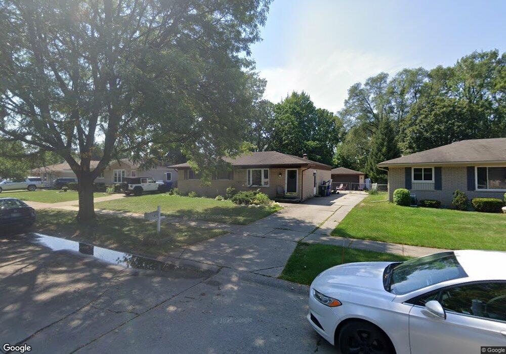
672 Buckingham Rd Canton, MI 48188
Estimated Value: $288,067 - $336,000
Studio
1
Bath
1,235
Sq Ft
$258/Sq Ft
Est. Value
About This Home
This home is located at 672 Buckingham Rd, Canton, MI 48188 and is currently estimated at $318,017, approximately $257 per square foot. 672 Buckingham Rd is a home located in Wayne County with nearby schools including Canton High School, Discovery Middle School, and Salem High School.
Ownership History
Date
Name
Owned For
Owner Type
Purchase Details
Closed on
Nov 18, 2024
Sold by
Straweka Daniel
Bought by
Straweka Sara
Current Estimated Value
Purchase Details
Closed on
Nov 23, 2018
Sold by
Antonucci Andrew
Bought by
Straweka Daniel
Home Financials for this Owner
Home Financials are based on the most recent Mortgage that was taken out on this home.
Original Mortgage
$205,535
Interest Rate
4.8%
Mortgage Type
FHA
Create a Home Valuation Report for This Property
The Home Valuation Report is an in-depth analysis detailing your home's value as well as a comparison with similar homes in the area
Home Values in the Area
Average Home Value in this Area
Purchase History
| Date | Buyer | Sale Price | Title Company |
|---|---|---|---|
| Straweka Sara | -- | None Listed On Document | |
| Straweka Sara | -- | None Listed On Document | |
| Straweka Daniel | $216,000 | Ravensood Title Co Llc |
Source: Public Records
Mortgage History
| Date | Status | Borrower | Loan Amount |
|---|---|---|---|
| Previous Owner | Straweka Daniel | $205,535 |
Source: Public Records
Tax History
| Year | Tax Paid | Tax Assessment Tax Assessment Total Assessment is a certain percentage of the fair market value that is determined by local assessors to be the total taxable value of land and additions on the property. | Land | Improvement |
|---|---|---|---|---|
| 2025 | $2,177 | $153,400 | $0 | $0 |
| 2024 | $2,115 | $140,700 | $0 | $0 |
| 2023 | $2,017 | $126,700 | $0 | $0 |
| 2022 | $4,426 | $116,800 | $0 | $0 |
| 2021 | $4,298 | $114,500 | $0 | $0 |
| 2020 | $4,242 | $108,200 | $0 | $0 |
| 2019 | $4,165 | $99,640 | $0 | $0 |
| 2018 | $2,535 | $100,280 | $0 | $0 |
| 2017 | $3,182 | $101,400 | $0 | $0 |
| 2016 | $4,053 | $100,100 | $0 | $0 |
| 2015 | $6,853 | $90,840 | $0 | $0 |
| 2013 | $6,639 | $69,100 | $0 | $0 |
| 2010 | -- | $77,160 | $39,523 | $37,637 |
Source: Public Records
Map
Nearby Homes
- 39209 Nottingham St
- 39234 Gloucester St
- 39615 Kirkland Dr
- 1260 S John Hix St
- 569 Worthington Rd
- 00000 Avondale St
- 1786 Daisey Ln Unit 32
- 127 S John Hix St
- 285 Carson Dr Unit 156
- 352 Cherry Hill Pointe Dr Unit 33
- 0 Cherry Hill Unit 16924
- 38478 Loruss Ave
- 40049 Rolling Green Ct
- 38249 N Jean Ct
- 38227 Avondale St
- 41009 Southwind Dr Unit 108
- 314 Marigold Cir Unit 49
- 308 Marigold Cir Unit 54
- 312 Marigold Cir Unit 52
- 41060 Northwind Dr
- 684 Buckingham Rd
- 660 Buckingham Rd
- 696 Buckingham Rd
- 648 Buckingham Rd
- 899 Meadowlake Rd
- 39701 Deepwood St
- 709 Comet Ct
- 708 Buckingham Rd
- 891 Meadowlake Rd
- 721 Comet Ct
- 636 Buckingham Rd
- 883 Meadowlake Rd
- 685 Buckingham Rd
- 720 Buckingham Rd
- 39711 Deepwood St
- 661 Buckingham Rd
- 649 Buckingham Rd
- 697 Buckingham Rd
- 708 Comet Ct
- 624 Buckingham Rd
Your Personal Tour Guide
Ask me questions while you tour the home.