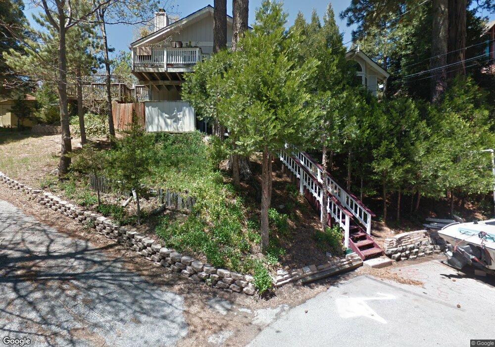
672 Maxson Dr Twin Peaks, CA 92391
Lake Arrowhead AreaEstimated Value: $412,412 - $559,000
About This Home
This home is located at 672 Maxson Dr, Twin Peaks, CA 92391 and is currently estimated at $505,603. 672 Maxson Dr is a home with nearby schools including Lake Arrowhead Elementary School, Mary P. Henck Intermediate School, and Rim Of The World Senior High School.
Ownership History
We collect this data history from publicly available records. To have your information removed, we recommend requesting removal directly through your county’s website.
Purchase Details
Home Financials for this Owner
Home Financials are based on the most recent Mortgage that was taken out on this home.Purchase Details
Home Financials for this Owner
Home Financials are based on the most recent Mortgage that was taken out on this home.Home Values in the Area
Average Home Value in this Area
Purchase History
We collect this data history from publicly available records. To have your information removed, we recommend requesting removal directly through your county’s website.
| Date | Buyer | Sale Price | Title Company |
|---|---|---|---|
| -- | Title365 | ||
| $169,000 | First American Title Insuran |
Mortgage History
We collect this data history from publicly available records. To have your information removed, we recommend requesting removal directly through your county’s website.
| Date | Status | Borrower | Loan Amount |
|---|---|---|---|
| Open | $92,208 | ||
| Closed | $100,000 | ||
| Closed | $164,783 | ||
| Closed | $166,945 | ||
| Closed | $167,568 |
Tax History
We collect this data history from publicly available records. To have your information removed, we recommend requesting removal directly through your county’s website.
| Year | Tax Paid | Tax Assessment Tax Assessment Total Assessment is a certain percentage of the fair market value that is determined by local assessors to be the total taxable value of land and additions on the property. | Land | Improvement |
|---|---|---|---|---|
| 2026 | $4,193 | $259,678 | $21,521 | $238,157 |
| 2025 | $4,193 | $254,586 | $21,099 | $233,487 |
| 2024 | $4,049 | $249,594 | $20,685 | $228,909 |
| 2023 | $3,983 | $244,700 | $20,279 | $224,421 |
| 2022 | $3,889 | $239,902 | $19,881 | $220,021 |
| 2021 | $3,846 | $235,198 | $19,491 | $215,707 |
| 2020 | $3,853 | $232,786 | $19,291 | $213,495 |
| 2019 | $4,344 | $228,222 | $18,913 | $209,309 |
| 2018 | $3,349 | $223,747 | $18,542 | $205,205 |
| 2017 | $3,277 | $219,359 | $18,178 | $201,181 |
| 2016 | $3,148 | $215,058 | $17,822 | $197,236 |
| 2015 | $3,145 | $211,827 | $17,554 | $194,273 |
| 2014 | $3,084 | $207,677 | $17,210 | $190,467 |
Map
- 683 Maxson Dr
- 26481 Alpine Ln
- 26509 Lake Forest Dr
- 26545 Forest Ln
- 26498 Lake Forest Dr
- 26638 Lake Forest Dr
- 26472 Lake Forest Dr
- 26408 Lake Forest Dr
- 26645 Lake Forest Dr
- 0 Forest Ln Unit 32600855
- 0 Forest Ln Unit IG26084160
- 26669 State Highway 189
- 26331 Alpine Ln
- 804 Sierra Vista Dr
- 810 Sierra Vista
- 0 California 189
- 0 California 189
- 644 Cedar Ln
- 807 Sierra Vista Dr
- 26752 California 189
- 688 Robin Dr
- 697 Alpine Spur
- 663 Maxson Dr
- 687 Alpine Spur Ln
- 683 Robin Dr
- 664 Maxson Dr
- 26494 State Highway 189
- 677 Alpine Spur Ln
- 671 Alpine Ln
- 717 Alpine Spur Ln
- 717 1/2 Alpine Spur Ln
- 717 Alpine Ln
- 701 Alpine Ln
- 701 Alpine Spur
- 674 Robin Dr
- 665 Alpine (Spur) Ln
- 26477 Alpine Ln
- 653 Maxson Dr
- 679 Robin Dr
- 654 Maxson Dr
Ask me questions while you tour the home.