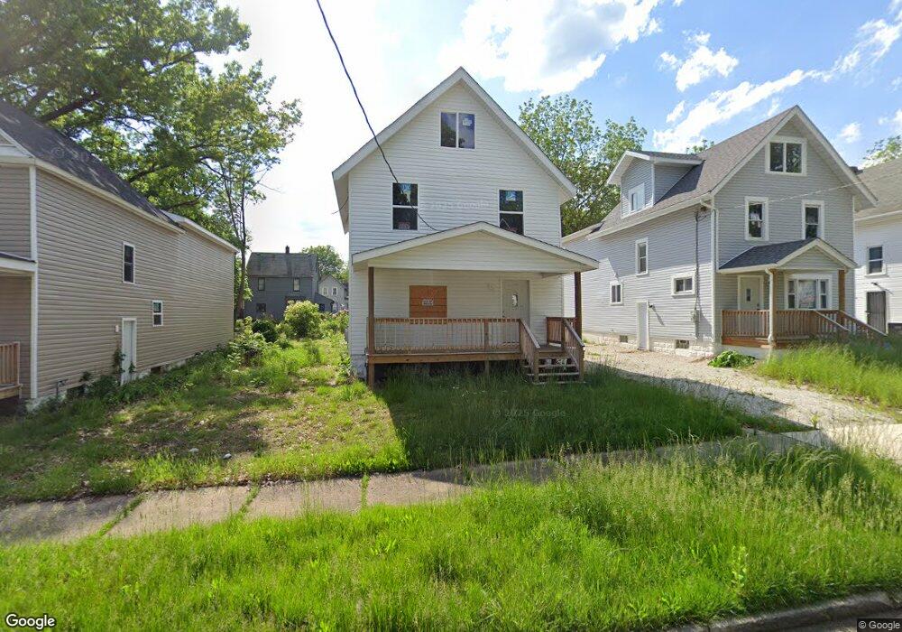
672 Moon St Akron, OH 44307
Sherbondy Hill NeighborhoodEstimated Value: $55,199 - $165,000
4
Beds
2
Baths
2,300
Sq Ft
$45/Sq Ft
Est. Value
About This Home
This home is located at 672 Moon St, Akron, OH 44307 and is currently estimated at $104,050, approximately $45 per square foot. 672 Moon St is a home located in Summit County with nearby schools including St. Bernard-St. Mary Elementary School.
Ownership History
Date
Name
Owned For
Owner Type
Purchase Details
Closed on
Feb 11, 2022
Sold by
Ray Robinson Timothy
Bought by
Instant Rehab Ohio Llc
Current Estimated Value
Purchase Details
Closed on
Feb 9, 2022
Sold by
Ray Robinson Timothy
Bought by
Instant Rehab Ohio Llc
Purchase Details
Closed on
Apr 26, 2016
Sold by
Boone Lula Robinson
Bought by
Robinson Timothy Iray
Purchase Details
Closed on
Jun 30, 2008
Sold by
Estate Of James E Boone
Bought by
Boone Lula Robinson
Create a Home Valuation Report for This Property
The Home Valuation Report is an in-depth analysis detailing your home's value as well as a comparison with similar homes in the area
Home Values in the Area
Average Home Value in this Area
Purchase History
| Date | Buyer | Sale Price | Title Company |
|---|---|---|---|
| Instant Rehab Ohio Llc | -- | None Listed On Document | |
| Instant Rehab Ohio Llc | -- | None Listed On Document | |
| Robinson Timothy Iray | -- | None Available | |
| Boone Lula Robinson | -- | None Available |
Source: Public Records
Tax History Compared to Growth
Tax History
| Year | Tax Paid | Tax Assessment Tax Assessment Total Assessment is a certain percentage of the fair market value that is determined by local assessors to be the total taxable value of land and additions on the property. | Land | Improvement |
|---|---|---|---|---|
| 2025 | $472 | $3,221 | $3,161 | $60 |
| 2024 | $472 | $3,221 | $3,161 | $60 |
| 2023 | $472 | $3,228 | $3,161 | $67 |
| 2022 | $467 | $2,808 | $1,859 | $949 |
| 2021 | $520 | $6,493 | $1,775 | $4,718 |
| 2020 | $513 | $6,500 | $1,780 | $4,720 |
| 2019 | $734 | $8,940 | $2,070 | $6,870 |
| 2018 | $725 | $8,940 | $2,070 | $6,870 |
| 2017 | $749 | $8,940 | $2,070 | $6,870 |
| 2016 | $749 | $9,120 | $2,070 | $7,050 |
| 2015 | $749 | $9,120 | $2,070 | $7,050 |
| 2014 | $743 | $9,120 | $2,070 | $7,050 |
| 2013 | $729 | $9,120 | $2,070 | $7,050 |
Source: Public Records
Map
Nearby Homes
- 639 Bellevue Ave
- 564 Euclid Ave
- 670 Euclid Ave
- 794 Ruth Ave
- 817 Raymond St
- 677 Vernon Odom Blvd
- 721 Vernon Odom Blvd
- 737 Vernon Odom Blvd
- 595 Rhodes Ave
- 577 Rhodes Ave
- 686 East Ave
- 364 Campbell St
- 949 Raymond St
- 1132 Bristol Terrace
- 644 Diagonal Rd
- 776 Krause Ct
- 985 Diana Ave
- 568 Auld Farm Cir
- 1001 Celina Ave
- 614 East Ave