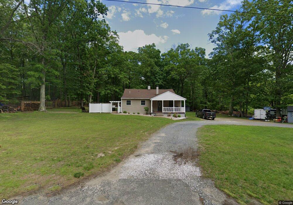
672 Route 539 New Egypt, NJ 08533
Estimated Value: $457,000 - $636,000
3
Beds
2
Baths
2,014
Sq Ft
$277/Sq Ft
Est. Value
About This Home
This home is located at 672 Route 539, New Egypt, NJ 08533 and is currently estimated at $557,004, approximately $276 per square foot. 672 Route 539 is a home located in Ocean County with nearby schools including Dr. Gerald H. Woehr Elementary School, New Egypt Middle School, and New Egypt High School.
Ownership History
Date
Name
Owned For
Owner Type
Purchase Details
Closed on
Oct 2, 2024
Sold by
Galloway Frank and Galloway Robbin L
Bought by
County Of Ocean
Current Estimated Value
Home Financials for this Owner
Home Financials are based on the most recent Mortgage that was taken out on this home.
Original Mortgage
$450,000
Interest Rate
6.35%
Mortgage Type
New Conventional
Purchase Details
Closed on
Aug 16, 2024
Sold by
Galloway Frank and Galloway Robbin L
Bought by
Caputo Jaime
Home Financials for this Owner
Home Financials are based on the most recent Mortgage that was taken out on this home.
Original Mortgage
$450,000
Interest Rate
6.35%
Mortgage Type
New Conventional
Purchase Details
Closed on
Oct 29, 2002
Create a Home Valuation Report for This Property
The Home Valuation Report is an in-depth analysis detailing your home's value as well as a comparison with similar homes in the area
Home Values in the Area
Average Home Value in this Area
Purchase History
| Date | Buyer | Sale Price | Title Company |
|---|---|---|---|
| County Of Ocean | $330,000 | None Listed On Document | |
| County Of Ocean | $330,000 | None Listed On Document | |
| Caputo Jaime | $500,000 | Heritage Abstract | |
| Caputo Jaime | $500,000 | Heritage Abstract | |
| -- | -- | -- |
Source: Public Records
Mortgage History
| Date | Status | Borrower | Loan Amount |
|---|---|---|---|
| Previous Owner | Caputo Jaime | $450,000 |
Source: Public Records
Tax History
| Year | Tax Paid | Tax Assessment Tax Assessment Total Assessment is a certain percentage of the fair market value that is determined by local assessors to be the total taxable value of land and additions on the property. | Land | Improvement |
|---|---|---|---|---|
| 2025 | $11,289 | $321,900 | $125,000 | $196,900 |
| 2024 | $10,309 | $355,100 | $207,300 | $147,800 |
| 2023 | $9,836 | $355,100 | $207,300 | $147,800 |
| 2022 | $9,836 | $355,100 | $207,300 | $147,800 |
| 2021 | $9,492 | $355,100 | $207,300 | $147,800 |
| 2020 | $9,272 | $355,100 | $207,300 | $147,800 |
| 2019 | $9,080 | $355,100 | $207,300 | $147,800 |
| 2018 | $9,240 | $355,100 | $207,300 | $147,800 |
| 2017 | $9,080 | $355,100 | $207,300 | $147,800 |
| 2016 | $8,949 | $355,100 | $207,300 | $147,800 |
| 2015 | $8,696 | $355,100 | $207,300 | $147,800 |
| 2014 | $8,494 | $355,100 | $207,300 | $147,800 |
Source: Public Records
Map
Nearby Homes
- 733 County Road 539
- 18 Country Woods Dr
- 254 Lakewood Rd
- 1 Hemlock Dr
- 138 Hemlock Dr
- 5 Pin Oak Dr
- 18 Hemlock Dr
- 71 Hemlock Dr
- 130 Hopkins Rd
- 510 Pinehurst Rd
- 60 Hampshire Ct
- 128 Bobbis Terrace
- 4 Marissa Dr
- 80 Ivins Dr
- 172 Hawkin Rd
- 353 Fieldcrest Dr
- 170-174 W Millstream Rd
- 889 Pinehurst Rd
- 393 E Millstream Rd
- 11 Mulberry Dr
Your Personal Tour Guide
Ask me questions while you tour the home.