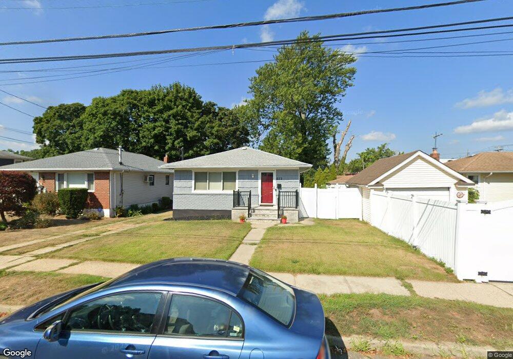
672 Thrush Ave West Hempstead, NY 11552
Estimated Value: $565,000 - $695,121
3
Beds
1
Bath
1,125
Sq Ft
$560/Sq Ft
Est. Value
About This Home
This home is located at 672 Thrush Ave, West Hempstead, NY 11552 and is currently estimated at $630,061, approximately $560 per square foot. 672 Thrush Ave is a home located in Nassau County with nearby schools including Chestnut Street School, West Hempstead Middle School, and West Hempstead Secondary School.
Ownership History
Date
Name
Owned For
Owner Type
Purchase Details
Closed on
Nov 24, 2017
Sold by
Williams Fallon M
Bought by
Williams Fallon M
Current Estimated Value
Purchase Details
Closed on
Dec 5, 2013
Sold by
Pardi Warren and Pardi Donna Maria
Bought by
Edwards Fallon
Home Financials for this Owner
Home Financials are based on the most recent Mortgage that was taken out on this home.
Original Mortgage
$270,019
Outstanding Balance
$202,139
Interest Rate
4.25%
Mortgage Type
FHA
Estimated Equity
$427,922
Purchase Details
Closed on
Jul 22, 1998
Create a Home Valuation Report for This Property
The Home Valuation Report is an in-depth analysis detailing your home's value as well as a comparison with similar homes in the area
Home Values in the Area
Average Home Value in this Area
Purchase History
| Date | Buyer | Sale Price | Title Company |
|---|---|---|---|
| Williams Fallon M | -- | -- | |
| Edwards Fallon | $275,000 | -- | |
| -- | -- | -- |
Source: Public Records
Mortgage History
| Date | Status | Borrower | Loan Amount |
|---|---|---|---|
| Open | Edwards Fallon | $270,019 |
Source: Public Records
Tax History Compared to Growth
Tax History
| Year | Tax Paid | Tax Assessment Tax Assessment Total Assessment is a certain percentage of the fair market value that is determined by local assessors to be the total taxable value of land and additions on the property. | Land | Improvement |
|---|---|---|---|---|
| 2025 | $10,375 | $409 | $190 | $219 |
| 2024 | $3,345 | $409 | $190 | $219 |
| 2023 | $9,364 | $409 | $190 | $219 |
| 2022 | $9,364 | $409 | $190 | $219 |
| 2021 | $12,474 | $390 | $181 | $209 |
| 2020 | $9,214 | $567 | $398 | $169 |
| 2019 | $2,999 | $567 | $398 | $169 |
| 2018 | $2,846 | $567 | $0 | $0 |
| 2017 | $4,701 | $567 | $398 | $169 |
| 2016 | $7,432 | $567 | $378 | $189 |
| 2015 | $3,183 | $567 | $378 | $189 |
| 2014 | $3,183 | $567 | $378 | $189 |
| 2013 | $1,863 | $597 | $398 | $199 |
Source: Public Records
Map
Nearby Homes
- 647 Jennings Ave
- 815 Sunshine Ave
- 639 Robin Ct
- 747 Janos Ln
- 729 Janos Ln
- 513 Washington Ave
- 596 Lincoln Ave
- 629 Park Ave
- 610 Park Ave
- 402 Maple St
- 55 Melvin Ave
- 841 Harrison St
- 669 Wadleigh Ave
- 841 Woodfield Rd
- 757 Harrison St
- 853 Arthur St
- 350 Coventry Rd N
- 450 Rhodes Ln
- 0 Rhodes Ln
- 883 Cleveland St