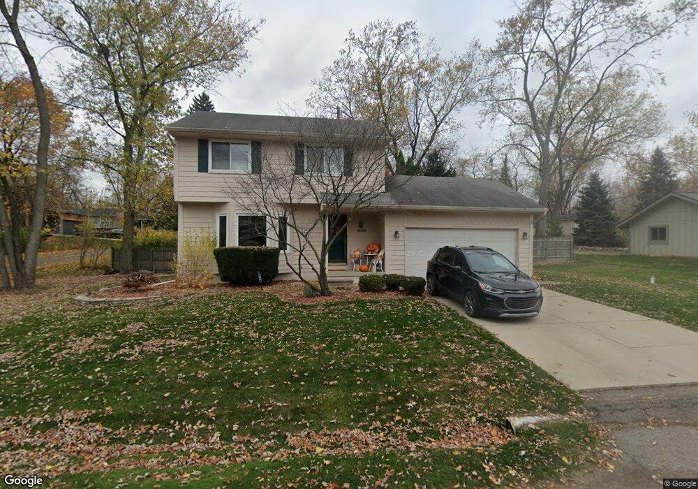
6720 Edwood Ave West Bloomfield, MI 48324
Estimated Value: $293,707 - $344,000
3
Beds
2
Baths
1,234
Sq Ft
$255/Sq Ft
Est. Value
About This Home
This home is located at 6720 Edwood Ave, West Bloomfield, MI 48324 and is currently estimated at $314,177, approximately $254 per square foot. 6720 Edwood Ave is a home located in Oakland County with nearby schools including Our Lady Of Refuge School and St Mary's Preparatory School.
Ownership History
Date
Name
Owned For
Owner Type
Purchase Details
Closed on
Dec 24, 2020
Sold by
Daugard Richard A and Daugard Nicole N
Bought by
Daugard Richard A and Daugard Nicole N
Current Estimated Value
Home Financials for this Owner
Home Financials are based on the most recent Mortgage that was taken out on this home.
Original Mortgage
$50,000
Interest Rate
2.65%
Mortgage Type
Credit Line Revolving
Purchase Details
Closed on
Jul 16, 2003
Sold by
Daugard Richard A and Daugard Nicole N
Bought by
Daugard Richard A and Daugard Nicole N
Purchase Details
Closed on
Nov 12, 1999
Sold by
Hutchison Jeffrey S
Bought by
Daugard Richard A
Home Financials for this Owner
Home Financials are based on the most recent Mortgage that was taken out on this home.
Original Mortgage
$137,600
Interest Rate
8.27%
Create a Home Valuation Report for This Property
The Home Valuation Report is an in-depth analysis detailing your home's value as well as a comparison with similar homes in the area
Home Values in the Area
Average Home Value in this Area
Purchase History
| Date | Buyer | Sale Price | Title Company |
|---|---|---|---|
| Daugard Richard A | -- | Progressive Title Co | |
| Daugard Richard A | -- | Progressive Title | |
| Daugard Richard Nicole | -- | Progressive Title | |
| Daugard Richard A | -- | -- | |
| Daugard Richard A | $172,000 | -- |
Source: Public Records
Mortgage History
| Date | Status | Borrower | Loan Amount |
|---|---|---|---|
| Previous Owner | Daugard Richard Nicole | $50,000 | |
| Previous Owner | Daugard Richard A | $137,600 |
Source: Public Records
Tax History Compared to Growth
Tax History
| Year | Tax Paid | Tax Assessment Tax Assessment Total Assessment is a certain percentage of the fair market value that is determined by local assessors to be the total taxable value of land and additions on the property. | Land | Improvement |
|---|---|---|---|---|
| 2024 | $1,927 | $118,580 | $0 | $0 |
| 2022 | $1,845 | $110,810 | $31,710 | $79,100 |
| 2021 | $2,804 | $106,190 | $0 | $0 |
| 2020 | $1,808 | $101,750 | $31,710 | $70,040 |
| 2018 | $2,704 | $89,720 | $31,710 | $58,010 |
| 2015 | -- | $75,220 | $0 | $0 |
| 2014 | -- | $70,150 | $0 | $0 |
| 2011 | -- | $62,910 | $0 | $0 |
Source: Public Records
Map
Nearby Homes
- 3950 Bradmore Ave
- 3965 Carrick Ave
- 3991 Fieldview Ave
- 4066 Green Lake Rd
- 0000 Langtoft
- 6675 Langtoft St
- 6768 Buckland Ave
- 6903 Dandison Blvd
- 6978 Colony Dr
- 3632 Fieldview Ave
- 3641 Green Lake Rd
- 4442 Borland St
- 4245 Bunker Ave
- 4335 Crestdale Ave
- 4540 Rolling Pine Ct
- 3701 Northwood
- 6707 Heatherwood Dr
- 4212 Greendale Ave
- 7337 Richardson Rd
- 6980 Hambro St
- 000 Vac Lots Edwood Ave
- 6690 Edwood Ave
- 3985 Mornhill Ave
- 3965 Mornhill Ave
- 6697 Edwood Ave
- 3965 Bradmore Ave
- 6680 Edwood Ave Unit Bldg-Unit
- Lots on Edwood Ave
- Lots Edwood Ave
- 3957 Bradmore Ave
- 6685 Edwood Ave
- 6737 Edwood Ave
- 3945 Mornhill Ave
- 6670 Edwood Ave
- 6752 Edwood Ave
- 6675 Edwood Ave
- 3951 Bradmore Ave
- 0 Mornhill Ave
- 6764 Edwood Ave