Estimated Value: $405,813 - $482,000
4
Beds
2
Baths
2,004
Sq Ft
$221/Sq Ft
Est. Value
About This Home
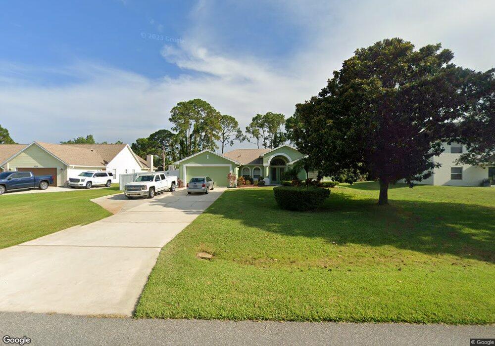
This home is located at 6720 Hundred Acre Dr, Cocoa, FL 32927 and is currently estimated at $443,703, approximately $221 per square foot. 6720 Hundred Acre Dr is a home located in Brevard County with nearby schools including Enterprise Elementary School, Space Coast Junior/Senior High School, and East Atlantic Prep of Brevard County.
Ownership History
Date
Name
Owned For
Owner Type
Purchase Details
Closed on
Mar 12, 1997
Sold by
Romar Homes Inc
Bought by
Campbell Ernest E and Campbell Sheila R
Current Estimated Value
Create a Home Valuation Report for This Property
The Home Valuation Report is an in-depth analysis detailing your home's value as well as a comparison with similar homes in the area
Home Values in the Area
Average Home Value in this Area
Purchase History
| Date | Buyer | Sale Price | Title Company |
|---|---|---|---|
| Campbell Ernest E | $18,500 | -- |
Source: Public Records
Tax History Compared to Growth
Tax History
| Year | Tax Paid | Tax Assessment Tax Assessment Total Assessment is a certain percentage of the fair market value that is determined by local assessors to be the total taxable value of land and additions on the property. | Land | Improvement |
|---|---|---|---|---|
| 2025 | $1,978 | $145,210 | -- | -- |
| 2024 | $1,937 | $141,120 | -- | -- |
| 2023 | $1,937 | $137,010 | $0 | $0 |
| 2022 | $1,811 | $133,020 | $0 | $0 |
| 2021 | $1,827 | $129,150 | $0 | $0 |
| 2020 | $1,756 | $127,370 | $0 | $0 |
| 2019 | $1,695 | $124,510 | $0 | $0 |
| 2018 | $1,692 | $122,190 | $0 | $0 |
| 2017 | $1,694 | $119,680 | $0 | $0 |
| 2016 | $1,706 | $117,220 | $32,000 | $85,220 |
| 2015 | $1,741 | $116,410 | $32,000 | $84,410 |
| 2014 | $1,746 | $115,490 | $32,000 | $83,490 |
Source: Public Records
Map
Nearby Homes
- 6581 Bancroft Ave
- 5575 Curtis Blvd
- 6615 Dock Ave
- 4650 N Highway 1 Hwy
- 5715 Fairbridge St
- 7065 Hundred Acre Dr
- 6665 Addie Ave
- 6760 Cairo Rd
- 6545 Addie Ave
- 6105 Banyan St
- TBD Freeport Rd
- 23-35-21-JX-B-2 Aruin St
- 6365 Homestead Ave
- 6775 Buxton Ave
- 6325 Ainsworth Rd
- 7230 Venus Ave
- 00 Unknown
- 5730 Friendly St
- 5155 Mayflower St
- 5130 Carter St
- 6710 Hundred Acre Dr
- 6730 Hundred Acre Dr
- 6705 Hundred Acre Dr
- 6740 Hundred Acre Dr
- 6700 Hundred Acre Dr
- 5600 Hastings St
- 5610 Hastings St
- 5570 Hastings St
- 6725 Hundred Acre Dr
- 5620 Hastings St
- 6750 Hundred Acre Dr Unit 4
- 6715 Hundred Acre Dr
- 6735 Hundred Acre Dr
- 6690 Hundred Acre Dr
- 5550 Hastings St
- 6745 Hundred Acre Dr
- 5640 Hastings St
- 5540 Hastings St
- 6760 Hundred Acre Dr
- 6755 Hundred Acre Dr