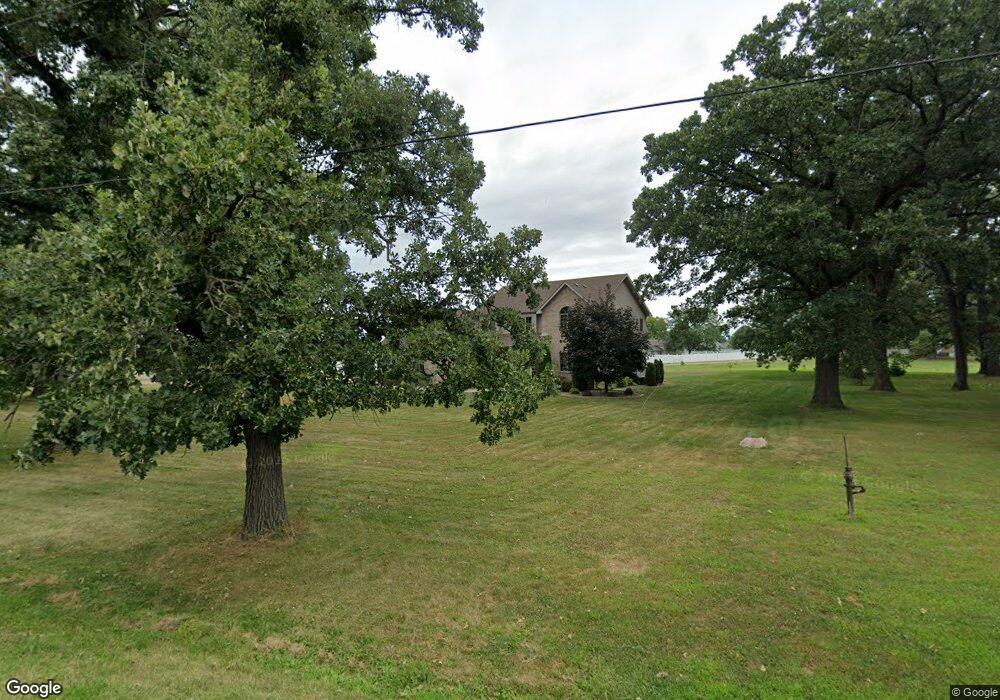
6720 Rohrman Rd Crown Point, IN 46307
Estimated Value: $451,000 - $627,000
3
Beds
3
Baths
3,746
Sq Ft
$152/Sq Ft
Est. Value
About This Home
This home is located at 6720 Rohrman Rd, Crown Point, IN 46307 and is currently estimated at $569,947, approximately $152 per square foot. 6720 Rohrman Rd is a home located in Lake County with nearby schools including Peifer Elementary School, Hal E Clark Middle School, and Lake Central High School.
Ownership History
Date
Name
Owned For
Owner Type
Purchase Details
Closed on
Dec 28, 2015
Sold by
Morley Patrick D and Morley Diana I
Bought by
Morley Lozano Diana I
Current Estimated Value
Home Financials for this Owner
Home Financials are based on the most recent Mortgage that was taken out on this home.
Original Mortgage
$70,000
Interest Rate
3.81%
Mortgage Type
New Conventional
Purchase Details
Closed on
Aug 26, 2008
Sold by
Morley Michael J
Bought by
Morley Patrick D and Morley Diana I
Create a Home Valuation Report for This Property
The Home Valuation Report is an in-depth analysis detailing your home's value as well as a comparison with similar homes in the area
Home Values in the Area
Average Home Value in this Area
Purchase History
| Date | Buyer | Sale Price | Title Company |
|---|---|---|---|
| Morley Lozano Diana I | -- | None Available | |
| Morley Patrick D | -- | Burnet Title Of Indiana Llc |
Source: Public Records
Mortgage History
| Date | Status | Borrower | Loan Amount |
|---|---|---|---|
| Previous Owner | Morley Lozano Diana I | $70,000 |
Source: Public Records
Tax History
| Year | Tax Paid | Tax Assessment Tax Assessment Total Assessment is a certain percentage of the fair market value that is determined by local assessors to be the total taxable value of land and additions on the property. | Land | Improvement |
|---|---|---|---|---|
| 2025 | $4,656 | $579,100 | $82,400 | $496,700 |
| 2024 | $9,848 | $546,200 | $82,400 | $463,800 |
| 2023 | $4,274 | $483,600 | $82,400 | $401,200 |
| 2022 | $4,274 | $404,600 | $82,400 | $322,200 |
| 2021 | $4,017 | $387,800 | $82,400 | $305,400 |
| 2020 | $3,711 | $354,500 | $47,700 | $306,800 |
| 2019 | $4,015 | $351,200 | $45,600 | $305,600 |
| 2018 | $3,708 | $324,200 | $45,600 | $278,600 |
| 2017 | $3,326 | $309,800 | $45,600 | $264,200 |
| 2016 | $3,045 | $287,300 | $45,600 | $241,700 |
| 2014 | $3,021 | $296,600 | $45,600 | $251,000 |
| 2013 | $3,046 | $291,800 | $45,600 | $246,200 |
Source: Public Records
Map
Nearby Homes
- 8323 Fairbanks St Unit 3E
- 2756 Autumn Dr
- 2914 Morningside Dr
- 7552 W 82nd Ct
- 2952 Freedom Cir
- 1444 Woodview Dr Unit 7
- 8676 Fulton Place
- 1874 Springvale Dr
- 1795 Wedgewood Ct
- 6076 Wexford Way
- 6440 W 89th Ave
- 5980 Wexford Way
- 8049 W 85th Ct
- 5536 Cedar Point Dr Unit A16
- 5547 Victoria Place
- 8777 Burr Ridge Cir
- 6640 W 89th Ave
- 7521 Kil Ct
- 10920 Missouri Place
- 8690 Durbin Ln
- 2813 Mockingbird Dr
- 2807 Mockingbird Dr
- 2819 Mockingbird Dr
- 2801 Mockingbird Dr
- 2825 Mockingbird Dr
- 2833 Mockingbird Dr
- 2749 Mockingbird Dr
- 6712 Rohrman Rd
- 2743 Mockingbird Dr
- 2814 Mockingbird Dr
- 2802 Mockingbird Dr
- 2820 Mockingbird Dr
- 2737 Mockingbird Dr
- 2826 Mockingbird Dr
- 2750 Mockingbird Dr
- 8261 Fairbanks St
- 2832 Mockingbird Dr
- 2744 Mockingbird Dr
- 2838 Mockingbird Dr
- 6710 Rohrman Rd
Your Personal Tour Guide
Ask me questions while you tour the home.