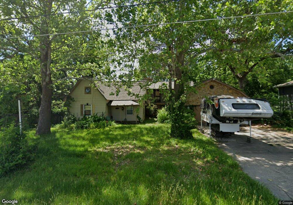
6720 Woodson Rd Raytown, MO 64133
Estimated Value: $270,830 - $356,000
3
Beds
2
Baths
2,534
Sq Ft
$124/Sq Ft
Est. Value
About This Home
This home is located at 6720 Woodson Rd, Raytown, MO 64133 and is currently estimated at $315,208, approximately $124 per square foot. 6720 Woodson Rd is a home located in Jackson County with nearby schools including Robinson Elementary School, Raytown Central Middle School, and Raytown South High School.
Ownership History
Date
Name
Owned For
Owner Type
Purchase Details
Closed on
Feb 28, 2006
Sold by
Harris Dawn L and Morain Dawn L
Bought by
Harris Dawn L and Harris Russel M
Current Estimated Value
Home Financials for this Owner
Home Financials are based on the most recent Mortgage that was taken out on this home.
Original Mortgage
$84,510
Interest Rate
6.21%
Mortgage Type
Fannie Mae Freddie Mac
Purchase Details
Closed on
Aug 1, 2002
Sold by
Morain Dawn L
Bought by
Morain Dawn L
Home Financials for this Owner
Home Financials are based on the most recent Mortgage that was taken out on this home.
Original Mortgage
$75,000
Interest Rate
11.5%
Mortgage Type
Purchase Money Mortgage
Create a Home Valuation Report for This Property
The Home Valuation Report is an in-depth analysis detailing your home's value as well as a comparison with similar homes in the area
Home Values in the Area
Average Home Value in this Area
Purchase History
| Date | Buyer | Sale Price | Title Company |
|---|---|---|---|
| Harris Dawn L | -- | First American Title Ins | |
| Morain Dawn L | -- | Ati Title Company |
Source: Public Records
Mortgage History
| Date | Status | Borrower | Loan Amount |
|---|---|---|---|
| Closed | Harris Dawn L | $84,510 | |
| Closed | Morain Dawn L | $75,000 |
Source: Public Records
Tax History
| Year | Tax Paid | Tax Assessment Tax Assessment Total Assessment is a certain percentage of the fair market value that is determined by local assessors to be the total taxable value of land and additions on the property. | Land | Improvement |
|---|---|---|---|---|
| 2025 | $2,192 | $27,939 | $5,580 | $22,359 |
| 2024 | $2,177 | $24,295 | $3,867 | $20,428 |
| 2023 | $2,177 | $24,296 | $3,217 | $21,079 |
| 2022 | $2,091 | $22,230 | $3,802 | $18,428 |
| 2021 | $2,098 | $22,230 | $3,802 | $18,428 |
| 2020 | $2,009 | $21,083 | $3,802 | $17,281 |
| 2019 | $1,999 | $21,083 | $3,802 | $17,281 |
| 2018 | $1,680 | $18,349 | $3,309 | $15,040 |
| 2017 | $1,680 | $18,349 | $3,309 | $15,040 |
| 2016 | $1,585 | $17,418 | $3,523 | $13,895 |
Source: Public Records
Map
Nearby Homes
- 6817 Englewood Ave
- 6828 Vermont Ave
- 6621 Woodson Rd
- 6913 Englewood Ave
- 6506 Sterling Ave
- 10816 E 66th Terrace
- 6411 Harvard Ave
- 7141 Sterling Ave
- 6817 Lakeshore Dr
- 6828 Lakeshore Dr
- 11601 E 62nd St
- 11101 E 72nd Terrace
- 12304 E 63rd Terrace
- 6215 Sterling Ave
- 12308 E 63rd Terrace
- 10600 E 65th St
- 7308 Crisp Ave
- 7402 Englewood Ln
- 10504 E 71st Terrace
- 7101 Willow Ave
- 6718 Woodson Rd
- 6729 Vermont Ave
- 6725 Vermont Ave
- 6801 Vermont Ave
- 6721 Vermont Ave
- 6714 Woodson Rd
- 6805 Vermont Ave
- 6717 Vermont Ave
- 6728 Vermont Ave
- 6724 Vermont Ave
- 6713 Vermont Ave
- 6720 Vermont Ave
- 6800 Vermont Ave
- 6811 Vermont Ave
- 6706 Woodson Rd
- 6716 Vermont Ave
- 6709 Vermont Ave
- 6804 Vermont Ave
- 6817 Vermont Ave
- 6702 Woodson Rd
Your Personal Tour Guide
Ask me questions while you tour the home.