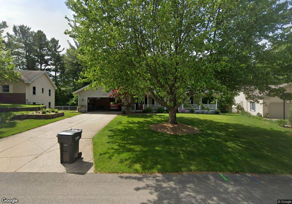
6723 Woodspointe Ct SW Byron Center, MI 49315
Estimated Value: $386,000 - $443,000
3
Beds
3
Baths
2,142
Sq Ft
$189/Sq Ft
Est. Value
About This Home
This home is located at 6723 Woodspointe Ct SW, Byron Center, MI 49315 and is currently estimated at $403,877, approximately $188 per square foot. 6723 Woodspointe Ct SW is a home located in Kent County with nearby schools including Marshall Elementary School, Robert L. Nickels Intermediate School, and Byron Center West Middle School.
Ownership History
Date
Name
Owned For
Owner Type
Purchase Details
Closed on
Apr 28, 2017
Sold by
Vigh Frank and Vigh Sharon K
Bought by
Vigh Frank and Vigh Sharon K
Current Estimated Value
Purchase Details
Closed on
Dec 3, 2003
Sold by
Shonk Ella M
Bought by
Vigh Frank and Vigh Sharon K
Home Financials for this Owner
Home Financials are based on the most recent Mortgage that was taken out on this home.
Original Mortgage
$100,000
Outstanding Balance
$46,758
Interest Rate
6.01%
Mortgage Type
Purchase Money Mortgage
Estimated Equity
$357,119
Create a Home Valuation Report for This Property
The Home Valuation Report is an in-depth analysis detailing your home's value as well as a comparison with similar homes in the area
Home Values in the Area
Average Home Value in this Area
Purchase History
| Date | Buyer | Sale Price | Title Company |
|---|---|---|---|
| Vigh Frank | -- | None Available | |
| Vigh Frank | $180,000 | Chicago Title |
Source: Public Records
Mortgage History
| Date | Status | Borrower | Loan Amount |
|---|---|---|---|
| Open | Vigh Frank | $100,000 |
Source: Public Records
Tax History Compared to Growth
Tax History
| Year | Tax Paid | Tax Assessment Tax Assessment Total Assessment is a certain percentage of the fair market value that is determined by local assessors to be the total taxable value of land and additions on the property. | Land | Improvement |
|---|---|---|---|---|
| 2025 | $2,026 | $180,500 | $0 | $0 |
| 2024 | $2,026 | $161,300 | $0 | $0 |
| 2023 | $1,938 | $143,400 | $0 | $0 |
| 2022 | $2,701 | $126,300 | $0 | $0 |
| 2021 | $2,629 | $116,600 | $0 | $0 |
| 2020 | $1,784 | $105,800 | $0 | $0 |
| 2019 | $2,565 | $102,200 | $0 | $0 |
| 2018 | $2,513 | $99,300 | $18,800 | $80,500 |
| 2017 | $2,445 | $89,300 | $0 | $0 |
| 2016 | $2,357 | $84,800 | $0 | $0 |
| 2015 | $2,317 | $84,800 | $0 | $0 |
| 2013 | -- | $75,200 | $0 | $0 |
Source: Public Records
Map
Nearby Homes
- 6696 Highmeadow Dr SW
- 1010 Bellview Meadow Dr SW Unit 68
- 1012 Bellview Meadow Dr SW
- 6540 Kingtree Dr SW
- 907 Amber View Dr SW
- 1171 Runway Place SW
- 825 Amber Ridge Dr SW
- 6787 Sunfield Dr SW
- 1058 Amberwood West Dr SW
- 924 Amberwood West Dr SW
- 6455 Silverton Dr
- 6450 Estate Dr SW
- 6471 Estate Dr SW
- 6455 Estate Dr SW
- 1493 Dexter Dr SW Unit 34
- 1501 Dexter St SW Unit 35
- 7074 Nantucket Dr SW
- 1531 Dexter Dr SW Unit 37
- 6840 Burlingame Ave SW
- 323 Scabbard St SW
- 6727 Woodspointe Ct SW
- 6719 Woodspointe Ct SW
- 6715 Woodspointe Ct SW
- 6731 Woodspointe Ct SW
- 6757 Southpointe Ct SW
- 6761 Southpointe Ct SW
- 6716 Woodspointe Ct SW
- 6724 Woodspointe Ct SW
- 6743 Southpointe Ct SW
- 6784 Highmeadow Dr SW
- 6711 Woodspointe Ct SW
- 6776 Highmeadow Dr SW
- 6731 Southpointe Ct SW
- 6710 Woodspointe Ct SW
- 6767 Southpointe Ct SW
- 6735 Woodspointe Ct SW
- 6730 Woodspointe Ct SW
- 6734 Woodspointe Ct SW
- 6764 Highmeadow Dr SW
- 6794 Highmeadow Dr SW