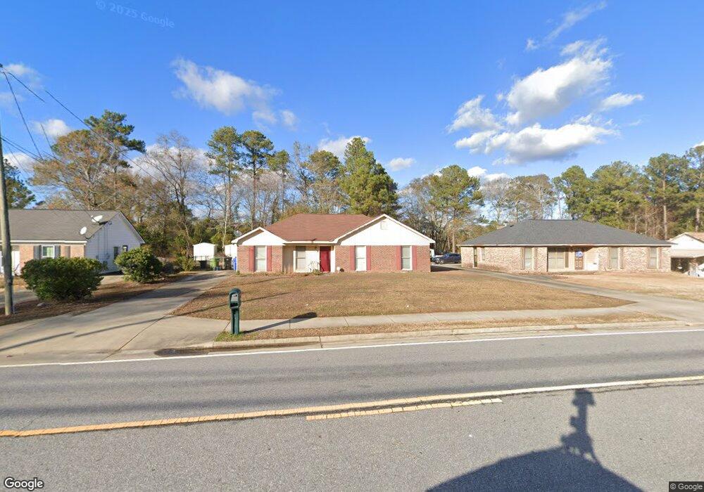
6725 Forrest Rd Columbus, GA 31907
East Columbus NeighborhoodEstimated Value: $157,000 - $182,000
3
Beds
3
Baths
1,401
Sq Ft
$118/Sq Ft
Est. Value
About This Home
This home is located at 6725 Forrest Rd, Columbus, GA 31907 and is currently estimated at $165,843, approximately $118 per square foot. 6725 Forrest Rd is a home located in Muscogee County with nearby schools including Forrest Road Elementary School, Fort Middle School, and Kendrick High School.
Ownership History
Date
Name
Owned For
Owner Type
Purchase Details
Closed on
Apr 10, 2014
Sold by
Rivers Julie Anne
Bought by
Columbus Consolidated Governme
Current Estimated Value
Purchase Details
Closed on
Feb 3, 2012
Sold by
Rivers Arthur
Bought by
Rivers Julie Anne
Create a Home Valuation Report for This Property
The Home Valuation Report is an in-depth analysis detailing your home's value as well as a comparison with similar homes in the area
Home Values in the Area
Average Home Value in this Area
Purchase History
| Date | Buyer | Sale Price | Title Company |
|---|---|---|---|
| Columbus Consolidated Governme | $3,285 | -- | |
| Rivers Julie Anne | -- | -- |
Source: Public Records
Tax History
| Year | Tax Paid | Tax Assessment Tax Assessment Total Assessment is a certain percentage of the fair market value that is determined by local assessors to be the total taxable value of land and additions on the property. | Land | Improvement |
|---|---|---|---|---|
| 2025 | $472 | $55,472 | $10,672 | $44,800 |
| 2024 | $471 | $55,472 | $10,672 | $44,800 |
| 2023 | $21 | $55,472 | $10,672 | $44,800 |
| 2022 | $491 | $37,160 | $10,672 | $26,488 |
| 2021 | $484 | $32,000 | $10,672 | $21,328 |
| 2020 | $485 | $32,000 | $10,672 | $21,328 |
| 2019 | $488 | $32,000 | $10,672 | $21,328 |
| 2018 | $488 | $32,000 | $10,672 | $21,328 |
| 2017 | $491 | $32,000 | $10,672 | $21,328 |
| 2016 | $494 | $48,212 | $2,708 | $45,504 |
| 2015 | $496 | $48,212 | $2,708 | $45,504 |
| 2014 | $499 | $48,212 | $2,708 | $45,504 |
| 2013 | -- | $48,212 | $2,708 | $45,504 |
Source: Public Records
Map
Nearby Homes
- 3041 Waddell Dr
- 6636 Foxboro Dr
- 2735 Schatulga Rd
- 2708 Courtland Ave
- 2737 Schatulga Rd
- 6424 Lemongrass Dr
- 5644 Peggy Dr
- 5646 Boby Dr
- 6946 Boby Ct
- 6374 Lemongrass Dr
- 6370 Lemongrass Dr
- 6362 Lemongrass Dr
- 2143 Hunter Ct
- 6703 Aldora Dr
- 6834 Aldora Dr
- 2312 Burnside Dr
- 2672 Honeysuckle Dr
- 6311 Morning Dew Dr
- 6303 Morning Dew Dr
- 6302 Morning Dew Dr
- 6713 Forrest Rd
- 6737 Forrest Rd
- 6749 Forrest Rd
- 2912 Fontaine Dr
- 2902 Fontaine Dr
- 6618 Foxdale Dr
- 6624 Foxdale Dr
- 2918 Fontaine Dr
- 6612 Foxdale Dr
- 6761 Forrest Rd
- 6630 Foxdale Dr
- 2926 Fontaine Dr
- 6636 Foxdale Dr
- 6773 Forrest Rd
- 6704 Forrest Rd
- 6642 Foxdale Dr
- 6644 Forrest Rd
- 6617 Foxdale Dr
- 2911 Fontaine Dr
- 6623 Foxdale Dr
Your Personal Tour Guide
Ask me questions while you tour the home.