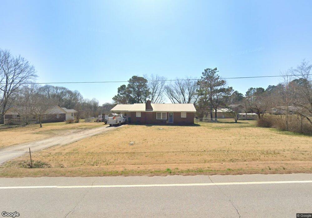
6725 Highway 59 Lavonia, GA 30553
Estimated Value: $186,000 - $246,000
2
Beds
1
Bath
1,032
Sq Ft
$215/Sq Ft
Est. Value
About This Home
This home is located at 6725 Highway 59, Lavonia, GA 30553 and is currently estimated at $221,946, approximately $215 per square foot. 6725 Highway 59 is a home with nearby schools including Franklin County High School.
Ownership History
Date
Name
Owned For
Owner Type
Purchase Details
Closed on
Apr 21, 2025
Sold by
Pulsifer Ansley A
Bought by
Ratliff William Charles
Current Estimated Value
Home Financials for this Owner
Home Financials are based on the most recent Mortgage that was taken out on this home.
Original Mortgage
$176,000
Outstanding Balance
$175,536
Interest Rate
6.67%
Mortgage Type
New Conventional
Estimated Equity
$46,410
Purchase Details
Closed on
Feb 14, 2020
Sold by
Akins Kelly
Bought by
Pulsifer Robert E and Pulsifer Ansley A
Purchase Details
Closed on
Sep 28, 2013
Sold by
J Athonthy Phillips Life Est
Bought by
Akin Kelly
Create a Home Valuation Report for This Property
The Home Valuation Report is an in-depth analysis detailing your home's value as well as a comparison with similar homes in the area
Home Values in the Area
Average Home Value in this Area
Purchase History
| Date | Buyer | Sale Price | Title Company |
|---|---|---|---|
| Ratliff William Charles | $220,000 | -- | |
| Pulsifer Robert E | -- | -- | |
| Akin Kelly | -- | -- |
Source: Public Records
Mortgage History
| Date | Status | Borrower | Loan Amount |
|---|---|---|---|
| Open | Ratliff William Charles | $176,000 |
Source: Public Records
Tax History Compared to Growth
Tax History
| Year | Tax Paid | Tax Assessment Tax Assessment Total Assessment is a certain percentage of the fair market value that is determined by local assessors to be the total taxable value of land and additions on the property. | Land | Improvement |
|---|---|---|---|---|
| 2024 | $1,300 | $40,697 | $2,019 | $38,678 |
| 2023 | $1,274 | $36,998 | $1,836 | $35,162 |
| 2022 | $1,145 | $33,392 | $1,420 | $31,972 |
| 2021 | $1,089 | $29,084 | $1,420 | $27,664 |
| 2020 | $925 | $24,342 | $1,420 | $22,922 |
| 2019 | $902 | $24,342 | $1,420 | $22,922 |
| 2018 | $789 | $21,204 | $1,781 | $19,423 |
| 2017 | $813 | $21,204 | $1,781 | $19,423 |
| 2016 | $740 | $18,349 | $1,781 | $16,568 |
| 2015 | -- | $14,274 | $1,781 | $12,494 |
| 2014 | -- | $14,275 | $1,781 | $12,494 |
| 2013 | -- | $14,546 | $1,781 | $12,765 |
Source: Public Records
Map
Nearby Homes
- 103 Ross Place
- 396 Brookwood Dr
- 159 Old Park Rd
- 90 Old City Park Rd
- 0 Highway 59 Unit 10615036
- 353 Bow Dr
- 5474 Vickery St
- 5494 Vickery St
- 5710 Vickery St
- 49 Wright St Unit 65
- 45 Wright St Unit 64
- 57 Wright St Unit 68
- 55 Wright St Unit 67
- 51 Wright St Unit 66
- 266 Randall St
- 86 Luckie St
- 89 Huntington Dr
- 59 Wright St Unit 69
- 138 Victoria Ln
- 0 Hwy 59 and Ross Place Unit 10499138
- 6699 West Ave
- 6755 West Ave
- 6781 West Ave
- 6671 West Ave
- 59 Tiger Tail Rd
- 6699 Highway 59
- 93 Tiger Tail Rd
- 30 Tiger Tail Rd
- 167 Tiger Tail Rd
- 187 Tiger Tail Rd
- 0 Tiger Tail Rd
- 214 Tiger Tail Rd
- 6531 West Ave
- 150 Ross Place
- 115 Ross Place
- 6946 Highway 59
- 6950 Highway 59
- 1 Clubhouse Way
- 7001 Highway 59
- 0 Bosal Way Unit 10190672