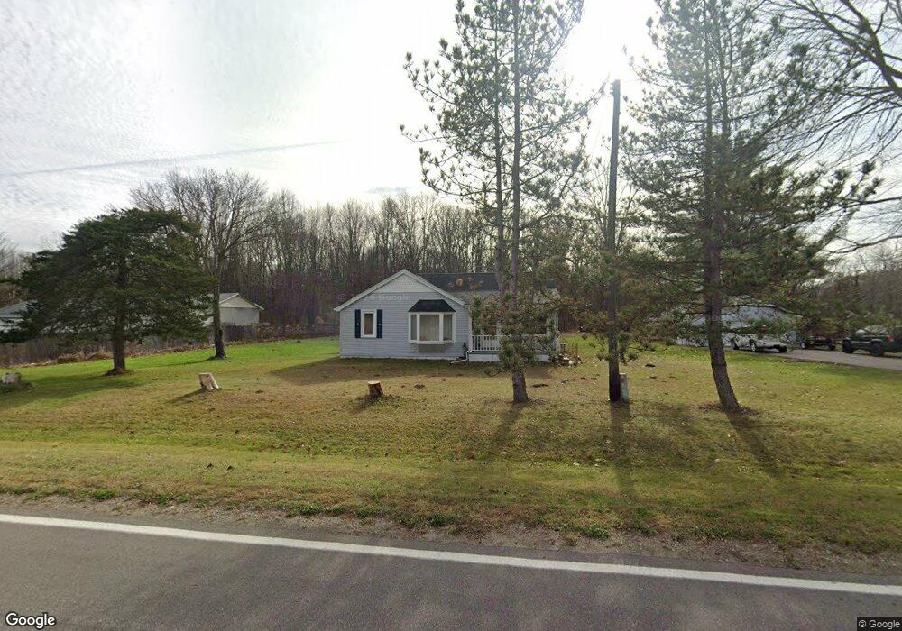
6725 Sparling Rd Kimball, MI 48074
Estimated Value: $186,191 - $202,000
3
Beds
1
Bath
1,319
Sq Ft
$147/Sq Ft
Est. Value
About This Home
This home is located at 6725 Sparling Rd, Kimball, MI 48074 and is currently estimated at $194,548, approximately $147 per square foot. 6725 Sparling Rd is a home located in St. Clair County with nearby schools including Kimball Elementary School, Central Middle School, and Port Huron High School.
Ownership History
Date
Name
Owned For
Owner Type
Purchase Details
Closed on
Sep 26, 2011
Sold by
Rowark Mark and Rowark Cynthia L
Bought by
Rowark Mark and Rowark Cynthia L
Current Estimated Value
Purchase Details
Closed on
Sep 22, 2011
Sold by
Secretary Of Housing & Urban Development
Bought by
Rowark Mark
Purchase Details
Closed on
Jan 7, 2010
Sold by
Barnes Thomas I and Barnes Hiromi
Bought by
Suntrust Mortgage Inc
Purchase Details
Closed on
Jul 11, 2006
Sold by
Barnes Thomas I and Barnes Hiromi N
Bought by
Barnes Thomas I
Home Financials for this Owner
Home Financials are based on the most recent Mortgage that was taken out on this home.
Original Mortgage
$161,041
Interest Rate
6.73%
Mortgage Type
FHA
Create a Home Valuation Report for This Property
The Home Valuation Report is an in-depth analysis detailing your home's value as well as a comparison with similar homes in the area
Home Values in the Area
Average Home Value in this Area
Purchase History
| Date | Buyer | Sale Price | Title Company |
|---|---|---|---|
| Rowark Mark | -- | Liberty Title | |
| Rowark Mark | $40,172 | None Available | |
| Suntrust Mortgage Inc | $184,850 | None Available | |
| Barnes Thomas I | -- | Metro Title Corp |
Source: Public Records
Mortgage History
| Date | Status | Borrower | Loan Amount |
|---|---|---|---|
| Previous Owner | Barnes Thomas I | $161,041 |
Source: Public Records
Tax History Compared to Growth
Tax History
| Year | Tax Paid | Tax Assessment Tax Assessment Total Assessment is a certain percentage of the fair market value that is determined by local assessors to be the total taxable value of land and additions on the property. | Land | Improvement |
|---|---|---|---|---|
| 2025 | $683 | $69,700 | $0 | $0 |
| 2024 | $683 | $64,500 | $0 | $0 |
| 2023 | $626 | $60,800 | $0 | $0 |
| 2022 | $1,093 | $54,400 | $0 | $0 |
| 2021 | $972 | $46,100 | $0 | $0 |
| 2020 | $972 | $55,100 | $55,100 | $0 |
| 2019 | $954 | $53,800 | $0 | $0 |
| 2018 | $932 | $52,400 | $0 | $0 |
| 2017 | $913 | $51,300 | $0 | $0 |
| 2016 | $509 | $51,300 | $0 | $0 |
| 2015 | -- | $46,900 | $46,900 | $0 |
| 2014 | -- | $35,800 | $35,800 | $0 |
| 2013 | -- | $52,100 | $0 | $0 |
Source: Public Records
Map
Nearby Homes
- 0 Sparling Rd Unit 2210034403
- I-69 vac Taylor Dr
- 00 Griswold Rd
- 6928 Lapeer Rd
- 0000 Conrad Dr
- 6201 Lapeer Rd
- 1371 Sturdevant Rd
- 7710 Sparling Rd
- 2019 Edward Ln E
- 1671 Ditty Rd
- 0 Sparling Unit 20230091288
- 1261 Sturdevant Rd
- 6241 Twin Lakes Dr
- 00000 Lapeer Rd
- 5128 Twin Lakes Dr
- 599 Trout Lake Ct
- 504 Bush Lake Ln
- 1876 Morningstar Ave
- 0000 V/L Lapeer Rd
- 5668 Hidden Cove Ln
- 6713 Sparling Rd
- 6709 Sparling Rd
- 6709 Sparling Rd
- 6710 Sparling Rd
- 6824 Sparling Rd
- 6690 Sparling Rd
- 6690 Sparling Rd
- 6828 Sparling Rd
- 6830 Sparling Rd
- 6622 Sparling Rd
- 6835 Sparling Rd
- 6832 Sparling Rd
- 6834 Sparling Rd
- 6837 Sparling Rd
- 6836 Sparling Rd
- 6699 Sparling Rd
- 6841 Sparling Rd
- 6840 Sparling Rd
- 6604 Sparling Rd
- 6881 Sparling Rd