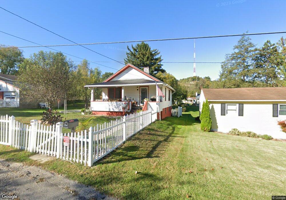
67250 Charles Ave Bridgeport, OH 43912
Estimated Value: $47,000 - $88,000
1
Bed
1
Bath
720
Sq Ft
$96/Sq Ft
Est. Value
About This Home
This home is located at 67250 Charles Ave, Bridgeport, OH 43912 and is currently estimated at $69,459, approximately $96 per square foot. 67250 Charles Ave is a home located in Belmont County with nearby schools including Bridgeport Elementary School, Bridgeport Middle School, and Bridgeport High School.
Ownership History
Date
Name
Owned For
Owner Type
Purchase Details
Closed on
Apr 18, 2011
Sold by
Aubrey Craig
Bought by
Aubrey Craig S and Craig S Aubrey Revocable Living Trust
Current Estimated Value
Purchase Details
Closed on
Feb 14, 2011
Sold by
Grandstaff Lloyd A and Grandstaff Carol L
Bought by
Aubrey Craig
Purchase Details
Closed on
Nov 9, 1994
Sold by
Grandstaff Lloyd A and Grandstaff Caro
Bought by
Grandstaff Lloyd A and Grandstaff Caro
Purchase Details
Closed on
Jan 1, 1986
Sold by
Grandstaff Lloyd A and Grandstaff Caro
Bought by
Grandstaff Lloyd A and Grandstaff Caro
Create a Home Valuation Report for This Property
The Home Valuation Report is an in-depth analysis detailing your home's value as well as a comparison with similar homes in the area
Home Values in the Area
Average Home Value in this Area
Purchase History
| Date | Buyer | Sale Price | Title Company |
|---|---|---|---|
| Aubrey Craig S | -- | Attorney | |
| Aubrey Craig | $25,000 | Attorney | |
| Grandstaff Lloyd A | -- | -- | |
| Grandstaff Lloyd A | -- | -- |
Source: Public Records
Tax History Compared to Growth
Tax History
| Year | Tax Paid | Tax Assessment Tax Assessment Total Assessment is a certain percentage of the fair market value that is determined by local assessors to be the total taxable value of land and additions on the property. | Land | Improvement |
|---|---|---|---|---|
| 2024 | $952 | $23,450 | $2,150 | $21,300 |
| 2023 | $679 | $14,880 | $2,150 | $12,730 |
| 2022 | $644 | $14,872 | $2,146 | $12,726 |
| 2021 | $641 | $14,872 | $2,146 | $12,726 |
| 2020 | $523 | $12,400 | $1,790 | $10,610 |
| 2019 | $526 | $12,400 | $1,790 | $10,610 |
| 2018 | $537 | $12,400 | $1,790 | $10,610 |
| 2017 | $453 | $9,690 | $1,570 | $8,120 |
| 2016 | $458 | $9,690 | $1,570 | $8,120 |
| 2015 | $456 | $9,690 | $1,570 | $8,120 |
| 2014 | $466 | $9,540 | $1,420 | $8,120 |
| 2013 | $424 | $9,540 | $1,420 | $8,120 |
Source: Public Records
Map
Nearby Homes
- 67730 Kirkwood Heights Rd
- 67531 Kirkwood Heights Rd
- 57950 Kilgore Rd
- 67478 Kirkwood Heights Rd
- 308 Whitely St
- 822 W Bennett St
- 629 1/2 Howard St
- 149 Virginia St
- 824 Howard St
- 219 S York St
- 120 S Wabash St
- 1123 Minellen Dr
- 411 S Penn St Unit 413
- 120 Iowa St
- 98 Iowa St
- 244 Lombardy Heights
- 19 S Broadway St
- 108 S Penn St
- 836 Main St
- 866 Main St
- 67240 Charles Ave
- 67262 Charles Ave
- 67711 Kirkwood Heights Rd
- 67717 Kirkwood Heights Rd
- 57600 S Eleanor St
- 57599 S Eleanor St
- 57578 Adams Ave
- 57619 S Eleanor St
- 67690 Kirkwood Heights Rd
- 67714 Kirkwood Heights Rd
- 57660 Willow St
- 57622 S Eleanor St
- 57622 S Eleanor St
- 67720 Kirkwood Heights Rd
- 57639 S Eleanor St
- 57635 Willow St
- 57621 N Eleanor St
- 67685 Kirkwood Heights Rd
- 57640 S Eleanor St
- 57659 S Eleanor St