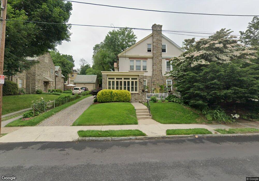
6727 Anderson St Philadelphia, PA 19119
East Mount Airy NeighborhoodEstimated Value: $524,000 - $681,000
4
Beds
4
Baths
2,403
Sq Ft
$239/Sq Ft
Est. Value
About This Home
This home is located at 6727 Anderson St, Philadelphia, PA 19119 and is currently estimated at $574,738, approximately $239 per square foot. 6727 Anderson St is a home located in Philadelphia County with nearby schools including Anna B. Day School, Martin Luther King High School, and West Oak Lane Charter School.
Ownership History
Date
Name
Owned For
Owner Type
Purchase Details
Closed on
Jun 23, 2009
Sold by
Bedno Edward and Bedno Jane
Bought by
Jones Jamilah A and Jones Cherie L
Current Estimated Value
Home Financials for this Owner
Home Financials are based on the most recent Mortgage that was taken out on this home.
Original Mortgage
$224,000
Outstanding Balance
$142,668
Interest Rate
4.92%
Mortgage Type
Purchase Money Mortgage
Estimated Equity
$432,070
Create a Home Valuation Report for This Property
The Home Valuation Report is an in-depth analysis detailing your home's value as well as a comparison with similar homes in the area
Home Values in the Area
Average Home Value in this Area
Purchase History
| Date | Buyer | Sale Price | Title Company |
|---|---|---|---|
| Jones Jamilah A | $280,000 | Lawyers Title Insurance Corp |
Source: Public Records
Mortgage History
| Date | Status | Borrower | Loan Amount |
|---|---|---|---|
| Open | Jones Jamilah A | $224,000 |
Source: Public Records
Tax History Compared to Growth
Tax History
| Year | Tax Paid | Tax Assessment Tax Assessment Total Assessment is a certain percentage of the fair market value that is determined by local assessors to be the total taxable value of land and additions on the property. | Land | Improvement |
|---|---|---|---|---|
| 2025 | $5,076 | $429,000 | $85,800 | $343,200 |
| 2024 | $5,076 | $429,000 | $85,800 | $343,200 |
| 2023 | $5,076 | $362,600 | $72,520 | $290,080 |
| 2022 | $3,215 | $317,600 | $72,520 | $245,080 |
| 2021 | $3,845 | $0 | $0 | $0 |
| 2020 | $3,845 | $0 | $0 | $0 |
| 2019 | $4,013 | $0 | $0 | $0 |
| 2018 | $4,008 | $0 | $0 | $0 |
| 2017 | $4,008 | $0 | $0 | $0 |
| 2016 | $3,588 | $0 | $0 | $0 |
| 2015 | $3,563 | $0 | $0 | $0 |
| 2014 | -- | $295,900 | $45,972 | $249,928 |
| 2012 | -- | $35,072 | $4,730 | $30,342 |
Source: Public Records
Map
Nearby Homes
- 614 E Vernon Rd
- 715 E Dorset St
- 609 E Hortter Place
- 725 E Vernon Rd
- 506 E Gorgas Ln
- 505 E Vernon Rd
- 258 E Sharpnack St
- 6648 Blakemore St
- 802 E Phil Ellena St
- 265 -267 E Hortter St
- 6904 Ardleigh St
- 457 E Vernon Rd
- 729 E Upsal St
- 6768 Stenton Ave
- 722 E Upsal St
- 441 E Pleasant St
- 501 E Sedgwick St
- 1235 Yerkes St
- 411 E Vernon Rd
- 400 E Vernon Rd
- 706 E Vernon Rd
- 711 E Dorset St
- 714 E Vernon Rd
- 713 E Dorset St
- 6725 Anderson St
- 620 E Vernon Rd
- 718 E Vernon Rd
- 717 E Dorset St
- 714 E Dorset St
- 720 E Vernon Rd
- 6723 Anderson St
- 716 E Dorset St
- 616 E Vernon Rd
- 719 E Dorset St
- 6712 Anderson St
- 718 E Dorset St
- 720 E Dorset St
- 721 E Dorset St
- 635 E Vernon Rd
- 705 E Vernon Rd