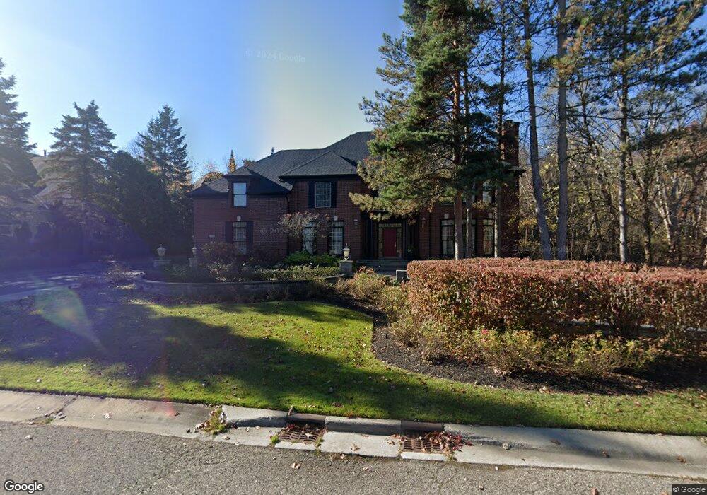
6728 Minnow Pond Dr Unit Bldg-Unit West Bloomfield, MI 48322
Estimated Value: $887,594 - $1,248,000
4
Beds
6
Baths
4,382
Sq Ft
$243/Sq Ft
Est. Value
About This Home
This home is located at 6728 Minnow Pond Dr Unit Bldg-Unit, West Bloomfield, MI 48322 and is currently estimated at $1,065,399, approximately $243 per square foot. 6728 Minnow Pond Dr Unit Bldg-Unit is a home located in Oakland County with nearby schools including Meadowbrook Elementary School, James R Geisler Middle School, and Walled Lake Western High School.
Ownership History
Date
Name
Owned For
Owner Type
Purchase Details
Closed on
Mar 12, 2025
Sold by
Plater Malesa
Bought by
Malesa Laschell Plater Revocable Living Trust
Current Estimated Value
Purchase Details
Closed on
Oct 27, 2016
Sold by
Edwards Braylon
Bought by
Plater Malesa
Purchase Details
Closed on
Aug 19, 2005
Sold by
Edwards Steven D and Edwards Diane M
Bought by
Edwards Braylon
Home Financials for this Owner
Home Financials are based on the most recent Mortgage that was taken out on this home.
Original Mortgage
$170,000
Interest Rate
5.82%
Mortgage Type
Unknown
Purchase Details
Closed on
Oct 26, 2000
Sold by
Millcreek Building Co
Bought by
Edwards Steven D
Create a Home Valuation Report for This Property
The Home Valuation Report is an in-depth analysis detailing your home's value as well as a comparison with similar homes in the area
Home Values in the Area
Average Home Value in this Area
Purchase History
| Date | Buyer | Sale Price | Title Company |
|---|---|---|---|
| Malesa Laschell Plater Revocable Living Trust | $700,000 | None Listed On Document | |
| Plater Malesa | -- | None Available | |
| Edwards Braylon | $850,000 | Devon Title Agency | |
| Edwards Steven D | $645,550 | -- |
Source: Public Records
Mortgage History
| Date | Status | Borrower | Loan Amount |
|---|---|---|---|
| Previous Owner | Edwards Braylon | $417,000 | |
| Previous Owner | Edwards Braylon | $170,000 | |
| Previous Owner | Edwards Braylon | $680,000 | |
| Closed | Edwards Steven D | -- |
Source: Public Records
Tax History Compared to Growth
Tax History
| Year | Tax Paid | Tax Assessment Tax Assessment Total Assessment is a certain percentage of the fair market value that is determined by local assessors to be the total taxable value of land and additions on the property. | Land | Improvement |
|---|---|---|---|---|
| 2024 | $6,339 | $389,320 | $0 | $0 |
| 2022 | $5,976 | $338,140 | $27,010 | $311,130 |
| 2021 | $9,906 | $332,400 | $0 | $0 |
| 2020 | $5,906 | $338,420 | $27,010 | $311,410 |
| 2018 | $9,839 | $297,190 | $27,010 | $270,180 |
| 2015 | -- | $289,190 | $0 | $0 |
| 2014 | -- | $265,740 | $0 | $0 |
| 2011 | -- | $250,430 | $0 | $0 |
Source: Public Records
Map
Nearby Homes
- 6608 Minnow Pond Dr
- 7990 Little Farm Ln
- 7863 Woodingham
- 7147 Elmhurst Unit 23
- 7296 Green Farm Rd Unit 133
- 7408 Westbury Blvd
- 6291 Pheasant Run
- 7453 Pepper Creek
- 7276 Somerby
- 7288 Danbrooke Unit 125
- 7156 Sturnbridge Unit 90
- 7156 Sturnbridge
- 6642 Carlyle Ct
- 31085 Estate Woods Ct
- 6986 Crosswell Dr
- 6775 Carlyle Crossing
- 6517 Chelsea Bridge
- 38872 Country Cir Unit 90
- 31033 Evergreen Ct
- 38887 Country Cir
- 6728 Minnow Pond Dr
- 7548 Promontory Pointe
- 7536 Promontory Pointe
- 7550 Promontory Pointe
- 6735 Minnow Pond Dr
- 7553 Knoll Crest Dr
- 7562 Promontory Pointe
- 7561 Knoll Crest Dr
- 6747 Minnow Pond Dr
- 6699 Minnow Pond Dr
- 7574 Promontory Pointe
- 6759 Minnow Pond Dr
- 7573 Knoll Crest Dr Unit Bldg-Unit
- 7573 Knoll Crest Dr
- 6687 Minnow Pond Dr
- 7586 Promontory Pointe
- 7542 Pinewood Trail
- 6675 Minnow Pond Dr
- 7554 Pinewood Trail
- 7585 Knoll Crest Dr