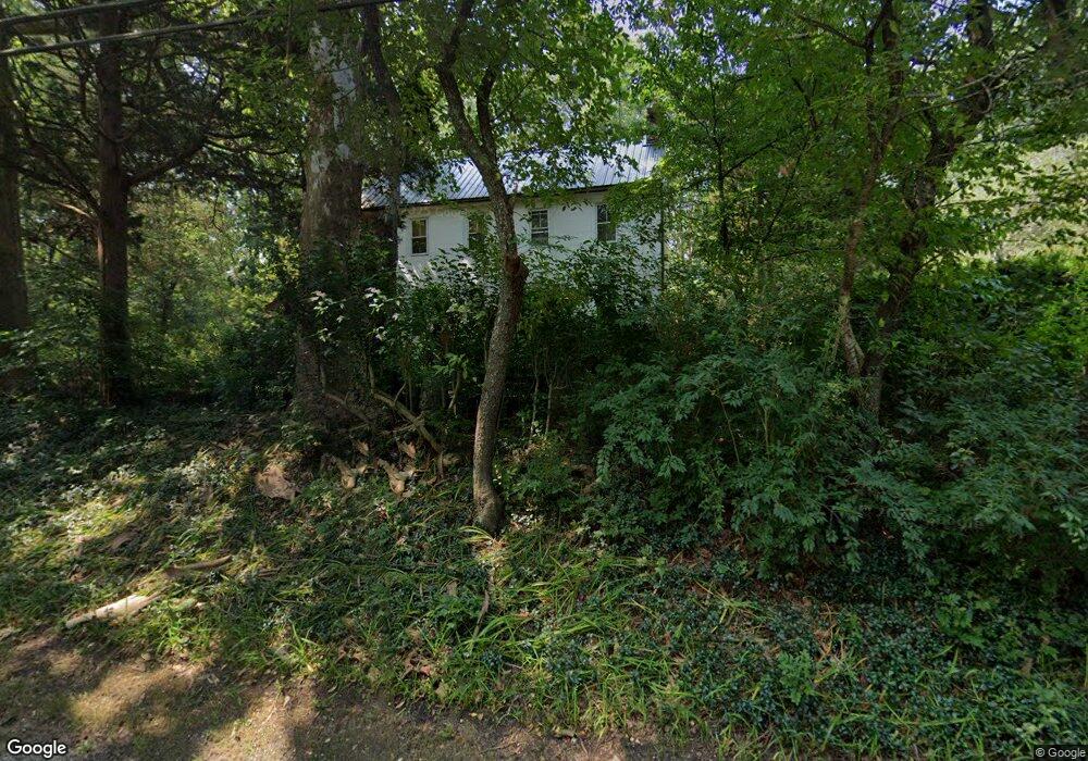
6728 Weymouth Rd Mays Landing, NJ 08330
Estimated Value: $241,000 - $412,000
--
Bed
--
Bath
1,320
Sq Ft
$231/Sq Ft
Est. Value
About This Home
This home is located at 6728 Weymouth Rd, Mays Landing, NJ 08330 and is currently estimated at $305,308, approximately $231 per square foot. 6728 Weymouth Rd is a home located in Atlantic County with nearby schools including Joseph Shaner School, George L. Hess Educational Complex, and William Davies Middle School.
Ownership History
Date
Name
Owned For
Owner Type
Purchase Details
Closed on
Sep 21, 2018
Sold by
Longstreet Ian R and The Estate Of Deborah Ann Wats
Bought by
Longstreet Ian R
Current Estimated Value
Purchase Details
Closed on
Jun 28, 2004
Sold by
Longstreet David R
Bought by
Watson Deborah Ann
Purchase Details
Closed on
Oct 15, 1999
Sold by
Ruland Carl J
Bought by
Ruland Carl J and Ruland Joan S
Purchase Details
Closed on
Dec 24, 1991
Sold by
Michalenko Rita S
Bought by
Longstreet David R
Create a Home Valuation Report for This Property
The Home Valuation Report is an in-depth analysis detailing your home's value as well as a comparison with similar homes in the area
Home Values in the Area
Average Home Value in this Area
Purchase History
| Date | Buyer | Sale Price | Title Company |
|---|---|---|---|
| Longstreet Ian R | -- | None Available | |
| Watson Deborah Ann | -- | -- | |
| Ruland Carl J | -- | Congress Title Corp | |
| Longstreet David R | $90,000 | -- |
Source: Public Records
Tax History Compared to Growth
Tax History
| Year | Tax Paid | Tax Assessment Tax Assessment Total Assessment is a certain percentage of the fair market value that is determined by local assessors to be the total taxable value of land and additions on the property. | Land | Improvement |
|---|---|---|---|---|
| 2025 | $4,903 | $142,900 | $39,700 | $103,200 |
| 2024 | $4,903 | $142,900 | $39,700 | $103,200 |
| 2023 | $4,610 | $142,900 | $39,700 | $103,200 |
| 2022 | $4,610 | $142,900 | $39,700 | $103,200 |
| 2021 | $4,362 | $135,500 | $39,700 | $95,800 |
| 2020 | $4,362 | $135,500 | $39,700 | $95,800 |
| 2019 | $4,373 | $135,500 | $39,700 | $95,800 |
| 2018 | $4,219 | $135,500 | $39,700 | $95,800 |
| 2017 | $4,153 | $135,500 | $39,700 | $95,800 |
| 2016 | $4,037 | $135,500 | $39,700 | $95,800 |
| 2015 | $3,900 | $135,500 | $39,700 | $95,800 |
| 2014 | $3,904 | $148,600 | $45,100 | $103,500 |
Source: Public Records
Map
Nearby Homes
- 0 Railroad Blvd
- 0 South Ave
- 850 Morningside Dr
- 6752 Harding Hwy
- Rt 50 and Old Mays Landing Rd
- 6301 Knight Ave
- 6310 Phillips Ave
- 1516 Thirty Third St
- 6314 Lance Ave
- 6302 Palmer Ave
- 6206 Roberts Ave
- 6251 Old Harding Hwy
- 0 Merton Ave Unit NJAC2020566
- 6839 Harding Hwy
- 1st First Ave
- 0 Harding Hwy Unit 597638
- 0 Harding Hwy Unit NJAC2019438
- Lot:11.02-12.02 Estelle Ave
- B:534 L:11.01 Estelle Ave
- B:534 L:12.02 Estelle Ave
- 6734 Weymouth Rd
- 6716 Weymouth Rd
- 6746 Weymouth Rd
- 6706 Weymouth Rd
- 6704 Weymouth Rd
- 6752 Weymouth Rd
- 6702 Weymouth Rd
- 6723 Weymouth Rd
- 6700 Weymouth Rd
- 6656 Weymouth Rd
- 6760 Weymouth Rd
- 6711 Weymouth Rd
- 6650 Weymouth Rd
- 6768 Weymouth Rd
- 6705 Weymouth Rd
- 6644 Weymouth Rd
- 6703 Weymouth Rd
- 6693 Weymouth Rd
- 6787 Weymouth Rd
- 6774 Weymouth Rd