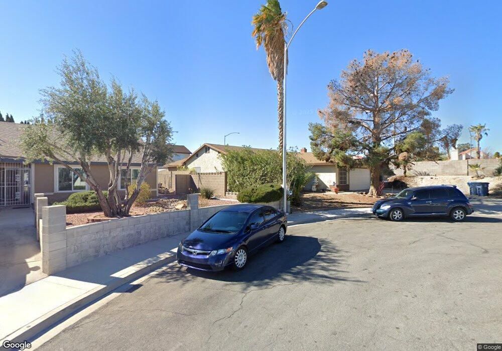
6729 Rexburg Cir Las Vegas, NV 89107
Charleston Preservation NeighborhoodEstimated Value: $374,000 - $420,000
3
Beds
2
Baths
1,481
Sq Ft
$270/Sq Ft
Est. Value
About This Home
This home is located at 6729 Rexburg Cir, Las Vegas, NV 89107 and is currently estimated at $399,604, approximately $269 per square foot. 6729 Rexburg Cir is a home located in Clark County with nearby schools including O. K. Adcock Elementary School, Frank F Garside Junior High School, and Bonanza High School.
Ownership History
Date
Name
Owned For
Owner Type
Purchase Details
Closed on
May 15, 2007
Sold by
Lovato Patricia M
Bought by
Lovato Alfonzo and Lovato Patricia
Current Estimated Value
Home Financials for this Owner
Home Financials are based on the most recent Mortgage that was taken out on this home.
Original Mortgage
$393,000
Outstanding Balance
$236,561
Interest Rate
5.98%
Mortgage Type
Reverse Mortgage Home Equity Conversion Mortgage
Estimated Equity
$163,043
Purchase Details
Closed on
Jul 6, 1998
Sold by
Lovato Valentin A
Bought by
Lovato Patricia M
Purchase Details
Closed on
Jan 8, 1997
Sold by
Wolfe Robert C and Wolfe Merilyn J
Bought by
Lovato Valentin A
Create a Home Valuation Report for This Property
The Home Valuation Report is an in-depth analysis detailing your home's value as well as a comparison with similar homes in the area
Home Values in the Area
Average Home Value in this Area
Purchase History
| Date | Buyer | Sale Price | Title Company |
|---|---|---|---|
| Lovato Alfonzo | -- | None Available | |
| Lovato Patricia M | -- | -- | |
| Lovato Valentin A | $112,000 | Ati Title |
Source: Public Records
Mortgage History
| Date | Status | Borrower | Loan Amount |
|---|---|---|---|
| Open | Lovato Alfonzo | $393,000 |
Source: Public Records
Tax History Compared to Growth
Tax History
| Year | Tax Paid | Tax Assessment Tax Assessment Total Assessment is a certain percentage of the fair market value that is determined by local assessors to be the total taxable value of land and additions on the property. | Land | Improvement |
|---|---|---|---|---|
| 2025 | $1,449 | $70,375 | $35,700 | $34,675 |
| 2024 | $1,407 | $70,375 | $35,700 | $34,675 |
| 2023 | $1,077 | $62,109 | $28,350 | $33,759 |
| 2022 | $1,366 | $55,141 | $23,800 | $31,341 |
| 2021 | $1,387 | $54,030 | $23,800 | $30,230 |
| 2020 | $1,285 | $49,934 | $19,600 | $30,334 |
| 2019 | $1,204 | $49,888 | $19,600 | $30,288 |
| 2018 | $1,149 | $47,300 | $17,850 | $29,450 |
| 2017 | $1,529 | $46,632 | $16,450 | $30,182 |
| 2016 | $1,077 | $41,353 | $10,500 | $30,853 |
| 2015 | $1,074 | $37,782 | $7,000 | $30,782 |
| 2014 | $1,042 | $31,040 | $7,000 | $24,040 |
Source: Public Records
Map
Nearby Homes
- 321 Bent Creek Dr
- 309 Warmside Dr
- 408 Greenfield Ln
- 6812 White Sands Ave
- 325 Greenfield Ln
- 404 Vassar Ln
- 6905 Singing Dunes Ln Unit 6B
- 201 Redstone St
- 6612 Burgundy Way
- 6628 Celeste Ave
- 405 Oil Lantern Ln
- 321 Oil Lantern Ln
- 421 Courtney Ln
- 613 Biljac St
- 416 Lindy Dr
- 6944 Alta Dr
- 6949 Cobblestone Ave
- 6949 Blacksmith Ct
- 6457 Celeste Ave
- 328 Antelope Way
- 6725 Rexburg Cir
- 6728 Papyrus Cir
- 6724 Papyrus Cir
- 6721 Rexburg Cir
- 6728 Rexburg Cir
- 6724 Rexburg Cir
- 6720 Papyrus Cir
- 6720 Rexburg Cir
- 6717 Rexburg Cir
- 6716 Papyrus Cir
- 341 Warmside Dr
- 333 Warmside Dr
- 345 Warmside Dr
- 329 Warmside Dr
- 6716 Rexburg Cir
- 349 Warmside Dr
- 6729 Papyrus Cir
- 6725 Kittery Dr
- 6729 Kittery Dr