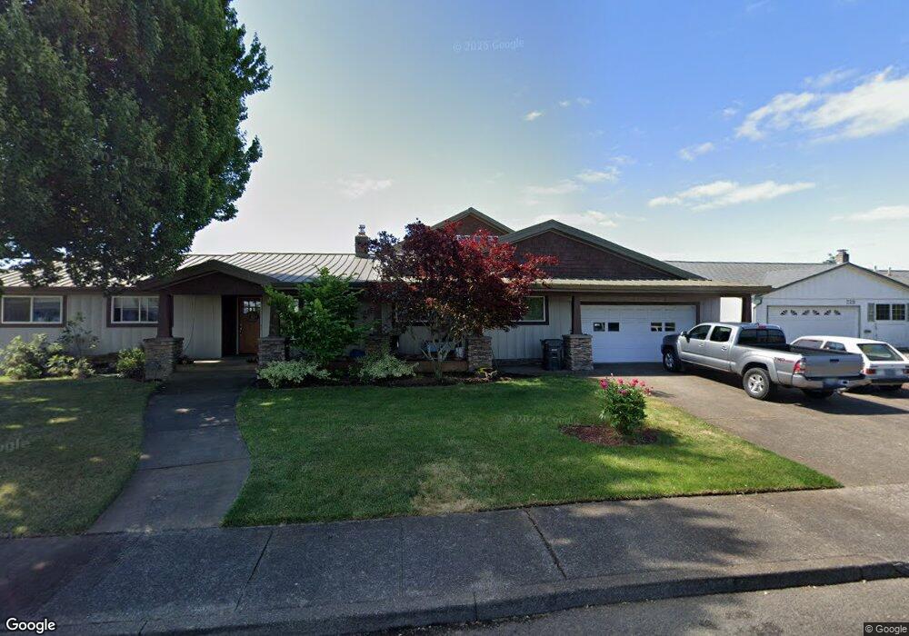
673 Cessna St Independence, OR 97351
Estimated Value: $683,000 - $763,000
3
Beds
3
Baths
2,538
Sq Ft
$291/Sq Ft
Est. Value
About This Home
This home is located at 673 Cessna St, Independence, OR 97351 and is currently estimated at $737,747, approximately $290 per square foot. 673 Cessna St is a home located in Polk County with nearby schools including Independence Elementary School, Talmadge Middle School, and Central High School.
Ownership History
Date
Name
Owned For
Owner Type
Purchase Details
Closed on
Apr 9, 2009
Sold by
Altman Kathryn L and Kalbfleisch Kathryn Lee
Bought by
Reid Robert W and Reid Marici
Current Estimated Value
Home Financials for this Owner
Home Financials are based on the most recent Mortgage that was taken out on this home.
Original Mortgage
$416,000
Outstanding Balance
$264,669
Interest Rate
5.06%
Mortgage Type
Purchase Money Mortgage
Estimated Equity
$473,078
Purchase Details
Closed on
Nov 20, 2007
Sold by
Altman David J
Bought by
Altman Kathryn L
Create a Home Valuation Report for This Property
The Home Valuation Report is an in-depth analysis detailing your home's value as well as a comparison with similar homes in the area
Home Values in the Area
Average Home Value in this Area
Purchase History
| Date | Buyer | Sale Price | Title Company |
|---|---|---|---|
| Reid Robert W | $520,000 | Ticor Title | |
| Altman Kathryn L | -- | None Available |
Source: Public Records
Mortgage History
| Date | Status | Borrower | Loan Amount |
|---|---|---|---|
| Open | Reid Robert W | $416,000 |
Source: Public Records
Tax History
| Year | Tax Paid | Tax Assessment Tax Assessment Total Assessment is a certain percentage of the fair market value that is determined by local assessors to be the total taxable value of land and additions on the property. | Land | Improvement |
|---|---|---|---|---|
| 2025 | $7,018 | $399,090 | $63,660 | $335,430 |
| 2024 | $7,018 | $387,470 | $61,810 | $325,660 |
| 2023 | $7,198 | $376,190 | $60,010 | $316,180 |
| 2022 | $6,608 | $365,240 | $58,260 | $306,980 |
| 2021 | $6,535 | $354,610 | $56,560 | $298,050 |
| 2020 | $6,364 | $344,290 | $54,920 | $289,370 |
| 2019 | $6,198 | $334,270 | $53,320 | $280,950 |
| 2018 | $6,001 | $324,540 | $51,770 | $272,770 |
| 2017 | $5,968 | $315,090 | $50,260 | $264,830 |
| 2016 | $6,078 | $305,920 | $48,800 | $257,120 |
| 2015 | $5,841 | $297,010 | $47,370 | $249,640 |
| 2014 | $5,716 | $288,360 | $45,990 | $242,370 |
Source: Public Records
Map
Nearby Homes
- 634 Cessna St
- 834 Cessna St
- 345 Stryker Rd
- 4215 Independence Hwy
- 8075 Hoffman Rd
- 0 Polk and Ash St
- 799 Morning Glory Dr
- 738 Log Cabin St
- 1026 Sassafras St
- 1025 Sassafras St
- 0 Deann Dr
- 585 Airport Rd
- 8575 Hoffman Rd
- 212 Picture St
- 621 Jasmine Cir
- 000 S Main St
- 320 N Gun Club Rd
- 200 N Gun Club Rd
- 1779 Parkmeadow Ave
- 544 C St
Your Personal Tour Guide
Ask me questions while you tour the home.