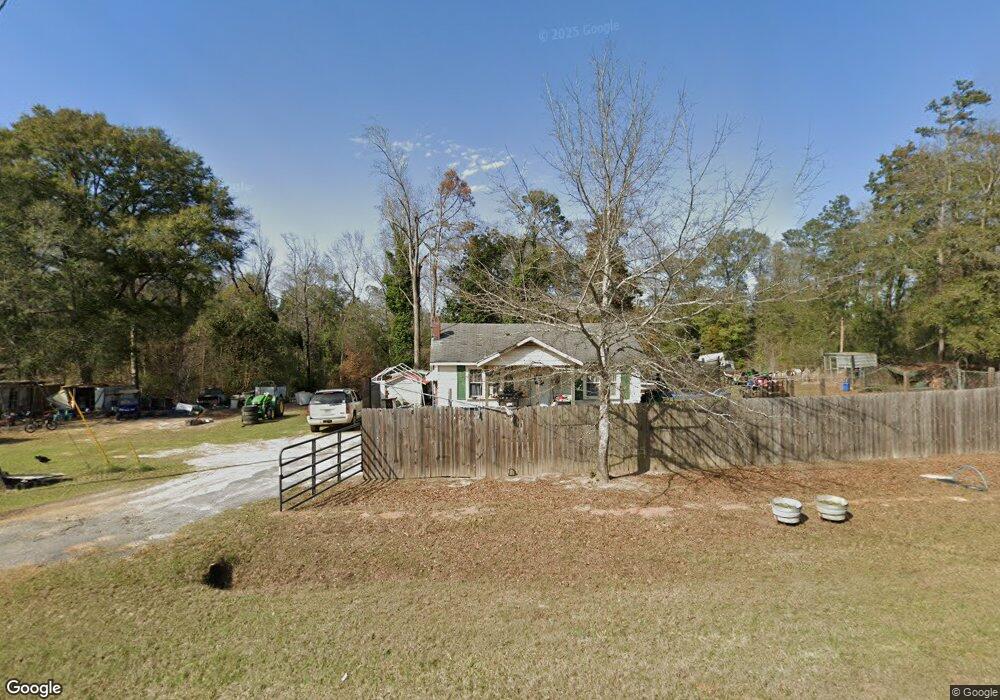
673 Ga Highway 27 Georgetown, GA 39854
Estimated Value: $44,818 - $90,000
2
Beds
1
Bath
768
Sq Ft
$87/Sq Ft
Est. Value
About This Home
This home is located at 673 Ga Highway 27, Georgetown, GA 39854 and is currently estimated at $66,455, approximately $86 per square foot. 673 Ga Highway 27 is a home located in Quitman County with nearby schools including Quitman County Elementary School and Quitman County High School.
Ownership History
Date
Name
Owned For
Owner Type
Purchase Details
Closed on
May 16, 2007
Sold by
Vickers Nina W
Bought by
Stewart Dustin P
Current Estimated Value
Purchase Details
Closed on
Jan 8, 2003
Sold by
Hobbs Mary E
Bought by
Vickers Nina W and Flowers Curtis
Purchase Details
Closed on
Jan 12, 1988
Bought by
Hobbs Mary E
Purchase Details
Closed on
Apr 3, 1986
Bought by
Owen Kenneth Marshal
Purchase Details
Closed on
Mar 28, 1985
Bought by
Owen Margaret
Create a Home Valuation Report for This Property
The Home Valuation Report is an in-depth analysis detailing your home's value as well as a comparison with similar homes in the area
Home Values in the Area
Average Home Value in this Area
Purchase History
| Date | Buyer | Sale Price | Title Company |
|---|---|---|---|
| Stewart Dustin P | $35,000 | -- | |
| Vickers Nina W | $18,500 | -- | |
| Hobbs Mary E | $12,700 | -- | |
| Owen Kenneth Marshal | -- | -- | |
| Owen Margaret | -- | -- |
Source: Public Records
Tax History Compared to Growth
Tax History
| Year | Tax Paid | Tax Assessment Tax Assessment Total Assessment is a certain percentage of the fair market value that is determined by local assessors to be the total taxable value of land and additions on the property. | Land | Improvement |
|---|---|---|---|---|
| 2025 | $618 | $14,472 | $2,740 | $11,732 |
| 2024 | $618 | $14,472 | $2,740 | $11,732 |
| 2023 | $623 | $14,472 | $2,740 | $11,732 |
| 2022 | $623 | $14,472 | $2,740 | $11,732 |
| 2021 | $398 | $12,109 | $4,030 | $8,079 |
| 2020 | $398 | $12,109 | $4,030 | $8,079 |
| 2019 | $365 | $11,086 | $4,030 | $7,056 |
| 2018 | $355 | $11,086 | $4,030 | $7,056 |
| 2017 | $295 | $11,361 | $4,030 | $7,331 |
| 2016 | $303 | $11,361 | $4,030 | $7,331 |
| 2015 | -- | $11,361 | $4,030 | $7,331 |
| 2014 | -- | $11,361 | $4,030 | $7,331 |
| 2013 | -- | $11,361 | $4,030 | $7,330 |
Source: Public Records
Map
Nearby Homes
- 253 Kaigler Rd
- 330 Georgia 27
- 76 Jacqueline Dr
- 0 Jacqueline Dr
- 0 Lower Lumpkin Rd
- 0 Lower Lumpkin Rd Unit 10511110
- 00 Georgia 39
- 2+/- Ac Fawn Dr
- 0 Old 39 Rd Unit 15.69
- 15.69 Old 39 Rd
- 288 Watson Rd
- 0 Sandra Dr Unit 10544581
- 0 Sandra Dr Unit 27509
- 1194 U S Hwy 82-Parcel B
- 0 Watson Spur Rd Unit 24072
- 0 Watson Spur Rd Unit 189883
- 0 Watson Spur Rd Unit 20115025
- 1794 Georgia 50
- 2036 Georgia 39
- 15 Bay Ln
- 667 Ga Highway 27
- 659 Ga Highway 27
- 659 Georgia 27
- 651 Ga Highway 27
- 654 Ga Highway 27
- 653 Ga Highway 27
- 653 Georgia 27
- 647 Ga Highway 27
- 668 Ga Highway 27
- 643 Ga Highway 27
- 644 Georgia 27
- 616 Ga Highway 27
- 596 Ga Highway 27
- 200 Ben Jones Rd
- 590 Ga Highway 27
- 104 Ben Jones Rd
- 818 Ga Highway 27
- 806 Ga Highway 27
- 90 Clements Rd
- 481 Ga Highway 27