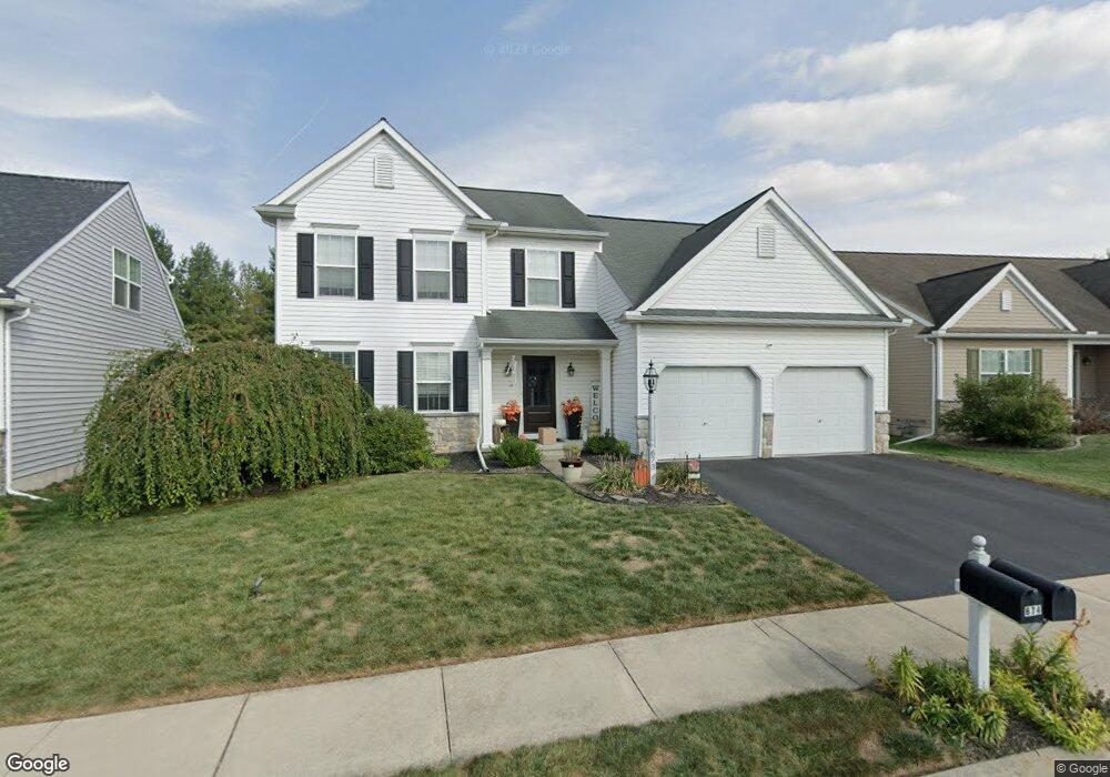
673 Hamaker Rd Manheim, PA 17545
Estimated Value: $439,000 - $507,000
3
Beds
2
Baths
1,778
Sq Ft
$263/Sq Ft
Est. Value
About This Home
This home is located at 673 Hamaker Rd, Manheim, PA 17545 and is currently estimated at $467,515, approximately $262 per square foot. 673 Hamaker Rd is a home located in Lancaster County with nearby schools including Manheim Central Senior High School, Manheim Christian Day School, and Sporting Hill Christian School.
Ownership History
Date
Name
Owned For
Owner Type
Purchase Details
Closed on
May 21, 2010
Sold by
Charles Investments Lp
Bought by
Iovino Darren and Iovino Danielle
Current Estimated Value
Home Financials for this Owner
Home Financials are based on the most recent Mortgage that was taken out on this home.
Original Mortgage
$215,861
Outstanding Balance
$147,834
Interest Rate
5.5%
Mortgage Type
FHA
Estimated Equity
$319,681
Create a Home Valuation Report for This Property
The Home Valuation Report is an in-depth analysis detailing your home's value as well as a comparison with similar homes in the area
Home Values in the Area
Average Home Value in this Area
Purchase History
| Date | Buyer | Sale Price | Title Company |
|---|---|---|---|
| Iovino Darren | $218,768 | None Available |
Source: Public Records
Mortgage History
| Date | Status | Borrower | Loan Amount |
|---|---|---|---|
| Open | Iovino Darren | $215,861 |
Source: Public Records
Tax History Compared to Growth
Tax History
| Year | Tax Paid | Tax Assessment Tax Assessment Total Assessment is a certain percentage of the fair market value that is determined by local assessors to be the total taxable value of land and additions on the property. | Land | Improvement |
|---|---|---|---|---|
| 2025 | $5,354 | $262,600 | $62,500 | $200,100 |
| 2024 | $5,354 | $262,600 | $62,500 | $200,100 |
| 2023 | $5,241 | $262,600 | $62,500 | $200,100 |
| 2022 | $5,106 | $262,600 | $62,500 | $200,100 |
| 2021 | $4,991 | $262,600 | $62,500 | $200,100 |
| 2020 | $4,852 | $255,300 | $62,500 | $192,800 |
| 2019 | $4,768 | $255,300 | $62,500 | $192,800 |
| 2018 | $3,543 | $255,300 | $62,500 | $192,800 |
| 2017 | $5,883 | $252,400 | $42,000 | $210,400 |
| 2016 | $5,883 | $252,400 | $42,000 | $210,400 |
| 2015 | $1,397 | $252,400 | $42,000 | $210,400 |
| 2014 | $4,216 | $252,400 | $42,000 | $210,400 |
Source: Public Records
Map
Nearby Homes
- 657 Hamaker Rd
- 489 Wood Duck Dr
- 609 Hamaker Rd
- 714 Heather Ridge Unit 140
- 854 Cambridge Dr Unit 7
- 988 Cambridge Dr
- 209 N Laurel St
- 68 Daffodil Dr
- 130 Julia Ln
- 222 E High St
- 33 E Gramby St
- 125 E Ferdinand St
- 57 N Charlotte St
- 126 N Charlotte St
- 157 S Wolf St
- 144 Rapho St
- 2 S Charlotte St
- 27 W Ferdinand St
- 43 W Ferdinand St
- 530 Orchard Rd
- 669 Hamaker Rd
- 677 Hamaker Rd
- 681 Hamaker Rd
- 665 Hamaker Rd
- 574 Wood Duck Dr
- 590 Wood Duck Dr
- 588 Wood Duck Dr
- 570 Wood Duck Dr
- 592 Wood Duck Dr
- 568 Wood Duck Dr
- 596 Wood Duck Dr
- 661 Hamaker Rd
- 564 Wood Duck Dr
- 685 Hamaker Rd
- 598 Wood Duck Dr
- 670 Hamaker Rd
- 674 Hamaker Rd
- 600 Wood Duck Dr
- 682 Hamaker Rd
- 662 Hamaker Rd