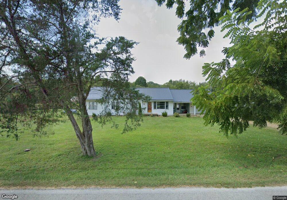
6730 N State Road 135 Freetown, IN 47235
Estimated Value: $217,000 - $280,952
4
Beds
1
Bath
1,452
Sq Ft
$171/Sq Ft
Est. Value
About This Home
This home is located at 6730 N State Road 135, Freetown, IN 47235 and is currently estimated at $248,976, approximately $171 per square foot. 6730 N State Road 135 is a home located in Jackson County with nearby schools including Brownstown Elementary School, Brownstown Central Middle School, and Brownstown Central High School.
Ownership History
Date
Name
Owned For
Owner Type
Purchase Details
Closed on
Jan 8, 2021
Sold by
Lucas David Michael
Bought by
Willow Creek Farm And Woodland Llc
Current Estimated Value
Purchase Details
Closed on
Dec 31, 2020
Sold by
Lucas Douglas Kevin
Bought by
Willow Creek Farm And Woodlands Llc
Purchase Details
Closed on
Dec 29, 2020
Sold by
Lucas Danny Joe
Bought by
Willow Creek Farm Llc
Purchase Details
Closed on
Aug 21, 2019
Sold by
Lucas Douglas K and Whitted Alan L
Bought by
Lucas Danny Joe and Lucas David Michael
Create a Home Valuation Report for This Property
The Home Valuation Report is an in-depth analysis detailing your home's value as well as a comparison with similar homes in the area
Home Values in the Area
Average Home Value in this Area
Purchase History
| Date | Buyer | Sale Price | Title Company |
|---|---|---|---|
| Willow Creek Farm And Woodland Llc | -- | None Available | |
| Willow Creek Farm And Woodlands Llc | -- | None Available | |
| Willow Creek Farm Llc | -- | None Listed On Document | |
| Lucas Danny Joe | -- | None Available |
Source: Public Records
Tax History Compared to Growth
Tax History
| Year | Tax Paid | Tax Assessment Tax Assessment Total Assessment is a certain percentage of the fair market value that is determined by local assessors to be the total taxable value of land and additions on the property. | Land | Improvement |
|---|---|---|---|---|
| 2024 | $2,474 | $145,300 | $44,800 | $100,500 |
| 2023 | $2,509 | $141,900 | $39,500 | $102,400 |
| 2022 | $3,494 | $134,500 | $34,000 | $100,500 |
| 2021 | $2,066 | $117,200 | $31,000 | $86,200 |
| 2020 | $2,040 | $117,100 | $30,900 | $86,200 |
| 2019 | $409 | $92,900 | $34,800 | $58,100 |
| 2018 | $619 | $93,700 | $35,500 | $58,200 |
| 2017 | $646 | $92,800 | $38,800 | $54,000 |
| 2016 | $522 | $84,500 | $30,400 | $54,100 |
| 2014 | $553 | $83,900 | $31,200 | $52,700 |
| 2013 | $553 | $71,800 | $28,700 | $43,100 |
Source: Public Records
Map
Nearby Homes
- 5000 W County Road 680 N
- 6100 W County Road 700 N
- 5000 W County Road 700 N
- 6000 W County Road 700 N
- 6725 W County Road 700 N
- 3000 W Block Co Rd 900 N
- 4325 N County Road 650 W
- 2221 Indiana 258
- 9649 N County Road 450 W
- 8000 W County Road 625 Tract 4 N
- 8000 W County Road 625 N Unit LotWP004
- 7594 W County Road 925 N
- 3780 W County Road 300 N
- 3264 N County Road 250 W
- 8515 N County Road 100 W
- 11000 N County Road 650 W
- 2000 Block W 1125 N
- 1109 N County Road 600 W Unit Medora
- 9601 Buffalo Pike
- 8650 Mount Nebo Rd
- 135 S
- 4969 W 1st St
- 4969 W 1st St
- 4966 W 1st St
- 6645 N State Road 135
- 6768 N Main St
- 6785 N Main St
- 6735 N Main St
- 3845 N Main St
- 4979 W State Road 58
- 4979 E State Road 58
- 6761 N Main St
- 6794 N Main St
- 6819 N State Road 135
- 4915 W 2nd St
- 6708 N Glendenning St
- 6682 N Glendenning St
- 6820 N Main St
- 6801 N Main St