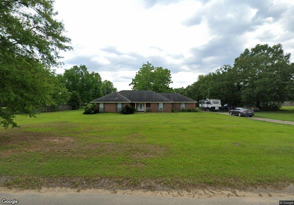
6735 Barnes Rd Theodore, AL 36582
Westfield NeighborhoodEstimated Value: $250,000 - $295,000
4
Beds
2
Baths
2,288
Sq Ft
$117/Sq Ft
Est. Value
About This Home
This home is located at 6735 Barnes Rd, Theodore, AL 36582 and is currently estimated at $266,645, approximately $116 per square foot. 6735 Barnes Rd is a home located in Mobile County with nearby schools including Nan Gray Davis Elementary School, Katherine H Hankins Middle School, and Theodore High School.
Ownership History
Date
Name
Owned For
Owner Type
Purchase Details
Closed on
Jun 27, 2007
Sold by
Raley Dane L and Raley Brenda T
Bought by
Parker Henry C and Parker Karen A
Current Estimated Value
Home Financials for this Owner
Home Financials are based on the most recent Mortgage that was taken out on this home.
Original Mortgage
$219,622
Outstanding Balance
$132,862
Interest Rate
6.16%
Mortgage Type
VA
Estimated Equity
$133,783
Create a Home Valuation Report for This Property
The Home Valuation Report is an in-depth analysis detailing your home's value as well as a comparison with similar homes in the area
Home Values in the Area
Average Home Value in this Area
Purchase History
| Date | Buyer | Sale Price | Title Company |
|---|---|---|---|
| Parker Henry C | -- | Slt |
Source: Public Records
Mortgage History
| Date | Status | Borrower | Loan Amount |
|---|---|---|---|
| Open | Parker Henry C | $219,622 |
Source: Public Records
Tax History
| Year | Tax Paid | Tax Assessment Tax Assessment Total Assessment is a certain percentage of the fair market value that is determined by local assessors to be the total taxable value of land and additions on the property. | Land | Improvement |
|---|---|---|---|---|
| 2025 | $1,037 | $20,820 | $3,000 | $17,820 |
| 2024 | $1,037 | $18,940 | $2,750 | $16,190 |
| 2023 | $973 | $16,450 | $2,860 | $13,590 |
| 2022 | $739 | $16,620 | $2,860 | $13,760 |
| 2021 | $756 | $16,960 | $2,860 | $14,100 |
| 2020 | $764 | $17,130 | $2,860 | $14,270 |
| 2019 | $791 | $17,700 | $0 | $0 |
| 2018 | $808 | $18,040 | $0 | $0 |
| 2017 | $824 | $18,380 | $0 | $0 |
| 2016 | $833 | $18,560 | $0 | $0 |
| 2013 | -- | $19,220 | $0 | $0 |
Source: Public Records
Map
Nearby Homes
- 6760 Barneswood Dr
- 6776 Barneswood Dr
- 6750 Barneswood Dr
- 6738 Barneswood Dr
- 7665 Oakmont Dr E
- 6521 Barnes Rd
- 6611 Madison Arras Ct
- 6840 Highmont Dr
- 7078 Westfield Rd
- 6293 Woodside Dr S
- 6292 Woodside Dr S
- 6561 Apache Run
- 6157 Magnolia Trace N
- 6178 Sperry Rd
- 7264 Broadview Dr W
- 7520 Oak Dr W
- 6675 Oak Dr E
- 6361 Rester Rd
- 0 Rester Rd
- 7215 Broadview Dr E
- 6778 Barnes Rd
- 6703 Barnes Rd
- 6751 Barnes Rd
- 6740 Barnes Rd
- 6730 Barnes Rd
- 6671 Barnes Rd
- 6670 Barnes Rd
- 6720 Browder Dr
- 6710 Browder Dr
- 6781 Barnes Rd
- 6750 Browder Dr
- 6750 Barnes Rd
- 6740 Browder Dr
- 6740 Browder Dr Unit 4
- 6700 Browder Dr
- 6770 Barnes Rd
- 6760 Browder Dr
- 6680 Browder Dr
- 6770 Browder Dr
- 6654 Barnes Rd
Your Personal Tour Guide
Ask me questions while you tour the home.