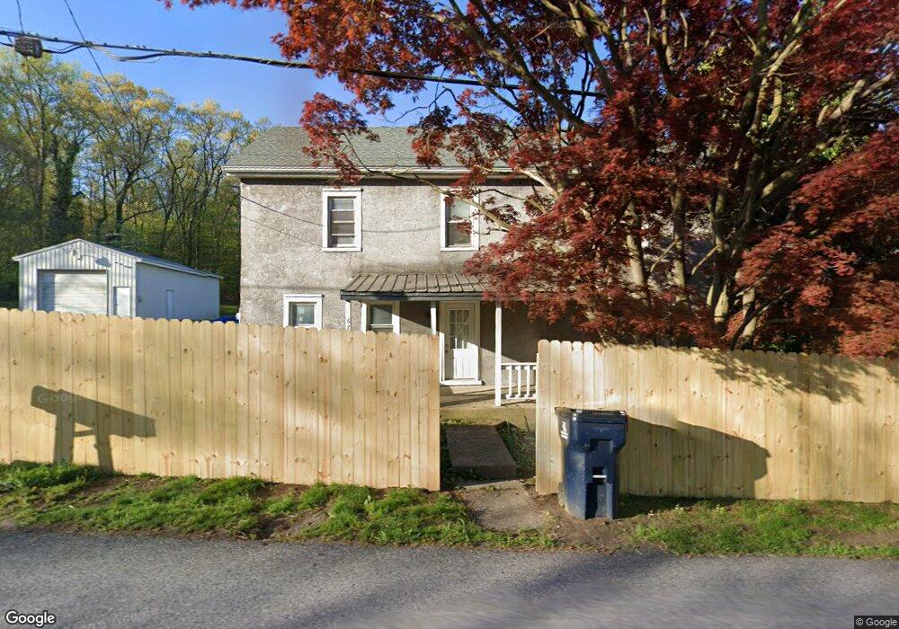
6735 Division Hwy Narvon, PA 17555
Estimated Value: $302,000 - $376,000
3
Beds
2
Baths
1,404
Sq Ft
$250/Sq Ft
Est. Value
About This Home
This home is located at 6735 Division Hwy, Narvon, PA 17555 and is currently estimated at $351,309, approximately $250 per square foot. 6735 Division Hwy is a home located in Lancaster County with nearby schools including Garden Spot Middle School, Garden Spot Senior High School, and Beartown School.
Ownership History
Date
Name
Owned For
Owner Type
Purchase Details
Closed on
Jul 22, 2013
Sold by
Zimmerman Delphine Z and Rhoads Delphine Z
Bought by
Zimmerman Luke R
Current Estimated Value
Purchase Details
Closed on
Jul 13, 2005
Sold by
Esbin Dale J and Esbin Pamela J
Bought by
Rhoads Kevin E and Zimmerman Delphine Z
Purchase Details
Closed on
Jan 28, 2000
Sold by
Martin Charles R and Martin Gloria Ann
Bought by
Esbin Dale J and Esbin Pamela J
Home Financials for this Owner
Home Financials are based on the most recent Mortgage that was taken out on this home.
Original Mortgage
$92,150
Interest Rate
7.98%
Create a Home Valuation Report for This Property
The Home Valuation Report is an in-depth analysis detailing your home's value as well as a comparison with similar homes in the area
Home Values in the Area
Average Home Value in this Area
Purchase History
| Date | Buyer | Sale Price | Title Company |
|---|---|---|---|
| Zimmerman Luke R | $15,000 | None Available | |
| Rhoads Kevin E | $170,200 | First American Title Ins Co | |
| Esbin Dale J | $97,000 | -- |
Source: Public Records
Mortgage History
| Date | Status | Borrower | Loan Amount |
|---|---|---|---|
| Previous Owner | Rhoads Kevin E | $5,000 | |
| Previous Owner | Esbin Dale J | $87,200 | |
| Previous Owner | Esbin Dale J | $92,150 |
Source: Public Records
Tax History Compared to Growth
Tax History
| Year | Tax Paid | Tax Assessment Tax Assessment Total Assessment is a certain percentage of the fair market value that is determined by local assessors to be the total taxable value of land and additions on the property. | Land | Improvement |
|---|---|---|---|---|
| 2025 | $2,402 | $148,100 | $79,000 | $69,100 |
| 2024 | $2,402 | $148,100 | $79,000 | $69,100 |
| 2023 | $2,364 | $148,100 | $79,000 | $69,100 |
| 2022 | $2,336 | $148,100 | $79,000 | $69,100 |
| 2021 | $2,295 | $148,100 | $79,000 | $69,100 |
| 2020 | $2,295 | $148,100 | $79,000 | $69,100 |
| 2019 | $2,267 | $148,100 | $79,000 | $69,100 |
| 2018 | $3,669 | $148,100 | $79,000 | $69,100 |
| 2017 | $1,847 | $98,300 | $48,600 | $49,700 |
| 2016 | $1,847 | $98,300 | $48,600 | $49,700 |
| 2015 | $369 | $98,300 | $48,600 | $49,700 |
| 2014 | $1,417 | $98,300 | $48,600 | $49,700 |
Source: Public Records
Map
Nearby Homes
- 1022 Elwood St
- 5907 Wertztown Rd
- 5884 Mast Rd
- 856 Reservoir Rd
- 2085 Main St
- 0 Westbrook Dr
- 0 Westbrook Dr
- 0 Westbrook Dr
- 0 Westbrook Dr
- 5788 Glen Oaks Dr
- 607 Buchland Rd
- 5892 Meadville Rd
- 671 Gault Rd
- 5867 Kingsfield Dr
- 650 Broad St
- 50 Nevin Dr
- 0 Cambridge Rd
- 283 Cambridge Rd
- 70 Waynebrook Dr
- 5720 Meadeville Rd
- 6811 Division Hwy
- 6729 Division Hwy
- 6757 Division Hwy
- 6709 Division Hwy
- 6803 Division Hwy
- 6742 Division Hwy
- 1904 Shady Ln
- 6821 Division Hwy Unit 1
- 6821 Division Hwy
- 6784 Division Hwy
- 1092 Elwood St
- 6667 Division Hwy
- 1074 Elwood St
- 1084 Elwood St
- 6657 Division Hwy
- 1100 Elwood St
- 1910 Shady Ln
- 6817 Division Hwy
- 1106 Elwood St
- 1068 Elwood St