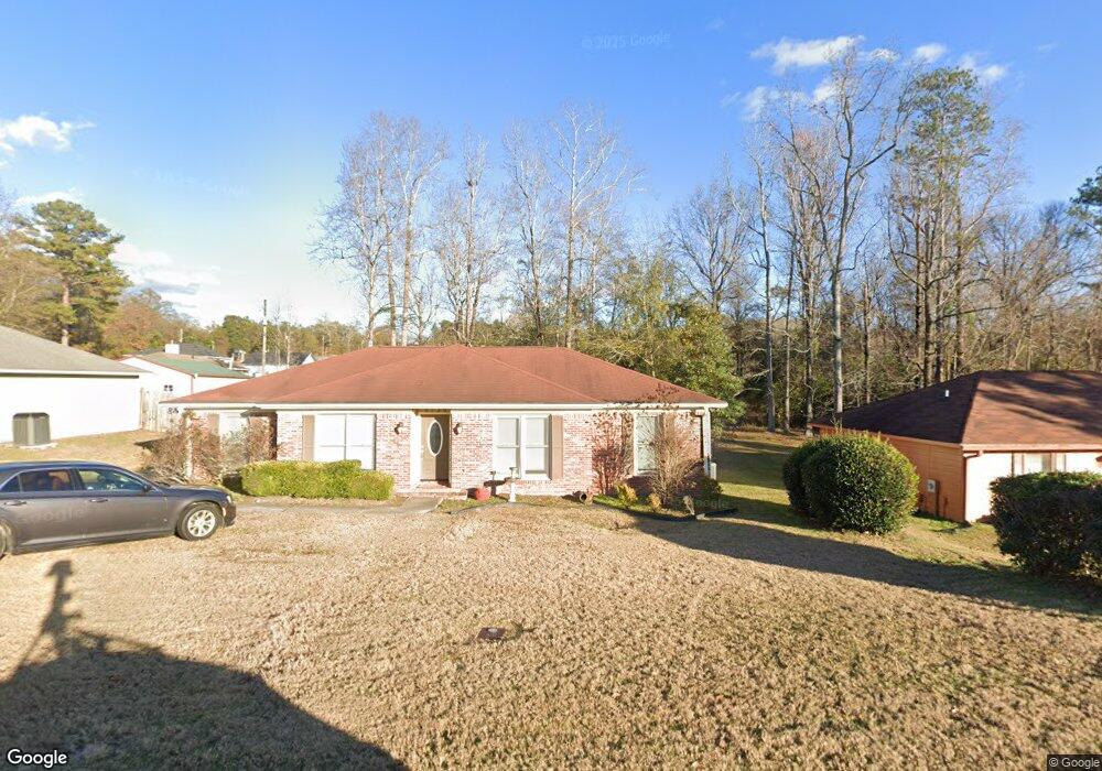
6736 Mitchell Dr Columbus, GA 31907
East Columbus NeighborhoodEstimated Value: $167,000 - $200,000
3
Beds
3
Baths
1,655
Sq Ft
$111/Sq Ft
Est. Value
About This Home
This home is located at 6736 Mitchell Dr, Columbus, GA 31907 and is currently estimated at $183,169, approximately $110 per square foot. 6736 Mitchell Dr is a home located in Muscogee County with nearby schools including Forrest Road Elementary School, Fort Middle School, and Kendrick High School.
Ownership History
Date
Name
Owned For
Owner Type
Purchase Details
Closed on
Jan 31, 2014
Sold by
Powers Investment Llc
Bought by
Walker Samantha
Current Estimated Value
Home Financials for this Owner
Home Financials are based on the most recent Mortgage that was taken out on this home.
Original Mortgage
$102,116
Outstanding Balance
$76,517
Interest Rate
4.12%
Mortgage Type
FHA
Estimated Equity
$106,652
Purchase Details
Closed on
May 24, 2013
Sold by
Fnma
Bought by
Powers Investments
Purchase Details
Closed on
Feb 22, 2013
Sold by
Gogins Roosevelt
Bought by
Federal National Mtg Associati
Create a Home Valuation Report for This Property
The Home Valuation Report is an in-depth analysis detailing your home's value as well as a comparison with similar homes in the area
Home Values in the Area
Average Home Value in this Area
Purchase History
| Date | Buyer | Sale Price | Title Company |
|---|---|---|---|
| Walker Samantha | $104,000 | -- | |
| Powers Investments | -- | -- | |
| Federal National Mtg Associati | $94,198 | -- |
Source: Public Records
Mortgage History
| Date | Status | Borrower | Loan Amount |
|---|---|---|---|
| Open | Walker Samantha | $102,116 | |
| Closed | Walker Samantha | $5,000 |
Source: Public Records
Tax History
| Year | Tax Paid | Tax Assessment Tax Assessment Total Assessment is a certain percentage of the fair market value that is determined by local assessors to be the total taxable value of land and additions on the property. | Land | Improvement |
|---|---|---|---|---|
| 2025 | $111 | $59,624 | $8,756 | $50,868 |
| 2024 | $1,111 | $59,624 | $8,756 | $50,868 |
| 2023 | $424 | $59,624 | $8,756 | $50,868 |
| 2022 | $1,159 | $47,012 | $8,756 | $38,256 |
| 2021 | $1,152 | $42,448 | $8,756 | $33,692 |
| 2020 | $1,152 | $42,448 | $8,756 | $33,692 |
| 2019 | $1,158 | $42,448 | $8,756 | $33,692 |
| 2018 | $1,158 | $42,448 | $8,756 | $33,692 |
| 2017 | $1,163 | $42,448 | $8,756 | $33,692 |
| 2016 | $1,169 | $41,600 | $4,512 | $37,088 |
| 2015 | $1,171 | $41,600 | $4,512 | $37,088 |
| 2014 | $1,009 | $24,400 | $4,512 | $19,888 |
| 2013 | -- | $25,372 | $4,512 | $20,860 |
Source: Public Records
Map
Nearby Homes
- 2216 Hunter Ct
- 2735 Schatulga Rd
- 2737 Schatulga Rd
- 2143 Hunter Ct
- 2708 Courtland Ave
- 3041 Waddell Dr
- 6424 Lemongrass Dr
- 6386 Lemongrass Dr
- 6378 Lemongrass Dr
- 6376 Lemongrass Dr
- 6374 Lemongrass Dr
- 3 Playfield Ct
- 6370 Lemongrass Dr
- 6362 Lemongrass Dr
- 6636 Foxboro Dr
- 1925 Woodhollow Dr
- 5646 Boby Dr
- 5644 Peggy Dr
- 1826 Woodhollow Dr
- 6946 Boby Ct
- 6744 Mitchell Dr
- 6732 Mitchell Dr
- 6726 Mitchell Dr
- 6724 Mitchell Dr
- 6756 Mitchell Dr
- 6735 Mitchell Dr
- 6743 Mitchell Dr
- 6727 Mitchell Dr
- 4 Jabbar Ct
- 1008 Mitchell Ridge Dr
- 1006 Mitchell Ridge Dr
- 1010 Mitchell Ridge Dr
- 1004 Mitchell Ridge Dr
- 6749 Mitchell Dr
- 1012 Mitchell Ridge Dr
- 2584 Kingsridge Dr
- 1002 Mitchell Ridge Dr
- 6755 Mitchell Dr
- 1014 Mitchell Ridge Dr
- 1000 Mitchell Ridge Dr
Your Personal Tour Guide
Ask me questions while you tour the home.