M
Seller's Agent in 2015
Mike Mansker
Coldwell Banker Reed Bros Rlty

Estimated Value: $1,218,000
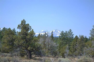
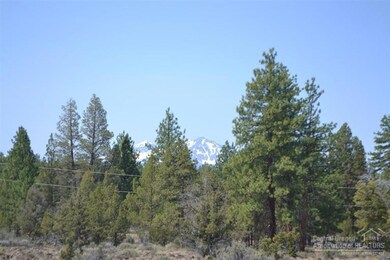
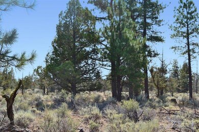
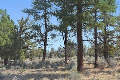
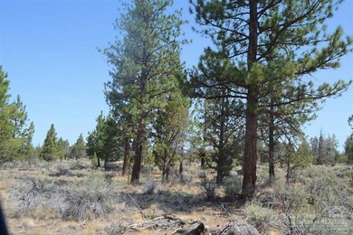
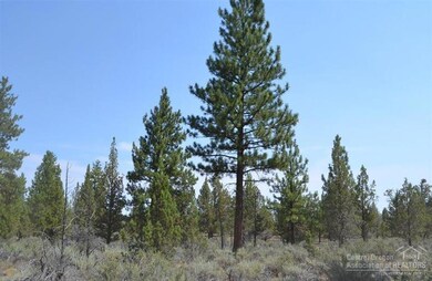
9.5 Acres with Mountain Views! Secluded parcel in desirable Harrington Loop Road area of Sisters. Offering great views, Pines, Juniper and lots of wildlife.
Last Agent to Sell the Property
Mike Mansker
Coldwell Banker Reed Bros Rlty License #950900152 Listed on: 08/08/2014
Last Buyer's Agent
Connie Mitchell
Coldwell Banker Reed Bros Rlty
| Date | Event | Price | List to Sale | Price per Sq Ft |
|---|---|---|---|---|
| 08/05/2015 08/05/15 | Sold | $215,000 | -14.0% | -- |
| 06/25/2015 06/25/15 | Pending | -- | -- | -- |
| 08/08/2014 08/08/14 | For Sale | $250,000 | -- | -- |
| Year | Tax Paid | Tax Assessment Tax Assessment Total Assessment is a certain percentage of the fair market value that is determined by local assessors to be the total taxable value of land and additions on the property. | Land | Improvement |
|---|---|---|---|---|
| 2025 | $3,319 | $282,670 | -- | -- |
| 2024 | $3,213 | $274,450 | -- | -- |
| 2023 | $3,123 | $266,470 | $0 | $0 |
| 2022 | $2,867 | $251,190 | $0 | $0 |
| 2021 | $2,744 | $243,880 | $0 | $0 |
| 2020 | $2,624 | $243,880 | $0 | $0 |
| 2019 | $2,544 | $183,300 | $0 | $0 |
| 2018 | $2,480 | $177,970 | $0 | $0 |
| 2017 | $2,395 | $172,790 | $0 | $0 |
| 2015 | $1,183 | $99,910 | $0 | $0 |
| 2014 | $1,147 | $97,000 | $0 | $0 |
M
Seller's Agent in 2015
Mike Mansker
Coldwell Banker Reed Bros Rlty
C
Buyer's Agent in 2015
Connie Mitchell
Coldwell Banker Reed Bros Rlty
Source: Oregon Datashare
MLS Number: 201407893
APN: 130762
Disclaimer: Certain information contained herein is derived from information provided by parties other than Homes.com. All information provided is deemed reliable, but is not guaranteed to be accurate and should be independently verified.
![]() © 2026 Oregon Datashare (KCAR | MLSCO | SOMLS). All rights reserved. The data relating to real estate for sale on this web site comes in part from the Internet Data Exchange Program of the Oregon Datashare. Real estate listings held by IDX Brokerage firms other than Ten-X are marked with the Internet Data Exchange logo or the Internet Data Exchange thumbnail logo and detailed information about them includes the name of the listing Brokers. Information provided is for consumers' personal, non-commercial use and may not be used for any purpose other than to identify prospective properties the viewer may be interested in purchasing. The consumer will not copy, retransmit nor redistribute any of the content from this website. Information provided is deemed reliable, but not guaranteed.
© 2026 Oregon Datashare (KCAR | MLSCO | SOMLS). All rights reserved. The data relating to real estate for sale on this web site comes in part from the Internet Data Exchange Program of the Oregon Datashare. Real estate listings held by IDX Brokerage firms other than Ten-X are marked with the Internet Data Exchange logo or the Internet Data Exchange thumbnail logo and detailed information about them includes the name of the listing Brokers. Information provided is for consumers' personal, non-commercial use and may not be used for any purpose other than to identify prospective properties the viewer may be interested in purchasing. The consumer will not copy, retransmit nor redistribute any of the content from this website. Information provided is deemed reliable, but not guaranteed.
Ask me questions while you tour the home.