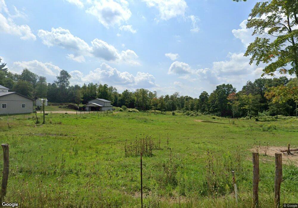
674 Panic Knoxdale Rd Reynoldsville, PA 15851
Estimated Value: $173,000 - $294,000
--
Bed
--
Bath
1,200
Sq Ft
$213/Sq Ft
Est. Value
About This Home
This home is located at 674 Panic Knoxdale Rd, Reynoldsville, PA 15851 and is currently estimated at $255,611, approximately $213 per square foot. 674 Panic Knoxdale Rd is a home with nearby schools including Punxsutawney Area High School.
Ownership History
Date
Name
Owned For
Owner Type
Purchase Details
Closed on
Jan 27, 2025
Sold by
Hershberger Joseph J and Hershberger Marie R
Bought by
Miller Johnny J and Miller Susan S
Current Estimated Value
Home Financials for this Owner
Home Financials are based on the most recent Mortgage that was taken out on this home.
Original Mortgage
$200,000
Outstanding Balance
$198,738
Interest Rate
6.6%
Mortgage Type
Credit Line Revolving
Estimated Equity
$56,873
Purchase Details
Closed on
Jul 28, 2022
Sold by
Miller Kenneth A and Miller Marie A
Bought by
Hershberger Joseph J and Hershberger Marie R
Home Financials for this Owner
Home Financials are based on the most recent Mortgage that was taken out on this home.
Original Mortgage
$250,000
Interest Rate
5.78%
Mortgage Type
New Conventional
Create a Home Valuation Report for This Property
The Home Valuation Report is an in-depth analysis detailing your home's value as well as a comparison with similar homes in the area
Home Values in the Area
Average Home Value in this Area
Purchase History
| Date | Buyer | Sale Price | Title Company |
|---|---|---|---|
| Miller Johnny J | $315,000 | None Listed On Document | |
| Hershberger Joseph J | $250,000 | None Listed On Document |
Source: Public Records
Mortgage History
| Date | Status | Borrower | Loan Amount |
|---|---|---|---|
| Open | Miller Johnny J | $200,000 | |
| Previous Owner | Hershberger Joseph J | $250,000 |
Source: Public Records
Tax History Compared to Growth
Tax History
| Year | Tax Paid | Tax Assessment Tax Assessment Total Assessment is a certain percentage of the fair market value that is determined by local assessors to be the total taxable value of land and additions on the property. | Land | Improvement |
|---|---|---|---|---|
| 2025 | $4,593 | $105,270 | $4,930 | $100,340 |
| 2024 | $4,494 | $105,270 | $4,930 | $100,340 |
| 2023 | $4,329 | $101,330 | $4,930 | $96,400 |
| 2022 | $734 | $17,120 | $4,930 | $12,190 |
| 2021 | $733 | $17,120 | $4,930 | $12,190 |
| 2020 | $212 | $4,930 | $4,930 | $0 |
Source: Public Records
Map
Nearby Homes
- 2021 Rd
- 290 Summit Rd
- 290 N Summit Rd
- 178 Summit Rd
- 92 Summit Rd
- 1089 Fire Tower Rd
- 00 Fuller Rd
- 3620 Fuller Rd
- 115 Walnut St
- 276 Main St
- 0 Crawfordtown Rd
- 0 Point View Rd Lot Unit WP001
- 0 Myrtle St
- 940 & 942 Jackson St
- 114 TO 126 Jackson St
- 609 Trout Run Rd
- 5025 Pennsylvania 36
- 20 2nd Ave
- 256 Ohio St
- 224 Bradford St
- 473 Panic Knoxdale Rd
- 529 Panic Knoxdale Rd
- 625 Panic Knoxdale Rd
- 235 Panic Knoxdale Rd
- 282 Ramsey Dr
- 155 Panic Knoxdale Rd
- 4502 Knox Dale Rd
- 154 Panic Knoxdale Rd
- 91 Panic Knoxdale Rd
- 188 Ramsey Dr
- 4550 Knox Dale Rd
- 4610 Knox Dale Rd
- 4525 Knox Dale Rd
- 4813 Knox Dale Rd
- 4563 Knox Dale Rd
- 4152 Knox Dale Rd
- 4573 4577 4675 &
- 4797 Knox Dale Rd
- 135 Deer Ridge Rd
- 659 Grange Hall Rd
