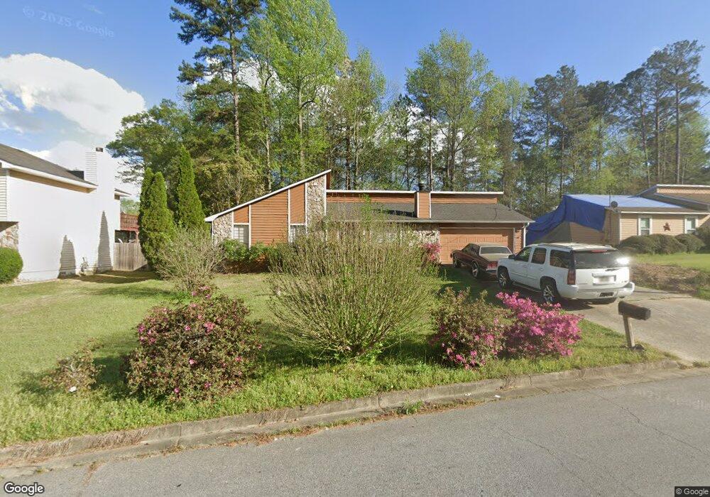
6740 Smoke Ridge Dr Unit 1 Atlanta, GA 30349
Estimated Value: $224,000 - $263,000
3
Beds
4
Baths
1,480
Sq Ft
$160/Sq Ft
Est. Value
About This Home
This home is located at 6740 Smoke Ridge Dr Unit 1, Atlanta, GA 30349 and is currently estimated at $237,480, approximately $160 per square foot. 6740 Smoke Ridge Dr Unit 1 is a home located in Fulton County with nearby schools including S. L. Lewis Elementary School, Bethune Elementary School, and Mcnair Middle School.
Ownership History
Date
Name
Owned For
Owner Type
Purchase Details
Closed on
May 21, 2007
Sold by
Hud & Housing Of Urban Dev
Bought by
Bailey-Robinson Tiffany and Robinson Timothy
Current Estimated Value
Home Financials for this Owner
Home Financials are based on the most recent Mortgage that was taken out on this home.
Original Mortgage
$82,650
Outstanding Balance
$50,273
Interest Rate
6.17%
Mortgage Type
New Conventional
Estimated Equity
$187,207
Purchase Details
Closed on
Jul 5, 2006
Sold by
Washington Mutual Bank
Bought by
Secretary Of Hud
Purchase Details
Closed on
May 24, 2004
Sold by
Ellerbee Tauna R and Ellerbee Tilford
Bought by
Render Gloria
Home Financials for this Owner
Home Financials are based on the most recent Mortgage that was taken out on this home.
Original Mortgage
$114,207
Interest Rate
6.09%
Mortgage Type
New Conventional
Create a Home Valuation Report for This Property
The Home Valuation Report is an in-depth analysis detailing your home's value as well as a comparison with similar homes in the area
Home Values in the Area
Average Home Value in this Area
Purchase History
| Date | Buyer | Sale Price | Title Company |
|---|---|---|---|
| Bailey-Robinson Tiffany | -- | -- | |
| Secretary Of Hud | -- | -- | |
| Washington Mutual Bank | $123,883 | -- | |
| Render Gloria | $116,000 | -- |
Source: Public Records
Mortgage History
| Date | Status | Borrower | Loan Amount |
|---|---|---|---|
| Open | Bailey-Robinson Tiffany | $82,650 | |
| Previous Owner | Render Gloria | $114,207 |
Source: Public Records
Tax History Compared to Growth
Tax History
| Year | Tax Paid | Tax Assessment Tax Assessment Total Assessment is a certain percentage of the fair market value that is determined by local assessors to be the total taxable value of land and additions on the property. | Land | Improvement |
|---|---|---|---|---|
| 2025 | $3,283 | $85,280 | $21,320 | $63,960 |
| 2023 | $2,543 | $90,080 | $25,920 | $64,160 |
| 2022 | $2,108 | $53,760 | $9,960 | $43,800 |
| 2021 | $2,091 | $52,240 | $9,680 | $42,560 |
| 2020 | $2,100 | $51,600 | $9,560 | $42,040 |
| 2019 | $1,603 | $40,600 | $7,200 | $33,400 |
| 2018 | $1,264 | $31,760 | $6,160 | $25,600 |
| 2017 | $1,244 | $30,520 | $5,920 | $24,600 |
| 2016 | $1,244 | $30,520 | $5,920 | $24,600 |
| 2015 | $1,248 | $30,520 | $5,920 | $24,600 |
| 2014 | $866 | $20,080 | $4,720 | $15,360 |
Source: Public Records
Map
Nearby Homes
- 3570 Keels Ln
- 6650 Smoke Ridge Dr
- 6600 Connell Rd
- 6435 Connell Rd Unit 2
- 6808 Merrywood Dr
- 1105 Buckhurst Dr
- 6410 Buckhurst Trail
- 6695 Buckhurst Trail
- 6665 Cedar Hurst Trail
- 3455 Leisure Ln
- 3325 Estate Lake Dr
- 3410 Leisure Ln
- 3250 Valley Bend Rd
- 6575 Hidden Brook Trail
- 6635 Hidden Brook Trail
- 3065 Keenan Rd
- 3260 Valley Bend Rd Unit 2
- 6945 Brown Dr S
- 6645 Hidden Brook Trail
- 6505 Cedar Hurst Trail
- 6730 Smoke Ridge Dr
- 6750 Smoke Ridge Dr Unit 73
- 6750 Smoke Ridge Dr
- 215 Springtree Ct
- 230 Whirlwind Ct Unit 159
- 230 Whirlwind Ct Unit 1
- 6760 Smoke Ridge Dr
- 240 Whirlwind Ct Unit 1
- 6715 Smoke Ridge Dr
- 225 Springtree Ct
- 6725 Smoke Ridge Dr
- 220 Whirlwind Ct
- 6770 Smoke Ridge Dr
- 6770 Smoke Ridge Dr Unit 75
- 6770 Smoke Ridge Dr Unit 1
- 6770 Smoke Ridge Dr Unit 13
- 6705 Smoke Ridge Dr
- 0 Springtree Ct Unit 8013393
- 0 Springtree Ct Unit 8631392
- 0 Springtree Ct Unit 3110679