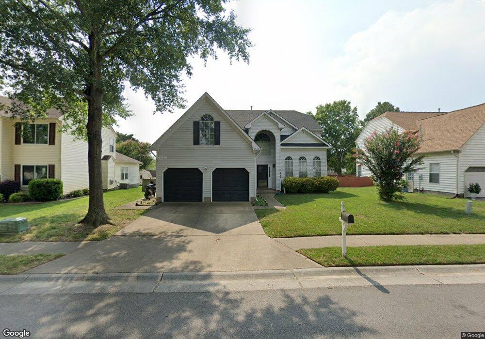
6741 Burbage Landing Cir Suffolk, VA 23435
Nansemond NeighborhoodEstimated Value: $454,000 - $472,000
5
Beds
3
Baths
2,481
Sq Ft
$186/Sq Ft
Est. Value
About This Home
This home is located at 6741 Burbage Landing Cir, Suffolk, VA 23435 and is currently estimated at $462,459, approximately $186 per square foot. 6741 Burbage Landing Cir is a home located in Suffolk City with nearby schools including Northern Shores Elementary School, John Yeates Middle School, and Nansemond River High School.
Ownership History
Date
Name
Owned For
Owner Type
Purchase Details
Closed on
Dec 14, 2020
Sold by
Colbert Darryl D and Colbert Crystal L
Bought by
Lindsey Joe E and Lindsey Devida D
Current Estimated Value
Home Financials for this Owner
Home Financials are based on the most recent Mortgage that was taken out on this home.
Original Mortgage
$325,000
Outstanding Balance
$289,347
Interest Rate
2.7%
Mortgage Type
VA
Estimated Equity
$173,112
Create a Home Valuation Report for This Property
The Home Valuation Report is an in-depth analysis detailing your home's value as well as a comparison with similar homes in the area
Home Values in the Area
Average Home Value in this Area
Purchase History
| Date | Buyer | Sale Price | Title Company |
|---|---|---|---|
| Lindsey Joe E | $325,000 | Attorney |
Source: Public Records
Mortgage History
| Date | Status | Borrower | Loan Amount |
|---|---|---|---|
| Open | Lindsey Joe E | $325,000 |
Source: Public Records
Tax History Compared to Growth
Tax History
| Year | Tax Paid | Tax Assessment Tax Assessment Total Assessment is a certain percentage of the fair market value that is determined by local assessors to be the total taxable value of land and additions on the property. | Land | Improvement |
|---|---|---|---|---|
| 2024 | $5,142 | $428,000 | $85,000 | $343,000 |
| 2023 | $4,973 | $398,400 | $85,000 | $313,400 |
| 2022 | $4,055 | $372,000 | $85,000 | $287,000 |
| 2021 | $3,540 | $318,900 | $69,000 | $249,900 |
| 2020 | $3,281 | $295,600 | $69,000 | $226,600 |
| 2019 | $3,129 | $281,900 | $69,000 | $212,900 |
| 2018 | $3,034 | $272,900 | $69,000 | $203,900 |
| 2017 | $2,845 | $265,900 | $69,000 | $196,900 |
| 2016 | $2,845 | $265,900 | $69,000 | $196,900 |
| 2015 | $1,375 | $258,700 | $61,800 | $196,900 |
| 2014 | $1,375 | $259,200 | $61,800 | $197,400 |
Source: Public Records
Map
Nearby Homes
- 6602 James Point Ct
- 6750 Burbage Landing Cir
- 5028 Bay Cir
- 6832 Ivanhoe Ct
- 5109 Hoffler St
- 4726 River Shore Rd
- 4913 Marina Dr
- 6446 Olde Bullocks Cir
- 4071 Long Point Blvd
- 6417 Pelican Crescent N
- 21 Windy Pines Crescent
- 8 Compass Ct
- 17 Shoal Ct
- 4619 River Shore Rd
- 4444 Southampton Arch
- 6215 Cambridge Dr
- 6109 Compton Ct
- 5833 Hawthorne Ln
- 1132 Samuel Greene Way
- 1130 Samuel Greene Way
- 6743 Burbage Landing Cir
- 6739 Burbage Landing Cir
- 6745 Burbage Landing Cir
- 6737 Burbage Landing Cir
- 6754 Burbage Landing Cir
- 6756 Burbage Landing Cir
- 6735 Burbage Landing Cir
- 6752 Burbage Landing Cir
- 6758 Burbage Landing Cir
- 6747 Burbage Landing Cir
- 6609 James Point Ct
- 6607 James Point Ct
- 6605 James Point Ct
- 6760 Burbage Landing Cir
- 6603 James Point Ct
- 6733 Burbage Landing Cir
- 6748 Burbage Landing Cir
- 6601 James Point Ct
- 6762 Burbage Landing Cir
- 6744 Burbage Landing Cir