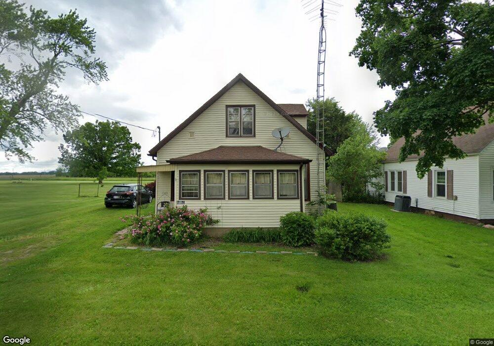
6741 Stockton Rd Mattoon, IL 61938
Estimated Value: $64,101 - $101,000
2
Beds
1
Bath
1,456
Sq Ft
$55/Sq Ft
Est. Value
About This Home
This home is located at 6741 Stockton Rd, Mattoon, IL 61938 and is currently estimated at $80,025, approximately $54 per square foot. 6741 Stockton Rd is a home located in Coles County with nearby schools including Charleston High School and Charis Christian Academy.
Ownership History
Date
Name
Owned For
Owner Type
Purchase Details
Closed on
Jan 4, 2013
Sold by
Harpster Gregory T and Harpster Tracy
Bought by
Fennema Deborah
Current Estimated Value
Home Financials for this Owner
Home Financials are based on the most recent Mortgage that was taken out on this home.
Original Mortgage
$48,970
Outstanding Balance
$33,953
Interest Rate
3.31%
Mortgage Type
New Conventional
Estimated Equity
$46,072
Purchase Details
Closed on
May 9, 2008
Sold by
Myers Gerald P and Myers Linda L
Bought by
Harpster Gregory T and Harpster Tracy
Home Financials for this Owner
Home Financials are based on the most recent Mortgage that was taken out on this home.
Original Mortgage
$30,000
Interest Rate
5.87%
Mortgage Type
New Conventional
Create a Home Valuation Report for This Property
The Home Valuation Report is an in-depth analysis detailing your home's value as well as a comparison with similar homes in the area
Home Values in the Area
Average Home Value in this Area
Purchase History
| Date | Buyer | Sale Price | Title Company |
|---|---|---|---|
| Fennema Deborah | $46,000 | None Available | |
| Harpster Gregory T | $26,000 | None Available |
Source: Public Records
Mortgage History
| Date | Status | Borrower | Loan Amount |
|---|---|---|---|
| Open | Fennema Deborah | $48,970 | |
| Previous Owner | Harpster Gregory T | $30,000 |
Source: Public Records
Tax History Compared to Growth
Tax History
| Year | Tax Paid | Tax Assessment Tax Assessment Total Assessment is a certain percentage of the fair market value that is determined by local assessors to be the total taxable value of land and additions on the property. | Land | Improvement |
|---|---|---|---|---|
| 2024 | $612 | $15,732 | $3,246 | $12,486 |
| 2023 | $534 | $14,173 | $2,924 | $11,249 |
| 2022 | $530 | $13,939 | $2,876 | $11,063 |
| 2021 | $491 | $12,558 | $2,591 | $9,967 |
| 2020 | $496 | $13,012 | $2,685 | $10,327 |
| 2019 | $473 | $12,558 | $2,591 | $9,967 |
| 2018 | $470 | $12,558 | $2,591 | $9,967 |
| 2017 | $467 | $12,558 | $2,591 | $9,967 |
| 2016 | $461 | $12,558 | $2,591 | $9,967 |
| 2015 | $472 | $12,312 | $2,540 | $9,772 |
| 2014 | $472 | $12,312 | $2,540 | $9,772 |
| 2013 | $472 | $12,312 | $2,540 | $9,772 |
Source: Public Records
Map
Nearby Homes
- 9517 E County Road 900n
- 9 Executive Ct
- 7 Executive Ct
- 0 Rt 16 and Miller Rd Unit 6202914
- 3625 Fox Trot Ln
- 8194 Country Club Rd
- 13475 Old State Rd
- 6936 Knollcrest Dr
- 2 Stonegate Dr
- 6046 Lerna Rd
- 22 Chestnut Run
- 16 Chestnut Run
- 14 Chestnut Run
- 23 Stonegate Dr
- 3 Chestnut Run
- 13 Chestnut Run
- 15 Chestnut Run
- 6 Fox Dr
- W Hayes Ave Lot Unit WP001
- Lot 10 Broadmoor
- 6729 Stockton Rd
- 6715 Stockton Rd
- 6730 Stockton Rd
- 6760 Stockton Rd
- 6691 Stockton Rd
- 6781 Stockton Rd
- 6710 Stockton Rd
- 6660 Stockton Rd
- 6616 Stockton Rd
- 6611 Stockton Rd
- 6565 Stockton Rd
- 6559 Stockton Rd
- 230 N Loxa Rd
- 246 N Loxa Rd
- 50 N Loxa Rd
- 149 N Loxa Rd
- 111 N Loxa Rd
- 135 N Loxa Rd
- 6430 Stockton Rd
- 6410 Stockton Rd