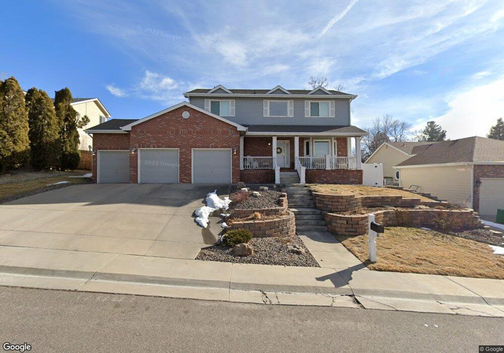
6742 Garland St Arvada, CO 80004
Scenic Heights NeighborhoodEstimated Value: $749,988 - $852,000
3
Beds
5
Baths
2,247
Sq Ft
$352/Sq Ft
Est. Value
About This Home
This home is located at 6742 Garland St, Arvada, CO 80004 and is currently estimated at $790,997, approximately $352 per square foot. 6742 Garland St is a home located in Jefferson County with nearby schools including Secrest Elementary School, Peck Elementary School, and Arvada K-8.
Ownership History
Date
Name
Owned For
Owner Type
Purchase Details
Closed on
Feb 15, 2017
Sold by
Fleetwood Maureen E
Bought by
Maureen E Fleetwood Trust
Current Estimated Value
Purchase Details
Closed on
Jul 16, 1996
Sold by
Harr Ricky and Harr Jennifer M
Bought by
Fleetwood Brent L and Fleetwood Maureen E
Home Financials for this Owner
Home Financials are based on the most recent Mortgage that was taken out on this home.
Original Mortgage
$172,800
Outstanding Balance
$12,593
Interest Rate
8.33%
Estimated Equity
$778,404
Purchase Details
Closed on
May 4, 1995
Sold by
Harr Ricky
Bought by
Harr Ricky and Harr Jennifer M
Purchase Details
Closed on
Jan 30, 1995
Sold by
Harr Rick and Roberts Michael L
Bought by
Harr Ricky
Home Financials for this Owner
Home Financials are based on the most recent Mortgage that was taken out on this home.
Original Mortgage
$135,000
Interest Rate
4.4%
Create a Home Valuation Report for This Property
The Home Valuation Report is an in-depth analysis detailing your home's value as well as a comparison with similar homes in the area
Home Values in the Area
Average Home Value in this Area
Purchase History
| Date | Buyer | Sale Price | Title Company |
|---|---|---|---|
| Maureen E Fleetwood Trust | -- | None Available | |
| Fleetwood Brent L | $216,000 | First American | |
| Harr Ricky | -- | -- | |
| Harr Ricky | $195,000 | Security Title Guaranty Co |
Source: Public Records
Mortgage History
| Date | Status | Borrower | Loan Amount |
|---|---|---|---|
| Open | Fleetwood Brent L | $172,800 | |
| Previous Owner | Harr Ricky | $135,000 |
Source: Public Records
Tax History Compared to Growth
Tax History
| Year | Tax Paid | Tax Assessment Tax Assessment Total Assessment is a certain percentage of the fair market value that is determined by local assessors to be the total taxable value of land and additions on the property. | Land | Improvement |
|---|---|---|---|---|
| 2024 | $4,794 | $49,422 | $22,660 | $26,762 |
| 2023 | $4,794 | $49,422 | $22,660 | $26,762 |
| 2022 | $3,844 | $39,256 | $16,810 | $22,446 |
| 2021 | $3,908 | $40,386 | $17,294 | $23,092 |
| 2020 | $3,434 | $35,583 | $14,193 | $21,390 |
| 2019 | $3,387 | $35,583 | $14,193 | $21,390 |
| 2018 | $3,126 | $31,930 | $10,481 | $21,449 |
| 2017 | $2,862 | $31,930 | $10,481 | $21,449 |
| 2016 | $2,816 | $29,596 | $7,411 | $22,185 |
| 2015 | $2,706 | $29,596 | $7,411 | $22,185 |
| 2014 | $2,706 | $26,731 | $7,794 | $18,937 |
Source: Public Records
Map
Nearby Homes
- 6750 Garrison St
- 9173 W 66th Place
- 6842 Garland St
- 6455 Field St
- 9743 W 67th Place
- 9642 W 69th Place
- 6580 Independence Way
- 6444 Holland Cir
- 8612 W 69th Place
- 6801 Carr St
- 6572 Kipling St
- 6532 Kipling St
- 6250 Everett Ct Unit E
- 6734 Kline St
- 9656 Rensselaer Dr
- 6240 Everett Ct Unit F
- 9175 Cole Dr
- 9636 W 71st Place
- 6200 Estes St
- 8300 W 67th Ave
- 6752 Garland St
- 6732 Garland St
- 6735 Garrison St
- 6762 Garland St
- 6712 Garland St
- 6743 Garland St
- 6733 Garland St
- 6753 Garland St
- 9227 W 67th Ave
- 6765 Garrison St
- 6713 Garland St
- 6772 Garland St
- 9320 W 68th Ave
- 6795 Garrison St
- 6744 Garland Ct
- 6724 Garland St
- 6754 Garland Ct
- 9248 W 67th Ave
- 9238 W 67th Ave
- 6730 Garrison St