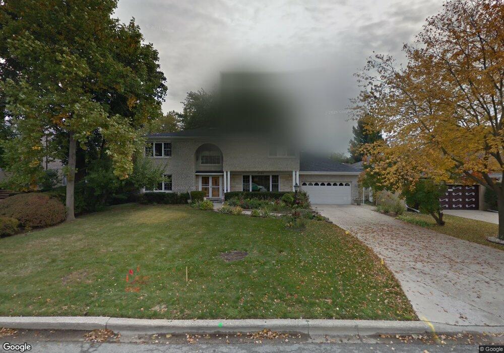
6743 N Nokomis Ave Lincolnwood, IL 60712
Estimated Value: $819,361 - $1,005,000
4
Beds
3
Baths
3,258
Sq Ft
$273/Sq Ft
Est. Value
About This Home
This home is located at 6743 N Nokomis Ave, Lincolnwood, IL 60712 and is currently estimated at $889,090, approximately $272 per square foot. 6743 N Nokomis Ave is a home located in Cook County with nearby schools including Todd Hall Elementary School, Rutledge Hall Elementary School, and Lincoln Hall Middle School.
Ownership History
Date
Name
Owned For
Owner Type
Purchase Details
Closed on
Aug 25, 1995
Sold by
Pioneer Bank & Trust Company
Bought by
Spyrakos Demetrios and Spyrakos Harriet
Current Estimated Value
Home Financials for this Owner
Home Financials are based on the most recent Mortgage that was taken out on this home.
Original Mortgage
$200,000
Interest Rate
7.76%
Create a Home Valuation Report for This Property
The Home Valuation Report is an in-depth analysis detailing your home's value as well as a comparison with similar homes in the area
Home Values in the Area
Average Home Value in this Area
Purchase History
| Date | Buyer | Sale Price | Title Company |
|---|---|---|---|
| Spyrakos Demetrios | $350,000 | Intercounty Title |
Source: Public Records
Mortgage History
| Date | Status | Borrower | Loan Amount |
|---|---|---|---|
| Closed | Spyrakos Demetrios | $200,000 |
Source: Public Records
Tax History Compared to Growth
Tax History
| Year | Tax Paid | Tax Assessment Tax Assessment Total Assessment is a certain percentage of the fair market value that is determined by local assessors to be the total taxable value of land and additions on the property. | Land | Improvement |
|---|---|---|---|---|
| 2024 | $14,983 | $62,000 | $16,335 | $45,665 |
| 2023 | $14,343 | $62,000 | $16,335 | $45,665 |
| 2022 | $14,343 | $62,000 | $16,335 | $45,665 |
| 2021 | $13,703 | $53,225 | $10,890 | $42,335 |
| 2020 | $13,567 | $53,225 | $10,890 | $42,335 |
| 2019 | $13,535 | $58,489 | $10,890 | $47,599 |
| 2018 | $14,719 | $60,425 | $9,405 | $51,020 |
| 2017 | $14,809 | $60,425 | $9,405 | $51,020 |
| 2016 | $14,544 | $60,425 | $9,405 | $51,020 |
| 2015 | $14,238 | $55,375 | $8,167 | $47,208 |
| 2014 | $15,266 | $61,254 | $8,167 | $53,087 |
| 2013 | $14,896 | $61,254 | $8,167 | $53,087 |
Source: Public Records
Map
Nearby Homes
- 6741 N Ramona Ave
- 6709 N Ramona Ave
- 6739 N Leroy Ave
- 5148 Coyle Ave
- 5255 Coyle Ave
- 6612 N Ramona Ave
- 4900 Morse Ave
- 6420 N Navajo Ave
- 6725 N Cicero Ave
- 5332 Fairview Ln
- 6632 N Sioux Ave
- 6835 N Waukesha Ave
- 5446 W Lunt Ave
- 6425 N Tower Ct
- 6923 N Chicora Ave
- 6339 N Leona Ave
- 5338 W Devon Ave
- 6846 N Dowagiac Ave
- 6400 N Cicero Ave Unit 410
- 6400 N Cicero Ave Unit 309
- 6733 N Nokomis Ave
- 6757 N Nokomis Ave
- 6742 N Navajo Ave
- 6750 N Navajo Ave
- 6727 N Nokomis Ave
- 6756 N Navajo Ave
- 6740 N Nokomis Ave
- 6750 N Nokomis Ave
- 6724 N Navajo Ave
- 6726 N Nokomis Ave
- 6758 N Nokomis Ave
- 6719 N Nokomis Ave
- 6720 N Navajo Ave
- 6720 N Navajo Ave
- 6747 N Minnehaha Ave
- 6747 N Minnehaha Ave
- 6722 N Nokomis Ave
- 5120 Pratt Ave
- 5120 Pratt Ave
- 5116 Pratt Ave