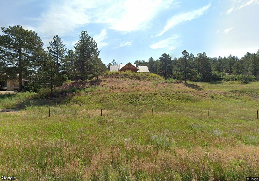
67450 State Highway 69 Westcliffe, CO 81252
Estimated Value: $811,000 - $1,089,658
3
Beds
4
Baths
2,362
Sq Ft
$389/Sq Ft
Est. Value
About This Home
This home is located at 67450 State Highway 69, Westcliffe, CO 81252 and is currently estimated at $919,553, approximately $389 per square foot. 67450 State Highway 69 is a home with nearby schools including Custer County Elementary School, Custer Middle School, and Custer County High School.
Ownership History
Date
Name
Owned For
Owner Type
Purchase Details
Closed on
Sep 7, 2022
Sold by
Lynn Safford Living Trust
Bought by
Robert Grantor Living Trust
Current Estimated Value
Purchase Details
Closed on
Oct 22, 2015
Sold by
Carpenter Andrew James
Bought by
Safford Lyan W
Home Financials for this Owner
Home Financials are based on the most recent Mortgage that was taken out on this home.
Original Mortgage
$21,000
Interest Rate
3.9%
Mortgage Type
Purchase Money Mortgage
Purchase Details
Closed on
Jun 17, 2001
Sold by
Erps Dale J
Bought by
Erps Eugenia M Trustee Of Dale J & Eugen
Purchase Details
Closed on
Dec 20, 2000
Sold by
Erps Dale J and Erps Eugenia
Bought by
Erps Dale J & Eugenia M Trustees
Create a Home Valuation Report for This Property
The Home Valuation Report is an in-depth analysis detailing your home's value as well as a comparison with similar homes in the area
Home Values in the Area
Average Home Value in this Area
Purchase History
| Date | Buyer | Sale Price | Title Company |
|---|---|---|---|
| Robert Grantor Living Trust | -- | -- | |
| Safford Lyan W | $59,000 | Stewart Title | |
| Erps Eugenia M Trustee Of Dale J & Eugen | -- | -- | |
| Erps Dale J & Eugenia M Trustees | -- | -- |
Source: Public Records
Mortgage History
| Date | Status | Borrower | Loan Amount |
|---|---|---|---|
| Previous Owner | Safford Lyan W | $21,000 |
Source: Public Records
Tax History Compared to Growth
Tax History
| Year | Tax Paid | Tax Assessment Tax Assessment Total Assessment is a certain percentage of the fair market value that is determined by local assessors to be the total taxable value of land and additions on the property. | Land | Improvement |
|---|---|---|---|---|
| 2024 | $2,709 | $46,680 | $0 | $0 |
| 2023 | $2,709 | $46,680 | $0 | $0 |
| 2022 | $2,990 | $6,250 | $6,250 | $0 |
| 2021 | $413 | $6,250 | $6,250 | $0 |
| 2020 | $408 | $6,250 | $6,250 | $0 |
| 2019 | $406 | $6,250 | $6,250 | $0 |
| 2018 | $408 | $6,250 | $6,250 | $0 |
| 2017 | $396 | $6,247 | $6,247 | $0 |
| 2016 | $380 | $6,250 | $6,250 | $0 |
| 2015 | $382 | $19,500 | $19,500 | $0 |
| 2012 | $331 | $19,500 | $19,500 | $0 |
Source: Public Records
Map
Nearby Homes
- 67445 State Highway 69
- 278 Blue Grouse Cir
- 68600 Colorado 69
- 68600 State Highway 69
- 188 Looters Ln
- 1301 Pheasant Loop
- 1328 Round up Rd
- 325 Mcmurtrie Rd
- 1491 Oak Dr
- 209 Rosewood Rd
- 370 Road 182w
- 1601 Desperado Dr
- 1601 Desperado Dr Unit 12
- 2850 County Road 191
- 249 Hagerman Rd
- 750 Roundup Rd
- TBD Palmer Rd
- 781 Ridgeway Rd
- 0 Corral N Unit REC4003395
- 0 Corral N Unit 5584754
- 67449 N Hwy 69
- 67445 Colorado 69
- 67449 State Highway 69
- 67449 State Highway 69
- 67724 State Highway 69
- 67725 State Highway 69
- 67725 Hwy 69
- 67725 State Highway 69
- TBD Blue Grouse Cir
- 300 Wild Turkey Rd Unit 6
- 300 Wild Turkey Rd
- 610 Wild Turkey Rd
- 916 Wild Turkey Rd
- 0 Colorado 69 Unit 6084032
- 0 Colorado 69 Unit 9150306
- 0 Colorado 69
- None Wild Turkey Rd
- 0 Wild Turkey Rd Unit C234419
- None Wild Turkey Rd Unit 1
- 537 Wild Turkey Rd