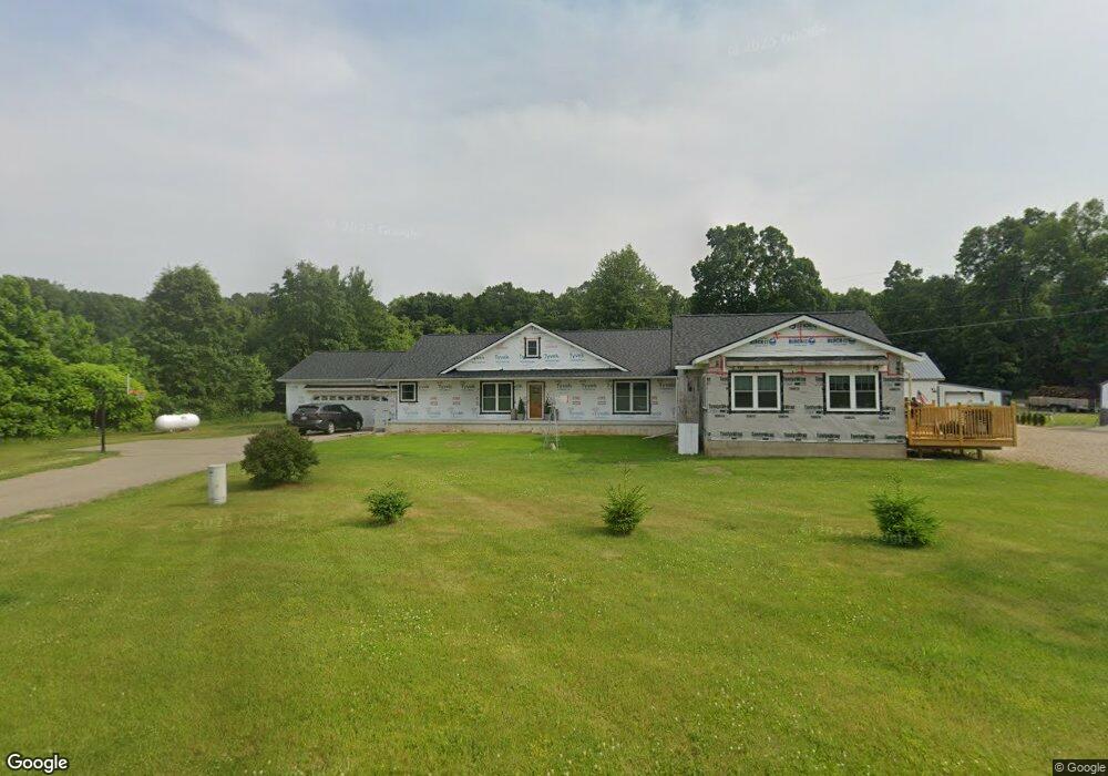
6747 W R Ave Schoolcraft, MI 49087
Estimated Value: $437,000 - $474,000
4
Beds
3
Baths
2,816
Sq Ft
$162/Sq Ft
Est. Value
About This Home
This home is located at 6747 W R Ave, Schoolcraft, MI 49087 and is currently estimated at $455,500, approximately $161 per square foot. 6747 W R Ave is a home located in Kalamazoo County with nearby schools including Mattawan Early Elementary School, Mattawan Later Elementary School, and Mattawan Middle School.
Ownership History
Date
Name
Owned For
Owner Type
Purchase Details
Closed on
Apr 10, 2019
Sold by
Sponable David J and Sponable David
Bought by
Sponable David J and David J Sponable Trust
Current Estimated Value
Purchase Details
Closed on
May 21, 2018
Sold by
Hamming Scott K and Hamming Carmela S
Bought by
Sponable David
Purchase Details
Closed on
Mar 1, 2005
Sold by
Hamming Wayne E and Hamming Jean A
Bought by
Hamming Scott K and Hamming Carmela S
Purchase Details
Closed on
Dec 29, 2004
Sold by
Hamming Scott K and Hamming Carmela S
Bought by
Hamming Scott K and Hamming Carmela S
Home Financials for this Owner
Home Financials are based on the most recent Mortgage that was taken out on this home.
Original Mortgage
$209,000
Interest Rate
5.78%
Mortgage Type
New Conventional
Create a Home Valuation Report for This Property
The Home Valuation Report is an in-depth analysis detailing your home's value as well as a comparison with similar homes in the area
Home Values in the Area
Average Home Value in this Area
Purchase History
| Date | Buyer | Sale Price | Title Company |
|---|---|---|---|
| Sponable David J | -- | None Available | |
| Sponable David | $270,000 | First American Title Ins Co | |
| Hamming Scott K | -- | -- | |
| Hamming Scott K | -- | Chicago Title |
Source: Public Records
Mortgage History
| Date | Status | Borrower | Loan Amount |
|---|---|---|---|
| Previous Owner | Hamming Scott K | $209,000 |
Source: Public Records
Tax History Compared to Growth
Tax History
| Year | Tax Paid | Tax Assessment Tax Assessment Total Assessment is a certain percentage of the fair market value that is determined by local assessors to be the total taxable value of land and additions on the property. | Land | Improvement |
|---|---|---|---|---|
| 2025 | $5,439 | $198,900 | $0 | $0 |
| 2024 | $1,728 | $184,300 | $0 | $0 |
| 2023 | $1,606 | $164,200 | $0 | $0 |
| 2022 | $4,821 | $142,400 | $0 | $0 |
| 2021 | $4,765 | $140,300 | $0 | $0 |
| 2020 | $4,617 | $140,300 | $0 | $0 |
| 2019 | $4,202 | $135,900 | $0 | $0 |
| 2018 | $1,475 | $115,400 | $0 | $0 |
| 2017 | -- | $116,300 | $0 | $0 |
| 2016 | -- | $112,500 | $0 | $0 |
| 2015 | -- | $93,500 | $39,500 | $54,000 |
| 2014 | -- | $93,500 | $0 | $0 |
Source: Public Records
Map
Nearby Homes
- 9030 S 8th St
- 8365 Logan Bay St
- 7148 Texas Heights Ave
- 8022 Magistrate St
- 8188 Coneflower Cove
- 6737 W Q Ave
- 7542 Northport Ave Unit 38
- 7207 Coreopsis Cove
- 7426 Texas Heights Ave
- 7839 Clydesdale Ave Unit 93
- 7875 Port Hope Dr Unit 13
- 6241 Saddle Ridge Ct Unit 120
- 7620 Stablebrook Cir
- 5353 Chickadee Dr
- 5284 Green Pine Ln
- 5850 Dunwoody Ct
- 7876 Turning Stone
- 5825 Saddle Club Dr
- 7414 Field Bay Ave Unit 12
- 9116 S 6th St