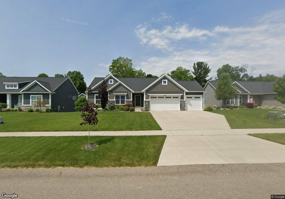
6749 Alward Dr Hudsonville, MI 49426
Estimated Value: $529,573 - $657,000
--
Bed
4
Baths
1,691
Sq Ft
$346/Sq Ft
Est. Value
About This Home
This home is located at 6749 Alward Dr, Hudsonville, MI 49426 and is currently estimated at $585,143, approximately $346 per square foot. 6749 Alward Dr is a home with nearby schools including Baldwin Street Middle School, Hudsonville Freshman Campus, and Hudsonville High School.
Ownership History
Date
Name
Owned For
Owner Type
Purchase Details
Closed on
Jun 24, 2020
Sold by
Lane Perrin Builder Llc
Bought by
Snoeyink Zachary and Snoeyink Samantha
Current Estimated Value
Home Financials for this Owner
Home Financials are based on the most recent Mortgage that was taken out on this home.
Original Mortgage
$373,205
Outstanding Balance
$330,818
Interest Rate
3.2%
Mortgage Type
New Conventional
Estimated Equity
$254,325
Purchase Details
Closed on
Mar 15, 2019
Sold by
Ymker Allen L and Ymker Carol M
Bought by
Lane Perrin Builder Llc and Wade Schut Builders Inc
Create a Home Valuation Report for This Property
The Home Valuation Report is an in-depth analysis detailing your home's value as well as a comparison with similar homes in the area
Home Values in the Area
Average Home Value in this Area
Purchase History
| Date | Buyer | Sale Price | Title Company |
|---|---|---|---|
| Snoeyink Zachary | $392,847 | Lighthouse Title Inc | |
| Lane Perrin Builder Llc | $86,000 | Lighthouse Title Inc |
Source: Public Records
Mortgage History
| Date | Status | Borrower | Loan Amount |
|---|---|---|---|
| Open | Snoeyink Zachary | $373,205 |
Source: Public Records
Tax History Compared to Growth
Tax History
| Year | Tax Paid | Tax Assessment Tax Assessment Total Assessment is a certain percentage of the fair market value that is determined by local assessors to be the total taxable value of land and additions on the property. | Land | Improvement |
|---|---|---|---|---|
| 2025 | $6,046 | $261,300 | $0 | $0 |
| 2024 | $5,231 | $233,400 | $0 | $0 |
| 2023 | $4,996 | $216,100 | $0 | $0 |
| 2022 | $5,491 | $199,200 | $0 | $0 |
| 2021 | $5,335 | $191,500 | $0 | $0 |
| 2020 | $2,697 | $58,700 | $0 | $0 |
| 2019 | $162 | $33,100 | $0 | $0 |
Source: Public Records
Map
Nearby Homes
- 4106 Blair St
- 6950 Meadowcreek Dr
- 7068 Jasper Dr
- 3808 Port Sheldon St
- 7114 Tory Dr
- 4372 Shady Oak Ct
- 3755 Black Creek Dr
- 6821 Bridgeport Dr
- 6863 Bridgeport Dr
- 3528 Tearose Dr
- 3646 Lenters Dr
- V/L Port Sheldon St
- 7318 Alycia Dr
- 3204 Port Sheldon St
- 0 Baldwin St
- 4087 Baldwin St
- 6620 Sheldon Crossings Dr
- 2969 Osprey Dr Unit 27
- 6207 Gemini Ct
- 7313 Valhalla Dr