Estimated Value: $700,110 - $814,000
4
Beds
3
Baths
3,224
Sq Ft
$234/Sq Ft
Est. Value
About This Home
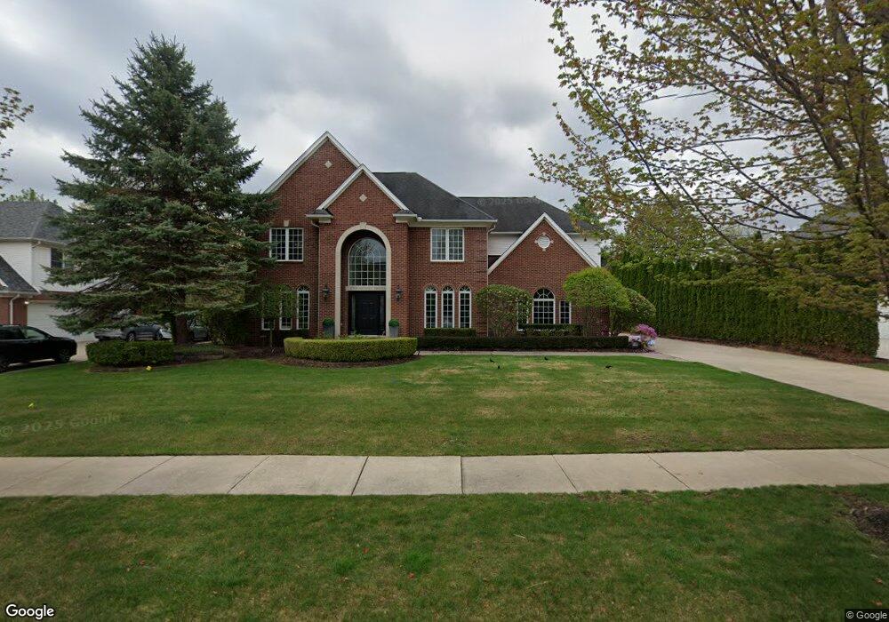
This home is located at 6749 Michael Dr, Troy, MI 48098 and is currently estimated at $754,528, approximately $234 per square foot. 6749 Michael Dr is a home located in Oakland County with nearby schools including Woodland Elementary School, Avondale Middle School, and Avondale High School.
Ownership History
Date
Name
Owned For
Owner Type
Purchase Details
Closed on
Sep 29, 2012
Sold by
Tonelli Raymond A and Tonelli Eugenia G
Bought by
Tonelli Raymond A and Tonelli Eugenia G
Current Estimated Value
Home Financials for this Owner
Home Financials are based on the most recent Mortgage that was taken out on this home.
Original Mortgage
$332,200
Interest Rate
3.32%
Mortgage Type
New Conventional
Purchase Details
Closed on
Feb 24, 2009
Sold by
Tonelli Raymond A and Tonelli Eugenia G
Bought by
Tonelli Raymond A and Tonelli Eugenia G
Purchase Details
Closed on
Dec 2, 2002
Sold by
Orion Homes Inc
Bought by
Tonelli Raymond A and Tonelli Eugenia G
Create a Home Valuation Report for This Property
The Home Valuation Report is an in-depth analysis detailing your home's value as well as a comparison with similar homes in the area
Home Values in the Area
Average Home Value in this Area
Purchase History
| Date | Buyer | Sale Price | Title Company |
|---|---|---|---|
| Tonelli Raymond A | -- | Title Source Inc | |
| Tonelli Raymond A | -- | Title Source Inc | |
| Tonelli Raymond A | -- | None Available | |
| Tonelli Raymond A | $480,000 | -- |
Source: Public Records
Mortgage History
| Date | Status | Borrower | Loan Amount |
|---|---|---|---|
| Closed | Tonelli Raymond A | $332,200 |
Source: Public Records
Tax History
| Year | Tax Paid | Tax Assessment Tax Assessment Total Assessment is a certain percentage of the fair market value that is determined by local assessors to be the total taxable value of land and additions on the property. | Land | Improvement |
|---|---|---|---|---|
| 2022 | $6,938 | $258,000 | $0 | $0 |
| 2015 | $7,566 | $250,020 | $0 | $0 |
| 2014 | -- | $257,000 | $0 | $0 |
| 2011 | -- | $181,590 | $0 | $0 |
Source: Public Records
Map
Nearby Homes
- 6622 Houghten Dr
- 6382 Houghten Dr
- 6177 Livernois Rd
- 496 E Lovell Dr
- 3970 Cone Ave
- 3788 Dearborn Ave
- 3950 Samuel Ave
- 396 South Blvd W
- 3750 Alida Ave
- 390 E Square Lake Rd
- 3566 Samuel Ave
- 6817 Woodcrest Dr
- 954 Sandalwood Dr Unit 52
- 764 Red Run Dr Unit 34
- 3845 Hazelton Ave
- 912 Sandalwood Dr
- 3175 Lexham Ln
- 3459 Hazelton Ave
- 1096 Prosper Dr
- 6178 Elarz Dr
- 6761 Michael Dr
- 6737 Michael Dr
- 102 Melanie Ln
- 84 Melanie Ln
- 120 Melanie Ln
- 6744 Michael Dr
- 6756 Michael Dr
- 6725 Michael Dr Unit Bldg-Unit
- 6725 Michael Dr
- 6773 Michael Dr
- 6732 Michael Dr
- 138 Melanie Ln
- 66 Melanie Ln
- 97 Melanie Ln
- 81 W Lovell Dr
- 6768 Michael Dr
- 115 Melanie Ln
- 79 Melanie Ln
- 111 W Lovell Dr
- 6785 Michael Dr
Your Personal Tour Guide
Ask me questions while you tour the home.