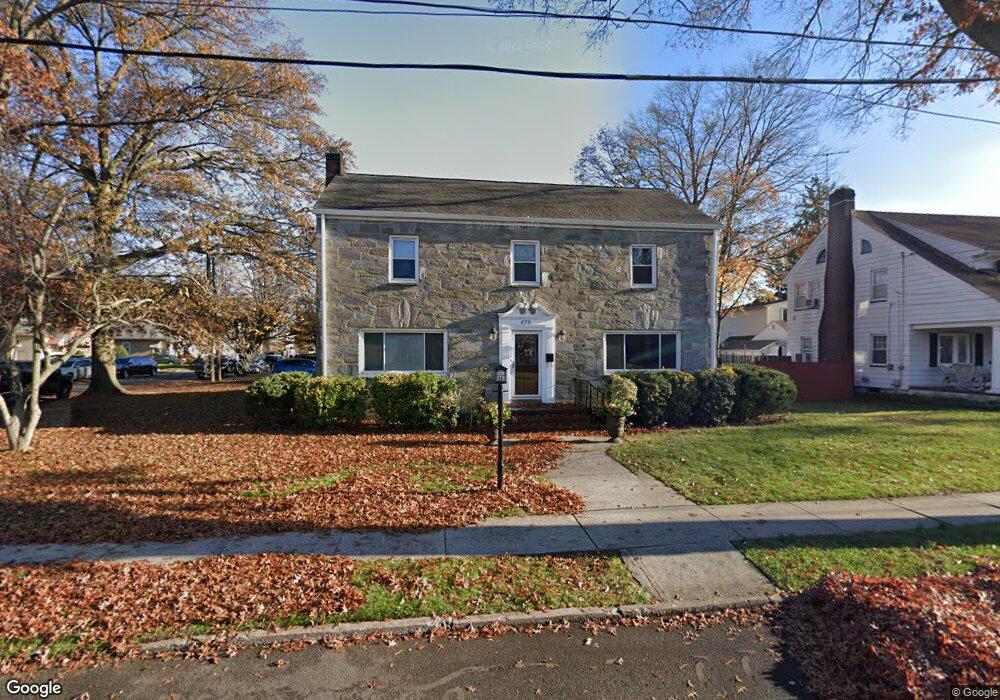
675 Bryant St Rahway, NJ 07065
Estimated Value: $688,464 - $770,000
--
Bed
--
Bath
2,800
Sq Ft
$259/Sq Ft
Est. Value
About This Home
This home is located at 675 Bryant St, Rahway, NJ 07065 and is currently estimated at $726,116, approximately $259 per square foot. 675 Bryant St is a home located in Union County with nearby schools including Rahway High School.
Ownership History
Date
Name
Owned For
Owner Type
Purchase Details
Closed on
Dec 12, 2007
Sold by
Jefferson Robert M and Jefferson Monique
Bought by
Hill Rovan D and Lauriano Hill Adele E
Current Estimated Value
Home Financials for this Owner
Home Financials are based on the most recent Mortgage that was taken out on this home.
Original Mortgage
$250,000
Outstanding Balance
$157,994
Interest Rate
6.27%
Mortgage Type
Purchase Money Mortgage
Estimated Equity
$568,122
Purchase Details
Closed on
Apr 24, 2003
Sold by
Quincy Mutual Fire Ins Co
Bought by
Clemendore Garfield and Clemendore Eunice
Home Financials for this Owner
Home Financials are based on the most recent Mortgage that was taken out on this home.
Original Mortgage
$236,000
Interest Rate
5.71%
Purchase Details
Closed on
Aug 29, 2001
Sold by
Heather William A and Heather Tammy
Bought by
Schartner Edward O
Purchase Details
Closed on
Jun 9, 1998
Sold by
Holt James T and Holt Alexandra
Bought by
Heather William A and Heather Tammy
Create a Home Valuation Report for This Property
The Home Valuation Report is an in-depth analysis detailing your home's value as well as a comparison with similar homes in the area
Home Values in the Area
Average Home Value in this Area
Purchase History
| Date | Buyer | Sale Price | Title Company |
|---|---|---|---|
| Hill Rovan D | $475,000 | Fidelity Natl Title Ins Co | |
| Clemendore Garfield | $295,000 | -- | |
| Schartner Edward O | $257,000 | -- | |
| Heather William A | $173,000 | -- |
Source: Public Records
Mortgage History
| Date | Status | Borrower | Loan Amount |
|---|---|---|---|
| Open | Hill Rovan D | $250,000 | |
| Previous Owner | Clemendore Garfield | $236,000 |
Source: Public Records
Tax History Compared to Growth
Tax History
| Year | Tax Paid | Tax Assessment Tax Assessment Total Assessment is a certain percentage of the fair market value that is determined by local assessors to be the total taxable value of land and additions on the property. | Land | Improvement |
|---|---|---|---|---|
| 2025 | $13,788 | $186,200 | $63,000 | $123,200 |
| 2024 | $13,354 | $186,200 | $63,000 | $123,200 |
| 2023 | $13,354 | $186,200 | $63,000 | $123,200 |
| 2022 | $13,075 | $186,200 | $63,000 | $123,200 |
| 2021 | $12,943 | $186,200 | $63,000 | $123,200 |
| 2020 | $12,894 | $186,200 | $63,000 | $123,200 |
| 2019 | $12,730 | $186,200 | $63,000 | $123,200 |
| 2018 | $12,462 | $186,200 | $63,000 | $123,200 |
| 2017 | $12,155 | $186,200 | $63,000 | $123,200 |
| 2016 | $11,896 | $186,200 | $63,000 | $123,200 |
| 2015 | $11,762 | $186,200 | $63,000 | $123,200 |
| 2014 | $11,552 | $186,200 | $63,000 | $123,200 |
Source: Public Records
Map
Nearby Homes
- 275 Forbes St
- 182 W Lake Ave
- 181 W Stearns St
- 59 Minna St
- 277 Orchard St
- 331 W Inman Ave
- 163 Stanton St
- 306 Orchard St
- 653 New Brunswick Ave
- 372 W Hazelwood Ave
- 48 W Hazelwood Ave
- 1016 Jaques Ave
- 591 Harris Dr
- 723 Dianne Ct
- 139 Maple Ave Unit 104
- 593 W Hazelwood Ave
- 156 W Emerson Ave
- 1025 New Brunswick Ave
- 935 Thorn St
- 276 E Stearns St