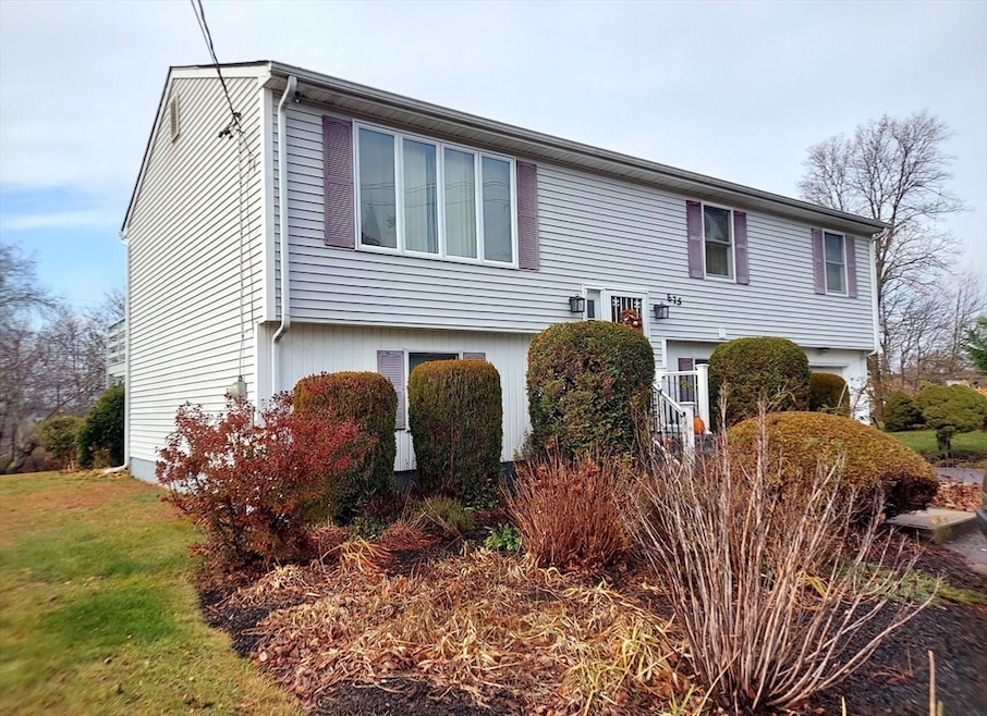
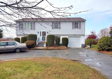
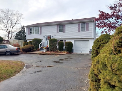
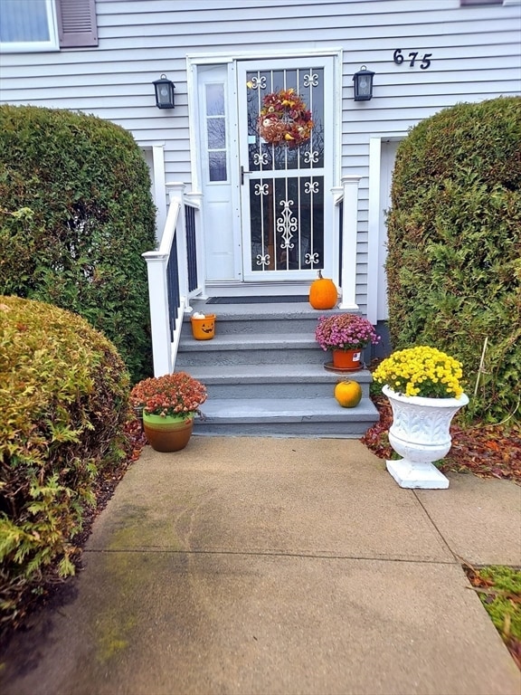
675 Lees River Ave Somerset, MA 02725
Brayton Point NeighborhoodEstimated payment $3,618/month
Highlights
- River View
- Deck
- 1 Car Attached Garage
- 0.67 Acre Lot
- No HOA
- Tile Flooring
About This Home
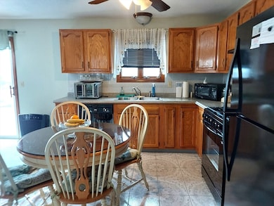
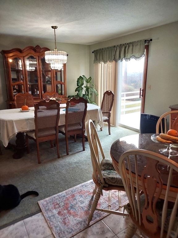
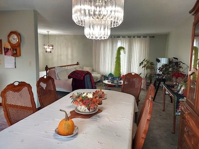
Handsome Split Level set on ample 29000+ SF lot overlooking the Lees River from Deck in Rear and backyard. 4 bedrooms, 2 full kitchens, 2 full baths. Garage with rear door to backyard. Horse-shoe Driveway for ease of entrance and exit. Ceramic floors in kitchens and baths. Gas baseboard heat, Gas cooking & Gas hot water. Vinyl Siding. One Owner Home. Ideal In-law setup. Estate Sale..
Listing Agent
Maria Araujo
White House Realty Listed on: 11/28/2025
Home Details
Home Type
- Single Family
Est. Annual Taxes
- $5,509
Year Built
- Built in 1992
Lot Details
- 0.67 Acre Lot
- Property is zoned R1
Parking
- 1 Car Attached Garage
- Tuck Under Parking
- Driveway
- Open Parking
- Off-Street Parking
Home Design
- Split Level Home
- Frame Construction
- Shingle Roof
- Concrete Perimeter Foundation
Interior Spaces
- River Views
Flooring
- Carpet
- Tile
Bedrooms and Bathrooms
- 4 Bedrooms
- 2 Full Bathrooms
Finished Basement
- Walk-Out Basement
- Basement Fills Entire Space Under The House
- Interior Basement Entry
- Garage Access
Outdoor Features
- Deck
Utilities
- No Cooling
- Central Heating
- 2 Heating Zones
- Baseboard Heating
- Gas Water Heater
Community Details
- No Home Owners Association
Listing and Financial Details
- Assessor Parcel Number 2954351
Map
Home Values in the Area
Average Home Value in this Area
Tax History
| Year | Tax Paid | Tax Assessment Tax Assessment Total Assessment is a certain percentage of the fair market value that is determined by local assessors to be the total taxable value of land and additions on the property. | Land | Improvement |
|---|---|---|---|---|
| 2025 | $5,509 | $414,200 | $182,500 | $231,700 |
| 2024 | $5,183 | $405,200 | $182,500 | $222,700 |
| 2023 | $4,491 | $354,200 | $152,500 | $201,700 |
| 2022 | $4,164 | $313,300 | $132,800 | $180,500 |
| 2021 | $4,215 | $287,100 | $121,000 | $166,100 |
| 2020 | $4,214 | $276,900 | $121,000 | $155,900 |
| 2019 | $4,738 | $259,600 | $121,000 | $138,600 |
| 2018 | $3,969 | $258,800 | $120,000 | $138,800 |
| 2017 | $4,247 | $244,100 | $114,000 | $130,100 |
| 2016 | $4,274 | $244,100 | $114,000 | $130,100 |
| 2015 | $4,131 | $238,100 | $120,400 | $117,700 |
| 2014 | $5,702 | $236,100 | $117,000 | $119,100 |
Property History
| Date | Event | Price | List to Sale | Price per Sq Ft |
|---|---|---|---|---|
| 11/28/2025 11/28/25 | For Sale | $599,900 | -- | $296 / Sq Ft |
Purchase History
| Date | Type | Sale Price | Title Company |
|---|---|---|---|
| Warranty Deed | -- | -- | |
| Warranty Deed | -- | -- | |
| Deed | $133,000 | -- | |
| Deed | $133,000 | -- |
Mortgage History
| Date | Status | Loan Amount | Loan Type |
|---|---|---|---|
| Previous Owner | $63,000 | No Value Available | |
| Previous Owner | $68,000 | Purchase Money Mortgage |
Source: MLS Property Information Network (MLS PIN)
MLS Number: 73458243
APN: SOME-000011A-000000-000079
Disclaimer: Certain information contained herein is derived from information provided by parties other than Homes.com. All information provided is deemed reliable, but is not guaranteed to be accurate and should be independently verified.
![]() The property listing data and information, or the Images, set forth herein were provided to MLS Property Information Network, Inc. from third party sources, including sellers, lessors and public records, and were compiled by MLS Property Information Network, Inc. The property listing data and information, and the Images, are for the personal, non-commercial use of consumers having a good faith interest in purchasing or leasing listed properties of the type displayed to them and may not be used for any purpose other than to identify prospective properties which such consumers may have a good faith interest in purchasing or leasing. MLS Property Information Network, Inc. and its subscribers disclaim any and all representations and warranties as to the accuracy of the property listing data and information, or as to the accuracy of any of the Images, set forth herein.
The property listing data and information, or the Images, set forth herein were provided to MLS Property Information Network, Inc. from third party sources, including sellers, lessors and public records, and were compiled by MLS Property Information Network, Inc. The property listing data and information, and the Images, are for the personal, non-commercial use of consumers having a good faith interest in purchasing or leasing listed properties of the type displayed to them and may not be used for any purpose other than to identify prospective properties which such consumers may have a good faith interest in purchasing or leasing. MLS Property Information Network, Inc. and its subscribers disclaim any and all representations and warranties as to the accuracy of the property listing data and information, or as to the accuracy of any of the Images, set forth herein.
- 1 Taunton River
- 30 Front St
- 24 Front St
- 8 2nd St
- 197 Alberta Ave
- 19 Richard Rd
- 167 Mercier Ave
- 19 Keller Ave
- 24 Knapp St
- 33 Rhinecliffe Rd
- 34 Base Lodge Ln
- 337 Lepes Rd
- 73 Bourne Rd
- 8 Tower Hill Rd
- 126 Jaffrey St
- 132 Jackson Ave
- 105 Cornhill Rd
- 0 Hortonville Rd Unit 73242268
- 21 Bradley Ave
- 462 Harbor View Blvd
- 508 Grand Army of the Republic Highway St
- 76 Houlton St Unit 1
- 297 Swansom Rd
- 229 Oneil Rd Unit 1
- 229 Oneil Rd Unit 2
- 1212 Riverside Ave Unit Furnished 2 Bed
- 1082 Davol St
- 32 Norfolk St Unit 1 E
- 112 Short St Unit 2 WEST
- 108 Shawomet Ave Unit 3
- 101 Cory St Unit 3
- 53 Bowker Terrace Unit 2
- 229 Brightman St
- 229 Brightman St Unit 2
- 88 Almy St Unit 1a
- 322 Brownell St Unit 3W
- 1968 N Main St Unit 3
- 764 Rock St Unit 2
- 764 Rock St Unit 2
- 396 Durfee St Unit 1
