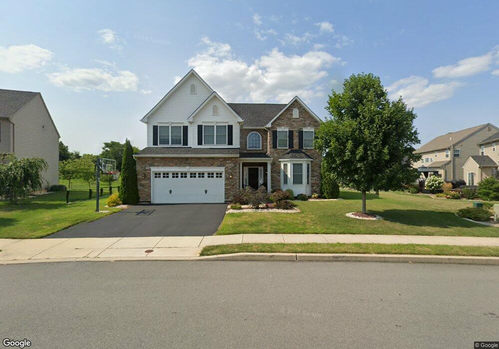
675 Mulberry Dr Nazareth, PA 18064
Estimated Value: $558,628 - $636,000
4
Beds
3
Baths
2,500
Sq Ft
$240/Sq Ft
Est. Value
About This Home
This home is located at 675 Mulberry Dr, Nazareth, PA 18064 and is currently estimated at $599,657, approximately $239 per square foot. 675 Mulberry Dr is a home located in Northampton County with nearby schools including Lower Nazareth Elementary School, Nazareth Area Middle School, and Nazareth Area High School.
Ownership History
Date
Name
Owned For
Owner Type
Purchase Details
Closed on
May 6, 2016
Sold by
Ramin Feriba
Bought by
Ehsan Amanullah
Current Estimated Value
Purchase Details
Closed on
Oct 20, 2015
Sold by
Kay Trio Llc
Bought by
Ramin Feriba
Purchase Details
Closed on
Jun 25, 2014
Sold by
Trio Farms Pa Llc
Bought by
Kay Trio Llc
Home Financials for this Owner
Home Financials are based on the most recent Mortgage that was taken out on this home.
Original Mortgage
$3,787,000
Interest Rate
4.14%
Mortgage Type
Future Advance Clause Open End Mortgage
Create a Home Valuation Report for This Property
The Home Valuation Report is an in-depth analysis detailing your home's value as well as a comparison with similar homes in the area
Home Values in the Area
Average Home Value in this Area
Purchase History
| Date | Buyer | Sale Price | Title Company |
|---|---|---|---|
| Ehsan Amanullah | $356,000 | None Available | |
| Ramin Feriba | $349,900 | None Available | |
| Kay Trio Llc | -- | First American Title Ins Co | |
| Kay Trio Llc | -- | First American Title Ins Co |
Source: Public Records
Mortgage History
| Date | Status | Borrower | Loan Amount |
|---|---|---|---|
| Previous Owner | Kay Trio Llc | $3,787,000 | |
| Previous Owner | Kay Trio Llc | $18,343,971 |
Source: Public Records
Tax History Compared to Growth
Tax History
| Year | Tax Paid | Tax Assessment Tax Assessment Total Assessment is a certain percentage of the fair market value that is determined by local assessors to be the total taxable value of land and additions on the property. | Land | Improvement |
|---|---|---|---|---|
| 2025 | $1,051 | $97,300 | $19,800 | $77,500 |
| 2024 | $7,084 | $97,300 | $19,800 | $77,500 |
| 2023 | $7,015 | $97,300 | $19,800 | $77,500 |
| 2022 | $7,015 | $97,300 | $19,800 | $77,500 |
| 2021 | $6,975 | $97,300 | $19,800 | $77,500 |
| 2020 | $6,975 | $97,300 | $19,800 | $77,500 |
| 2019 | $6,854 | $97,300 | $19,800 | $77,500 |
| 2018 | $6,735 | $97,300 | $19,800 | $77,500 |
| 2017 | $6,614 | $97,300 | $19,800 | $77,500 |
| 2016 | -- | $97,300 | $19,800 | $77,500 |
| 2015 | -- | $1,100 | $1,100 | $0 |
| 2014 | -- | $1,100 | $1,100 | $0 |
Source: Public Records
Map
Nearby Homes
- 4497 Cottonwood Dr
- 4450 Elmwood Dr
- 4571 Newburg Rd
- 656 Daniels Rd
- 4441 Newburg Rd
- 4454 Fieldstone Dr
- 2747 New England Dr
- 3113 Newburg Rd
- 394 Manor Dr
- 4620 Graystone Dr
- 4652 Oakwood Ln
- 2438 Blue Jay Dr
- 3235 Michaels School Rd Unit 10
- 3237 Michaels School Rd Unit 9
- 3229 Michaels School Rd Unit 13
- 3243 Michaels School Rd Unit 4
- 3253 Michaels School Rd Unit 1
- 3239 Michaels School Rd Unit 8
- 3231 Michaels School Rd Unit 12
- 309 Georgetown Rd
- 671 Mulberry Dr
- 4227 Beech Dr
- 4231 Beech Dr
- 4235 Beech Dr
- 674 Mulberry Dr
- 667 Mulberry Dr
- 676 Mulberry Dr
- 684 Mulberry Dr
- 4245 Beech Dr
- 678 Mulberry Dr
- 4472 Beech Dr
- 4239 Beech Dr
- 682 Mulberry Dr
- 663 Mulberry Dr
- 689 Mulberry Dr
- 4243 Beech Dr
- 686 Mulberry Dr
- 4506 Whitetail Dr
- 4508 Whitetail Dr
- 4504 Whitetail Dr