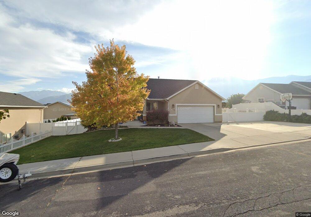
675 S 1260 E Payson, UT 84651
Estimated Value: $484,000 - $559,000
3
Beds
2
Baths
3,128
Sq Ft
$171/Sq Ft
Est. Value
About This Home
This home is located at 675 S 1260 E, Payson, UT 84651 and is currently estimated at $535,622, approximately $171 per square foot. 675 S 1260 E is a home located in Utah County with nearby schools including Barnett Elementary School, Salem Junior High School, and Valley View Middle School.
Ownership History
Date
Name
Owned For
Owner Type
Purchase Details
Closed on
Feb 27, 2012
Sold by
Cloud Karen L
Bought by
Beutler Jon and Beutler Melissa
Current Estimated Value
Home Financials for this Owner
Home Financials are based on the most recent Mortgage that was taken out on this home.
Original Mortgage
$182,000
Outstanding Balance
$144,368
Interest Rate
3.84%
Mortgage Type
USDA
Estimated Equity
$391,254
Purchase Details
Closed on
Oct 25, 2002
Sold by
Cloud Curtis and Cloud Karen
Bought by
Cloud Curtis L and Cloud Karen L
Home Financials for this Owner
Home Financials are based on the most recent Mortgage that was taken out on this home.
Original Mortgage
$138,000
Interest Rate
5.99%
Purchase Details
Closed on
Dec 5, 2000
Sold by
Kroneberger Patrick W
Bought by
Cloud Curtis L and Cloud Karen L
Home Financials for this Owner
Home Financials are based on the most recent Mortgage that was taken out on this home.
Original Mortgage
$67,000
Interest Rate
7.66%
Create a Home Valuation Report for This Property
The Home Valuation Report is an in-depth analysis detailing your home's value as well as a comparison with similar homes in the area
Home Values in the Area
Average Home Value in this Area
Purchase History
| Date | Buyer | Sale Price | Title Company |
|---|---|---|---|
| Beutler Jon | -- | None Available | |
| Cloud Curtis L | -- | First American Title Co | |
| Cloud Curtis | -- | First American Title Co | |
| Cloud Curtis L | -- | Empire Land Title Company |
Source: Public Records
Mortgage History
| Date | Status | Borrower | Loan Amount |
|---|---|---|---|
| Open | Beutler Jon | $182,000 | |
| Previous Owner | Cloud Curtis | $138,000 | |
| Previous Owner | Cloud Curtis L | $28,250 | |
| Previous Owner | Cloud Curtis L | $67,000 |
Source: Public Records
Tax History Compared to Growth
Tax History
| Year | Tax Paid | Tax Assessment Tax Assessment Total Assessment is a certain percentage of the fair market value that is determined by local assessors to be the total taxable value of land and additions on the property. | Land | Improvement |
|---|---|---|---|---|
| 2025 | $2,551 | $270,325 | -- | -- |
| 2024 | $2,551 | $259,600 | $0 | $0 |
| 2023 | $2,601 | $265,430 | $0 | $0 |
| 2022 | $2,514 | $252,340 | $0 | $0 |
| 2021 | $2,114 | $340,300 | $120,600 | $219,700 |
| 2020 | $1,972 | $310,600 | $104,900 | $205,700 |
| 2019 | $1,778 | $287,100 | $86,800 | $200,300 |
| 2018 | $1,788 | $278,300 | $79,600 | $198,700 |
| 2017 | $1,664 | $139,260 | $0 | $0 |
| 2016 | $1,593 | $132,495 | $0 | $0 |
| 2015 | $1,429 | $117,975 | $0 | $0 |
| 2014 | $1,299 | $108,075 | $0 | $0 |
Source: Public Records
Map
Nearby Homes
- 753 N Emery Ln Unit 57
- 678 N Mountain View Dr
- 552 E Longview Dr Unit 29
- 643 E Longview Dr Unit 8
- 942 W Wilcock Cove
- 4100 W 12400 S
- 761 N Birch Ln Unit 64
- 61 S Lighthouse Cir Unit 14
- 627 E Birch N Unit 68
- 526 E Sophie Cir Unit 1
- 700 S Hillside Dr E
- 792 N Mountain Dr
- 791 N Emery Ln Unit 55
- 648 N Cosette Cove E Unit 5
- 823 N Mountain View Dr Unit 62
- 1186 E 470 S
- 660 S Goosenest Dr
- 1356 E 320 S
- 876 E 400 S
- 862 E 400 S
- 665 S 1260 E
- 687 S 1260 E
- 684 S 1260 St E Unit 25
- 688 S 1300 E
- 1243 E Salem Canal Rd
- 668 S 1300 E
- 672 S 1260 E
- 672 S 1260 E Unit 17
- 655 S 1260 E
- 1227 E Salem Canal Rd
- 1227 E Salem Canal Rd Unit 24
- 658 S 1300 E
- 1244 E 640 S
- 645 S 1260 E
- 659 S 1300 E
- 1240 E 640 St S
- 1594 N 1300 E
- 1661 N 1300 E
- 1641 N 1300 E
- 1613 N 1300 E