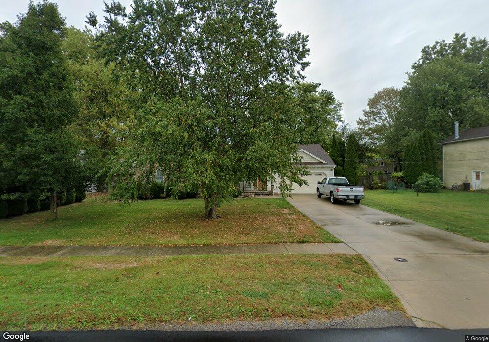
675 Sheffield Rd Sheffield Lake, OH 44054
Estimated Value: $139,000 - $254,617
3
Beds
3
Baths
1,666
Sq Ft
$133/Sq Ft
Est. Value
About This Home
This home is located at 675 Sheffield Rd, Sheffield Lake, OH 44054 and is currently estimated at $221,404, approximately $132 per square foot. 675 Sheffield Rd is a home located in Lorain County with nearby schools including Knollwood Elementary School, Brookside Intermediate School, and Brookside Middle School.
Ownership History
Date
Name
Owned For
Owner Type
Purchase Details
Closed on
Dec 21, 2004
Sold by
Stevenson Mark and Stevenson Elaine
Bought by
Brake Larry and Brake Naomi A
Current Estimated Value
Purchase Details
Closed on
Sep 28, 2004
Sold by
Dudas Ronald
Bought by
Stevenson Mark and Stevenson Elaine
Purchase Details
Closed on
Dec 15, 2000
Sold by
Dudas Janis and Hanna Dudas Janis
Bought by
Dudas Ronald and Dorsey Duane
Home Financials for this Owner
Home Financials are based on the most recent Mortgage that was taken out on this home.
Original Mortgage
$68,000
Interest Rate
7.8%
Purchase Details
Closed on
Dec 14, 2000
Sold by
Mary West
Bought by
Hanna Dudas Janis
Home Financials for this Owner
Home Financials are based on the most recent Mortgage that was taken out on this home.
Original Mortgage
$68,000
Interest Rate
7.8%
Create a Home Valuation Report for This Property
The Home Valuation Report is an in-depth analysis detailing your home's value as well as a comparison with similar homes in the area
Home Values in the Area
Average Home Value in this Area
Purchase History
| Date | Buyer | Sale Price | Title Company |
|---|---|---|---|
| Brake Larry | $26,000 | -- | |
| Stevenson Mark | $17,000 | -- | |
| Dudas Ronald | $93,000 | -- | |
| Hanna Dudas Janis | $32,500 | Real Estate Title Service Co |
Source: Public Records
Mortgage History
| Date | Status | Borrower | Loan Amount |
|---|---|---|---|
| Previous Owner | Dudas Ronald | $68,000 |
Source: Public Records
Tax History Compared to Growth
Tax History
| Year | Tax Paid | Tax Assessment Tax Assessment Total Assessment is a certain percentage of the fair market value that is determined by local assessors to be the total taxable value of land and additions on the property. | Land | Improvement |
|---|---|---|---|---|
| 2024 | $3,308 | $73,350 | $10,885 | $62,465 |
| 2023 | $2,713 | $54,978 | $10,129 | $44,849 |
| 2022 | $2,711 | $54,978 | $10,129 | $44,849 |
| 2021 | $2,727 | $54,978 | $10,129 | $44,849 |
| 2020 | $2,562 | $48,480 | $8,930 | $39,550 |
| 2019 | $2,547 | $48,480 | $8,930 | $39,550 |
| 2018 | $2,557 | $48,480 | $8,930 | $39,550 |
| 2017 | $3,893 | $53,800 | $10,330 | $43,470 |
| 2016 | $3,930 | $53,800 | $10,330 | $43,470 |
| 2015 | $3,879 | $53,800 | $10,330 | $43,470 |
| 2014 | $3,324 | $48,250 | $9,260 | $38,990 |
| 2013 | $3,151 | $48,250 | $9,260 | $38,990 |
Source: Public Records
Map
Nearby Homes
- 646 Dunny Ave
- 737 Dunny Ave
- 662 Kenilworth Ave
- 0 Kenilworth Ave
- 644 Pasadena Ave
- 640 Pasadena Ave
- 885 Lake Breeze Rd
- 786 Oliver St
- 4154 Belle Ave
- 4260 Brockley Ave
- 4272 Brockley Ave
- 580 Alameda Ave
- 0 E Lake Rd
- 4502 Edgewater Dr
- 4283 Holl Ave
- 738 W Shore Blvd
- 4286 Holl Ave
- 762 Maplewood Ave
- 819 Warwick Dr
- 827 West Dr
- 685 Sheffield Rd
- 669 Sheffield Rd
- 678 Rowelyn Ave
- 670 Rowelyn Ave
- 686 Rowelyn Ave
- 665 Sheffield Rd
- 674 Sheffield Rd
- 684 Sheffield Rd
- 664 Rowelyn Ave
- 703 Sheffield Rd
- 689 Rowelyn Ave
- 673 Rowelyn Ave
- 669 Rowelyn Ave
- 649 Sheffield Rd
- 657 Rowelyn Ave
- 719 Sheffield Rd
- 657 Rowelyn St
- 4246 Hawthorne Ave
- 727 Sheffield Rd
- 4252 Hawthorne Ave