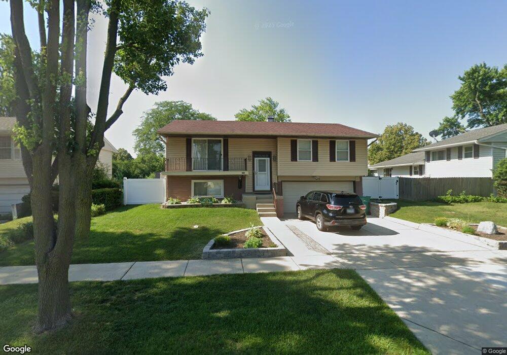
675 Sycamore Rd Buffalo Grove, IL 60089
South Buffalo Grove NeighborhoodEstimated Value: $369,000 - $443,000
3
Beds
2
Baths
1,151
Sq Ft
$350/Sq Ft
Est. Value
About This Home
This home is located at 675 Sycamore Rd, Buffalo Grove, IL 60089 and is currently estimated at $402,840, approximately $349 per square foot. 675 Sycamore Rd is a home located in Cook County with nearby schools including Henry W Longfellow Elementary School, Cooper Middle School, and Buffalo Grove High School.
Ownership History
Date
Name
Owned For
Owner Type
Purchase Details
Closed on
Oct 6, 2021
Sold by
Davidovich Gene and Davidovich Sophia
Bought by
Kochev Georgi
Current Estimated Value
Home Financials for this Owner
Home Financials are based on the most recent Mortgage that was taken out on this home.
Original Mortgage
$180,000
Outstanding Balance
$164,592
Interest Rate
2.99%
Mortgage Type
New Conventional
Estimated Equity
$238,248
Create a Home Valuation Report for This Property
The Home Valuation Report is an in-depth analysis detailing your home's value as well as a comparison with similar homes in the area
Home Values in the Area
Average Home Value in this Area
Purchase History
| Date | Buyer | Sale Price | Title Company |
|---|---|---|---|
| Kochev Georgi | $280,000 | Fidelity National Title |
Source: Public Records
Mortgage History
| Date | Status | Borrower | Loan Amount |
|---|---|---|---|
| Open | Kochev Georgi | $180,000 |
Source: Public Records
Tax History Compared to Growth
Tax History
| Year | Tax Paid | Tax Assessment Tax Assessment Total Assessment is a certain percentage of the fair market value that is determined by local assessors to be the total taxable value of land and additions on the property. | Land | Improvement |
|---|---|---|---|---|
| 2024 | $7,905 | $24,792 | $6,480 | $18,312 |
| 2023 | $8,626 | $28,015 | $6,480 | $21,535 |
| 2022 | $8,626 | $28,015 | $6,480 | $21,535 |
| 2021 | $5,367 | $21,186 | $4,140 | $17,046 |
| 2020 | $5,364 | $21,186 | $4,140 | $17,046 |
| 2019 | $5,361 | $23,488 | $4,140 | $19,348 |
| 2018 | $4,759 | $20,002 | $3,600 | $16,402 |
| 2017 | $5,342 | $21,878 | $3,600 | $18,278 |
| 2016 | $5,884 | $23,017 | $3,600 | $19,417 |
| 2015 | $5,436 | $20,498 | $3,060 | $17,438 |
| 2014 | $5,377 | $20,498 | $3,060 | $17,438 |
| 2013 | $4,939 | $20,498 | $3,060 | $17,438 |
Source: Public Records
Map
Nearby Homes
- 665 Thornwood Dr
- 820 Weidner Rd Unit 409
- 813 Stradford Cir Unit 21B2
- 535 Estate Dr
- 859 Beechwood Rd
- 455 Mayfair Ln
- 410 Chatham Cir
- 3300 N Carriageway Dr Unit 317
- 561 Park View Terrace Unit 153
- 408 Indian Hill Dr
- 476 Raupp Blvd
- 310 Rosewood Ave
- 921 Bernard Dr
- 1127 Miller Ln Unit 107
- 250 Old Oak Dr Unit 275
- 234 Mohawk Trail
- 1115 Miller Ln Unit 104
- 972 Thornton Ln Unit 102
- 18 E Heritage Ct
- 3157 N Daniels Ct Unit 1502
- 667 Sycamore Rd
- 695 White Pine Rd
- 657 Sycamore Rd
- 765 White Pine Rd Unit 5B1
- 765 White Pine Rd Unit 765
- 669 White Pine Rd
- 761 White Pine Rd Unit 5A1
- 647 Sycamore Rd
- 763 White Pine Rd Unit 5A2
- 767 White Pine Rd Unit 5B2
- 658 Sycamore Rd
- 698 Hapsfield Ln Unit 4A2
- 696 Hapsfield Ln Unit 4A1
- 771 White Pine Rd Unit 5C1
- 694 Hapsfield Ln Unit 4B2
- 773 White Pine Rd Unit 5C2
- 775 White Pine Rd Unit 5D1
- 692 Hapsfield Ln Unit 4B1
- 700 White Pine Rd
- 708 White Pine Rd