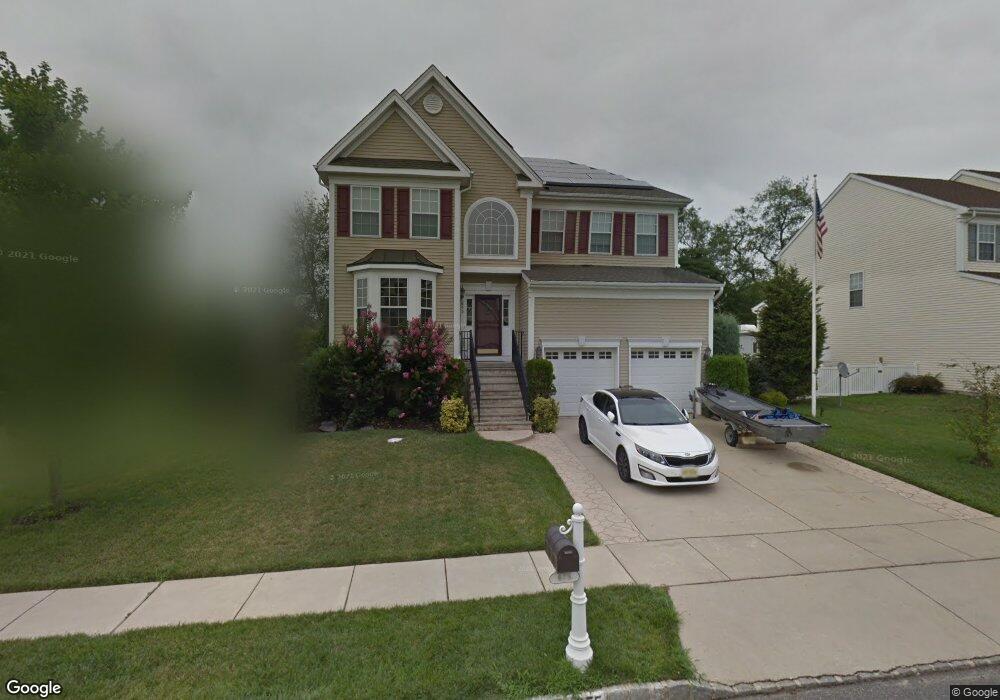
675 Worcester Dr West Deptford, NJ 08086
West Deptford Township NeighborhoodEstimated Value: $586,696 - $631,000
--
Bed
--
Bath
2,814
Sq Ft
$216/Sq Ft
Est. Value
About This Home
This home is located at 675 Worcester Dr, West Deptford, NJ 08086 and is currently estimated at $606,674, approximately $215 per square foot. 675 Worcester Dr is a home located in Gloucester County with nearby schools including Green-Fields Elementary School, Red Bank Elementary School, and Oakview Elementary School.
Ownership History
Date
Name
Owned For
Owner Type
Purchase Details
Closed on
Jul 14, 2022
Sold by
Garson Scott B and Garson Karen
Bought by
Holroyd Stephen and Holroyd Kelly
Current Estimated Value
Home Financials for this Owner
Home Financials are based on the most recent Mortgage that was taken out on this home.
Original Mortgage
$375,000
Outstanding Balance
$358,582
Interest Rate
5.7%
Mortgage Type
New Conventional
Estimated Equity
$248,092
Purchase Details
Closed on
Apr 29, 2005
Sold by
D R Horton Inc New Jersey
Bought by
Garson Scott B and Garson Karen S
Home Financials for this Owner
Home Financials are based on the most recent Mortgage that was taken out on this home.
Original Mortgage
$220,000
Interest Rate
6.01%
Mortgage Type
Fannie Mae Freddie Mac
Create a Home Valuation Report for This Property
The Home Valuation Report is an in-depth analysis detailing your home's value as well as a comparison with similar homes in the area
Home Values in the Area
Average Home Value in this Area
Purchase History
| Date | Buyer | Sale Price | Title Company |
|---|---|---|---|
| Holroyd Stephen | $500,000 | Wollman David A | |
| Holroyd Stephen | $500,000 | Wollman David A | |
| Garson Scott B | $309,490 | Grande Title Agency Llc |
Source: Public Records
Mortgage History
| Date | Status | Borrower | Loan Amount |
|---|---|---|---|
| Open | Holroyd Stephen | $375,000 | |
| Closed | Holroyd Stephen | $375,000 | |
| Previous Owner | Garson Scott B | $220,000 |
Source: Public Records
Tax History Compared to Growth
Tax History
| Year | Tax Paid | Tax Assessment Tax Assessment Total Assessment is a certain percentage of the fair market value that is determined by local assessors to be the total taxable value of land and additions on the property. | Land | Improvement |
|---|---|---|---|---|
| 2025 | $11,845 | $339,200 | $67,300 | $271,900 |
| 2024 | $11,692 | $339,200 | $67,300 | $271,900 |
| 2023 | $11,692 | $339,200 | $67,300 | $271,900 |
| 2022 | $11,638 | $339,200 | $67,300 | $271,900 |
| 2021 | $11,347 | $339,200 | $67,300 | $271,900 |
| 2020 | $11,570 | $339,200 | $67,300 | $271,900 |
| 2019 | $11,248 | $339,200 | $67,300 | $271,900 |
| 2018 | $10,943 | $339,200 | $67,300 | $271,900 |
| 2017 | $10,688 | $339,200 | $67,300 | $271,900 |
| 2016 | $10,390 | $339,200 | $67,300 | $271,900 |
| 2015 | $10,213 | $350,000 | $67,300 | $282,700 |
| 2014 | $9,706 | $350,000 | $67,300 | $282,700 |
Source: Public Records
Map
Nearby Homes
- 640 Worcester Dr
- 863 Doncaster Dr
- 1091 Buckingham Dr Unit 45
- 16 Maplewood Ct
- 87 Woodway Dr Unit 87
- 12 Highbridge Ln Unit I2
- 125 Lionheart Ln Unit C125
- 1012 Moore Rd Unit 6
- 1066 Buckingham Dr
- 740 Carter Hill Dr
- 1220 Royal Ln
- 1102 Barnesdale Rd
- 1311 Barnesdale Rd
- 4 Saint Emilion Ct
- 1810 Fernwood Dr
- 94 Aviary Rd
- 14 Aviary Rd
- 97 Church St
- 296 Ogden Station Rd
- 64 Tilden Rd
- 677 Worcester Dr
- 665 Worcester Dr
- 946 Doncaster Dr
- 663 Worcester Dr
- 734 Lancaster Dr
- 676 Worcester Dr
- 661 Worcester Dr
- 1 Lord Ln
- 0 Lord Ln
- 940 Doncaster Dr
- 659 Worcester Dr
- 947 Doncaster Dr
- 600 Worcester Dr
- 731 Lancaster Dr
- 4 Lord Ln
- 934 Doncaster Dr
- 666 Worcester Dr
- 664 Worcester Dr
- 668 Worcester Dr
- 657 Worcester Dr